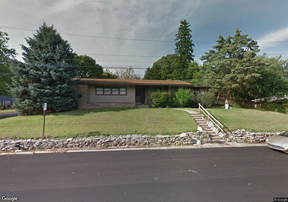
408 W Leslie Ave West Lafayette, IN 47906
Estimated Value: $411,000 - $432,000
3
Beds
5
Baths
2,041
Sq Ft
$207/Sq Ft
Est. Value
About This Home
This home is located at 408 W Leslie Ave, West Lafayette, IN 47906 and is currently estimated at $422,445, approximately $206 per square foot. 408 W Leslie Ave is a home located in Tippecanoe County with nearby schools including West Lafayette Intermediate School, West Lafayette Elementary School, and West Lafayette Junior/Senior High School.
Ownership History
Date
Name
Owned For
Owner Type
Purchase Details
Closed on
Oct 13, 2023
Sold by
Wulle Bernard W
Bought by
Wulle Bernard W and Pollbck Juanita H
Current Estimated Value
Purchase Details
Closed on
Jul 9, 2004
Sold by
Homestead Guarantees Llc
Bought by
Wulle Bernard W
Purchase Details
Closed on
Jun 9, 2004
Sold by
Crossmann Communities Partnership
Bought by
Homestead Gurantees Llc
Purchase Details
Closed on
Mar 15, 2004
Sold by
Collins William B and Morgan Melanie
Bought by
Crossmann Communities Partnership
Purchase Details
Closed on
Jun 19, 2001
Sold by
Chong Edwin K P and Chong Yat Yee
Bought by
Collins William B and Morgan Melanie
Home Financials for this Owner
Home Financials are based on the most recent Mortgage that was taken out on this home.
Original Mortgage
$144,530
Interest Rate
7.11%
Mortgage Type
Purchase Money Mortgage
Create a Home Valuation Report for This Property
The Home Valuation Report is an in-depth analysis detailing your home's value as well as a comparison with similar homes in the area
Home Values in the Area
Average Home Value in this Area
Purchase History
| Date | Buyer | Sale Price | Title Company |
|---|---|---|---|
| Wulle Bernard W | -- | None Listed On Document | |
| Wulle Bernard W | -- | -- | |
| Homestead Gurantees Llc | -- | -- | |
| Crossmann Communities Partnership | -- | Stewart Title | |
| Collins William B | -- | -- |
Source: Public Records
Mortgage History
| Date | Status | Borrower | Loan Amount |
|---|---|---|---|
| Previous Owner | Collins William B | $144,530 |
Source: Public Records
Tax History Compared to Growth
Tax History
| Year | Tax Paid | Tax Assessment Tax Assessment Total Assessment is a certain percentage of the fair market value that is determined by local assessors to be the total taxable value of land and additions on the property. | Land | Improvement |
|---|---|---|---|---|
| 2024 | $4,880 | $205,900 | $127,300 | $78,600 |
| 2023 | $5,626 | $237,400 | $80,000 | $157,400 |
| 2022 | $5,626 | $237,400 | $80,000 | $157,400 |
| 2021 | $4,979 | $210,100 | $80,000 | $130,100 |
| 2020 | $4,610 | $194,500 | $80,000 | $114,500 |
| 2019 | $4,422 | $186,600 | $80,000 | $106,600 |
| 2018 | $4,252 | $179,400 | $30,700 | $148,700 |
| 2017 | $4,230 | $187,700 | $30,700 | $157,000 |
| 2016 | $4,394 | $185,370 | $30,700 | $154,670 |
| 2014 | $4,856 | $204,900 | $26,800 | $178,100 |
| 2013 | $4,835 | $204,000 | $26,800 | $177,200 |
Source: Public Records
Map
Nearby Homes
- 1220 Ravinia Rd
- 618 Northridge Dr
- 1411 N Salisbury St
- 502 Hillcrest Rd
- 509 Carrolton Blvd
- 701 Carrolton Blvd
- 500 Carrolton Blvd
- 805 N Chauncey Ave
- 237 E Sunset Ln
- 229 Connolly St
- 238 Connolly St
- 845 Rose St
- 1909 Indian Trail Dr
- 1912 Indian Trail Dr
- 306 E Stadium Ave
- 2200 Miami Trail
- 1201 Lindberg Rd
- 2212 Sycamore Ln
- 1868 N River Rd
- 2306 Carmel Dr
- 408 Leslie Ave
- 1206 Hayes St
- 400 Leslie Ave
- 1205 N Grant St
- 1205 Hayes St
- 1214 Hayes St
- 1213 N Grant St
- 1215 Hayes St
- 444 Leslie Ave
- 1221 N Grant St
- 1200 N Grant St
- 415 Forest Hill Dr
- 1204 N Grant St
- 403 Forest Hill Dr
- 425 Forest Hill Dr
- 345 Leslie Ave
- 1208 N Grant St
- 333 Forest Hill Dr
- 1100 N Grant St
- 334 Leslie Ave