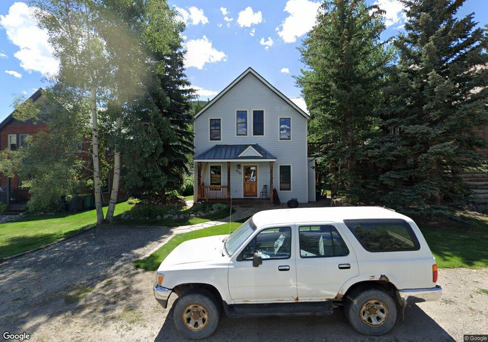
408 Whiterock Ave Crested Butte, CO 81224
Estimated Value: $1,081,874 - $1,674,000
3
Beds
2
Baths
1,421
Sq Ft
$931/Sq Ft
Est. Value
About This Home
This home is located at 408 Whiterock Ave, Crested Butte, CO 81224 and is currently estimated at $1,322,719, approximately $930 per square foot. 408 Whiterock Ave is a home with nearby schools including Gunnison Elementary School, Crested Butte Community School, and Gunnison Middle School.
Ownership History
Date
Name
Owned For
Owner Type
Purchase Details
Closed on
May 25, 2009
Sold by
Banks Steven M and Banks Priscila
Bought by
Banks Steven M
Current Estimated Value
Home Financials for this Owner
Home Financials are based on the most recent Mortgage that was taken out on this home.
Original Mortgage
$417,000
Outstanding Balance
$267,837
Interest Rate
5.16%
Mortgage Type
New Conventional
Estimated Equity
$1,054,882
Purchase Details
Closed on
Jan 22, 2003
Sold by
Fahrlander Michael W
Bought by
Banks Steven M
Create a Home Valuation Report for This Property
The Home Valuation Report is an in-depth analysis detailing your home's value as well as a comparison with similar homes in the area
Home Values in the Area
Average Home Value in this Area
Purchase History
| Date | Buyer | Sale Price | Title Company |
|---|---|---|---|
| Banks Steven M | -- | None Available | |
| Banks Steven M | $280,000 | -- |
Source: Public Records
Mortgage History
| Date | Status | Borrower | Loan Amount |
|---|---|---|---|
| Open | Banks Steven M | $417,000 |
Source: Public Records
Tax History Compared to Growth
Tax History
| Year | Tax Paid | Tax Assessment Tax Assessment Total Assessment is a certain percentage of the fair market value that is determined by local assessors to be the total taxable value of land and additions on the property. | Land | Improvement |
|---|---|---|---|---|
| 2024 | $5,299 | $78,120 | $10,970 | $67,150 |
| 2023 | $5,246 | $74,430 | $10,450 | $63,980 |
| 2022 | $4,846 | $61,830 | $7,360 | $54,470 |
| 2021 | $4,389 | $63,610 | $7,570 | $56,040 |
| 2020 | $3,646 | $53,350 | $8,040 | $45,310 |
| 2019 | $3,573 | $53,350 | $8,040 | $45,310 |
| 2018 | $2,924 | $42,180 | $5,620 | $36,560 |
| 2017 | $2,943 | $42,180 | $5,620 | $36,560 |
| 2016 | $2,526 | $38,050 | $5,600 | $32,450 |
| 2015 | $1,118 | $38,050 | $5,600 | $32,450 |
| 2014 | $1,118 | $33,000 | $5,860 | $27,140 |
Source: Public Records
Map
Nearby Homes
- 602 & 604 Fourth St
- 418 Elk Ave
- 308 Whiterock Ave
- 309 Belleview #2-C Residential Unit 2-C
- 309 Belleview #2-B Residential Unit 2-B
- 309 Belleview #2-A Residential Unit 2-A
- 513 Third St
- 315 Elk Ave
- 414 Maroon Ave
- 223 Sopris Ave
- 209 Whiterock Ave
- 218 Maroon Ave Unit E
- 609 2nd St
- 398 Journey's End Rd
- 413 2nd St
- 422 Belleview Ave
- 310 2nd St
- 721 Whiterock Ave
- 119 Elk Ave
- 520 Teocalli Ave
- 412 Whiterock Ave
- 618 4th St
- 406 Whiterock Ave
- 418 Whiterock Ave Unit Lots 8-10, Block 38
- 602 4th St
- 4TH Street St
- 611 4th St
- 611 Fourth St
- 330 Whiterock Ave
- 423 Belleview Ave Unit 1
- 423 Belleview Ave Unit 1
- 423 Belleview Ave Unit 2
- 329 Belleview Ave
- 409 Whiterock Ave
- 426 Whiterock Ave
- 430 Belleview Ave Unit 301
- 430 Belleview Ave
- 0 Belleview Ave Unit 1942
- 00 Belleview Ave
- 0 Belleview Ave Unit 4371