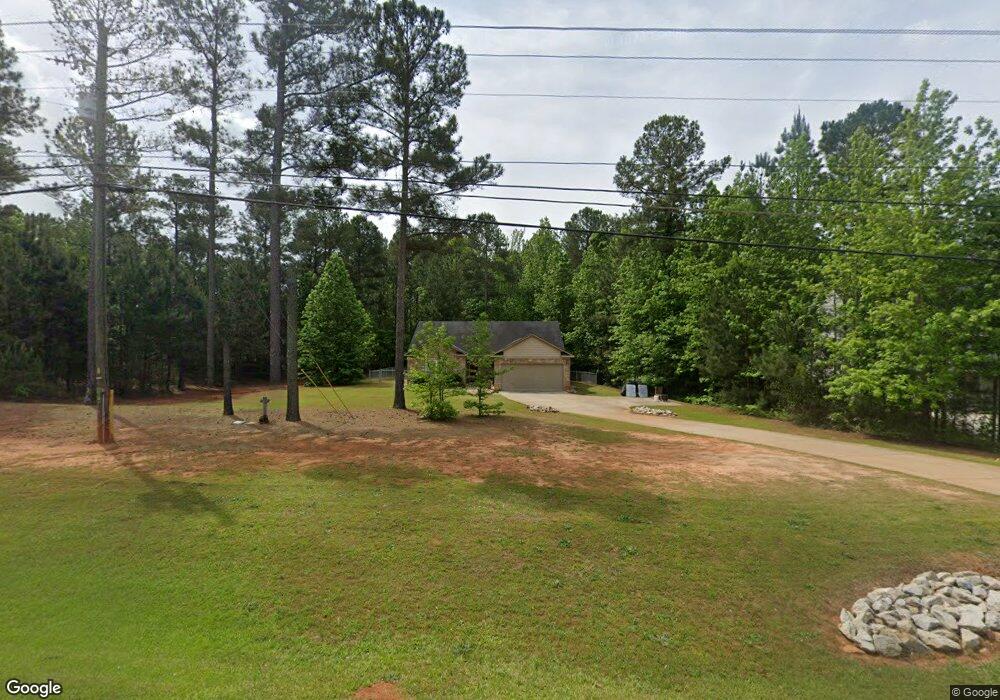
4080 Highway 81 E McDonough, GA 30252
Estimated Value: $290,000 - $330,000
3
Beds
2
Baths
1,614
Sq Ft
$191/Sq Ft
Est. Value
About This Home
This home is located at 4080 Highway 81 E, McDonough, GA 30252 and is currently estimated at $308,773, approximately $191 per square foot. 4080 Highway 81 E is a home located in Henry County with nearby schools including Ola Elementary School, Ola Middle School, and Ola High School.
Ownership History
Date
Name
Owned For
Owner Type
Purchase Details
Closed on
Dec 21, 2011
Sold by
Berry Roan
Bought by
Horsham Minerva M
Current Estimated Value
Home Financials for this Owner
Home Financials are based on the most recent Mortgage that was taken out on this home.
Original Mortgage
$109,016
Outstanding Balance
$74,789
Interest Rate
4.07%
Mortgage Type
New Conventional
Estimated Equity
$233,984
Purchase Details
Closed on
Nov 28, 2006
Sold by
Platinum Assocs Inc
Bought by
B Mac Prop Inc
Home Financials for this Owner
Home Financials are based on the most recent Mortgage that was taken out on this home.
Original Mortgage
$127,500
Interest Rate
6.36%
Create a Home Valuation Report for This Property
The Home Valuation Report is an in-depth analysis detailing your home's value as well as a comparison with similar homes in the area
Home Values in the Area
Average Home Value in this Area
Purchase History
| Date | Buyer | Sale Price | Title Company |
|---|---|---|---|
| Horsham Minerva M | $112,573 | -- | |
| Berry Roan | -- | -- | |
| B Mac Prop Inc | -- | -- |
Source: Public Records
Mortgage History
| Date | Status | Borrower | Loan Amount |
|---|---|---|---|
| Open | Berry Roan | $109,016 | |
| Closed | Horsham Minerva M | $109,016 | |
| Previous Owner | B Mac Prop Inc | $127,500 |
Source: Public Records
Tax History Compared to Growth
Tax History
| Year | Tax Paid | Tax Assessment Tax Assessment Total Assessment is a certain percentage of the fair market value that is determined by local assessors to be the total taxable value of land and additions on the property. | Land | Improvement |
|---|---|---|---|---|
| 2025 | $3,413 | $128,120 | $14,000 | $114,120 |
| 2024 | $3,413 | $120,960 | $14,000 | $106,960 |
| 2023 | $2,879 | $121,120 | $14,000 | $107,120 |
| 2022 | $2,708 | $92,520 | $14,000 | $78,520 |
| 2021 | $2,143 | $74,560 | $14,000 | $60,560 |
| 2020 | $2,143 | $68,600 | $12,000 | $56,600 |
| 2019 | $1,989 | $62,080 | $12,000 | $50,080 |
| 2018 | $294 | $58,040 | $12,000 | $46,040 |
| 2016 | $1,782 | $53,320 | $10,000 | $43,320 |
| 2015 | $1,195 | $53,040 | $8,000 | $45,040 |
| 2014 | $1,583 | $44,520 | $8,000 | $36,520 |
Source: Public Records
Map
Nearby Homes
- 530 Austin Dr
- 393 Stallsworth Rd
- 3000 Keeneland Blvd
- 146 Aubree Way
- 523 Barhams Ridge Dr
- 4075 O Henry Ct
- 125 Floresta Dr
- 505 Judith Ct
- 545 Barhams Ridge Dr
- 0 Keys Ferry Rd Unit 10362682
- 0 Keys Ferry Rd Unit 10362675
- 117 Floresta Dr
- 326 Dylan Way
- 1012 Gloria Grand Blvd
- 501 Barhams Ridge Dr
- 1908 Munford Place
- 40 Austin Dr
- 1512 Lincoln Terrace
- 0 Wynn Rd Unit 10627608
- 185 Wynn Rd
- 4090 Highway 81 E
- 4070 Highway 81 E Unit LOT 3
- 4070 Highway 81 E Unit KEYS RD, LOT 3
- 4070 Highway 81 E
- 4070 Highway 81 E
- 4070 Highway 81 E Unit KEYS RD, LOT 3
- 4070 Highway 81 E Unit KEYS RD
- 4070 Highway 81 E Unit LOT 3
- 0 Austin Dr Unit 10169738
- 0 Austin Dr Unit 8110039
- 213 Knollside Ct
- 4060 Highway 81 E Unit 4
- 4060 Highway 81 E
- 4060 Highway 81 Unit 4
- 4075 Highway 81 E
- 580 Austin Dr
- 212 Knollside Ct
- 207 Knollside Ct
- 4055 Highway 81 E
- 101 Buddy Blvd Unit 5