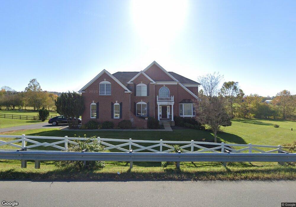
40801 Stumptown Rd Waterford, VA 20197
Estimated Value: $1,211,000 - $1,586,000
4
Beds
4
Baths
3,890
Sq Ft
$342/Sq Ft
Est. Value
About This Home
This home is located at 40801 Stumptown Rd, Waterford, VA 20197 and is currently estimated at $1,330,457, approximately $342 per square foot. 40801 Stumptown Rd is a home located in Loudoun County with nearby schools including Waterford Elementary School, Woodgrove High School, and Harmony Middle School.
Ownership History
Date
Name
Owned For
Owner Type
Purchase Details
Closed on
Mar 9, 2005
Sold by
Toll Land Ix L P
Bought by
Shaffi Hussain S
Current Estimated Value
Home Financials for this Owner
Home Financials are based on the most recent Mortgage that was taken out on this home.
Original Mortgage
$565,000
Outstanding Balance
$286,440
Interest Rate
5.61%
Mortgage Type
New Conventional
Estimated Equity
$1,044,017
Create a Home Valuation Report for This Property
The Home Valuation Report is an in-depth analysis detailing your home's value as well as a comparison with similar homes in the area
Home Values in the Area
Average Home Value in this Area
Purchase History
| Date | Buyer | Sale Price | Title Company |
|---|---|---|---|
| Shaffi Hussain S | $765,015 | -- |
Source: Public Records
Mortgage History
| Date | Status | Borrower | Loan Amount |
|---|---|---|---|
| Open | Shaffi Hussain S | $565,000 |
Source: Public Records
Tax History Compared to Growth
Tax History
| Year | Tax Paid | Tax Assessment Tax Assessment Total Assessment is a certain percentage of the fair market value that is determined by local assessors to be the total taxable value of land and additions on the property. | Land | Improvement |
|---|---|---|---|---|
| 2025 | $9,097 | $1,130,080 | $368,800 | $761,280 |
| 2024 | $9,351 | $1,081,000 | $343,800 | $737,200 |
| 2023 | $8,785 | $1,004,010 | $308,800 | $695,210 |
| 2022 | $7,741 | $869,730 | $235,400 | $634,330 |
| 2021 | $7,283 | $743,190 | $195,400 | $547,790 |
| 2020 | $7,140 | $689,850 | $195,400 | $494,450 |
| 2019 | $6,954 | $665,470 | $195,400 | $470,070 |
| 2018 | $7,145 | $658,540 | $195,400 | $463,140 |
| 2017 | $7,300 | $648,860 | $195,400 | $453,460 |
| 2016 | $7,428 | $648,710 | $0 | $0 |
| 2015 | $7,535 | $468,500 | $0 | $468,500 |
| 2014 | $7,411 | $451,420 | $0 | $451,420 |
Source: Public Records
Map
Nearby Homes
- 14785 Bankfield Dr
- 40788 Lastos Ct
- 15058 Bankfield Dr
- 15140 Loyalty Rd
- 40372 Stonebrook Hamlet Place
- 14132 Amys Meadow Ct
- 41541 Carter Ridge Ln
- 40162 Main St
- 15493 Second St
- 14388 Waterford Woods Ct
- 41681 Rosemont Place
- 15759 Dorneywood Dr
- TBD Glenmore Lot 37 Ln
- 14453 Woodstar Ct
- 14460 Milltown Rd
- 14248 Milltown Rd
- 40954 Canter Ln
- 39728 Charles Henry Place
- 42046 Lamz Place
- 16158 Clarkes Gap Rd
- 40825 Stumptown Rd
- 17000 Loyalty Rd
- 15000 Loyalty Rd
- 14777 Loyalty Rd
- 40824 Cliford Ct
- 0 Bankfield Dr Unit LO6759060
- 14786 Bankfield Dr
- 40860 Cliford Ct
- 40819 Cliford Ct
- 14844 Bankfield Dr
- 14886 Bankfield Dr
- 14866 Loyalty Rd
- 14925 Bankfield Dr
- 14868 Bankfield Dr
- 40845 Cliford Ct
- 40889 Stumptown Rd
- 14872 Loyalty Rd
- 14924 Bankfield Dr
- 40970 Tesla Ct
- 14945 Bankfield Dr