Estimated Value: $283,000 - $328,904
3
Beds
2
Baths
2,010
Sq Ft
$151/Sq Ft
Est. Value
About This Home
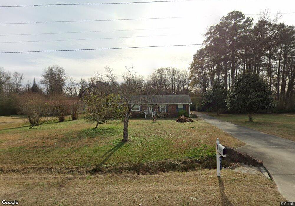
This home is located at 4082 Us Highway 301 N, Selma, NC 27576 and is currently estimated at $303,226, approximately $150 per square foot. 4082 Us Highway 301 N is a home located in Johnston County with nearby schools including Micro Elementary School, North Johnston Middle School, and North Johnston High School.
Ownership History
Date
Name
Owned For
Owner Type
Purchase Details
Closed on
Oct 7, 2019
Sold by
Sadler John M and Sadler Brenda G
Bought by
Lanewala Jumana and Lanewala Najimuddin
Current Estimated Value
Purchase Details
Closed on
Oct 1, 2010
Sold by
Creech Russell Lynn and Creech Sandra Pate
Bought by
Sadler John M and Sadler Brenda G
Home Financials for this Owner
Home Financials are based on the most recent Mortgage that was taken out on this home.
Original Mortgage
$104,000
Interest Rate
4.39%
Mortgage Type
New Conventional
Create a Home Valuation Report for This Property
The Home Valuation Report is an in-depth analysis detailing your home's value as well as a comparison with similar homes in the area
Home Values in the Area
Average Home Value in this Area
Purchase History
| Date | Buyer | Sale Price | Title Company |
|---|---|---|---|
| Lanewala Jumana | $190,000 | None Available | |
| Sadler John M | $130,000 | None Available |
Source: Public Records
Mortgage History
| Date | Status | Borrower | Loan Amount |
|---|---|---|---|
| Previous Owner | Sadler John M | $104,000 |
Source: Public Records
Tax History Compared to Growth
Tax History
| Year | Tax Paid | Tax Assessment Tax Assessment Total Assessment is a certain percentage of the fair market value that is determined by local assessors to be the total taxable value of land and additions on the property. | Land | Improvement |
|---|---|---|---|---|
| 2025 | $1,837 | $289,240 | $38,380 | $250,860 |
| 2024 | $1,497 | $184,820 | $22,370 | $162,450 |
| 2023 | $1,497 | $184,820 | $22,370 | $162,450 |
| 2022 | $1,571 | $184,820 | $22,370 | $162,450 |
| 2021 | $1,571 | $184,820 | $22,370 | $162,450 |
| 2020 | $1,589 | $184,820 | $22,370 | $162,450 |
| 2019 | $1,251 | $145,480 | $22,010 | $123,470 |
| 2018 | $0 | $131,800 | $20,760 | $111,040 |
| 2017 | $1,160 | $131,800 | $20,760 | $111,040 |
| 2016 | $1,160 | $131,800 | $20,760 | $111,040 |
| 2014 | $1,160 | $131,800 | $20,760 | $111,040 |
Source: Public Records
Map
Nearby Homes
- 1829 Old Batten Rd
- 1216 Browns Dairy Rd
- 0 R St Unit 10062482
- 110 Dwight Dr
- 112 E Main St
- 306 W Main St
- 509 W Main St
- 201 N Us 301
- 0 W Wilson St
- 0 Old Creech Rd
- 1101 Oak Grove Inn Rd
- 73 Laramie Ln
- 223 N Nolan Park Dr
- 215 Maxwell Farm Ln
- 241 Maxwell Farm Ln
- 103 Maxwell Farm Ln
- 61 Maxwell Farm Ln
- 210 Maxwell Farm Ln
- 242 Maxwell Farm Ln
- 131 Brentwood Dr
- 4082 U S 301
- 4100 Us Highway 301 N
- 4061 U S 301
- 4150 N Us 301 Hwy
- 4150 Us 301 Hwy
- 0 Us 301 Hwy Unit TR618481
- 0 Us 301 Hwy Unit TR1739043
- 0 Us 301 Hwy Unit TR1739230
- 0 Us 301 Hwy Unit TR1951645
- 0 Us 301 Hwy Unit TR2051414
- 0 Us 301 Hwy Unit 1888005
- 0 Us 301 Hwy Unit 598821
- 0 Us 301 Hwy Unit 1809646
- 0 Us 301 Hwy Unit TR1755067
- 0 Us 301 Hwy Unit TR1809646
- 0 Us 301 Hwy Unit TR1888005
- 0 Us 301 Hwy Unit TR2051419
- 0 Us 301 Hwy Unit TR2174209
- 0 Us 301 Hwy Unit TR2174212
- 0 Us 301 Hwy Unit TR2174213