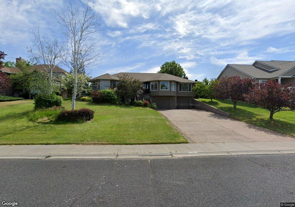
4085 Cove West Dr Moses Lake, WA 98837
Estimated Value: $540,000 - $625,000
4
Beds
3
Baths
2,213
Sq Ft
$263/Sq Ft
Est. Value
About This Home
This home is located at 4085 Cove West Dr, Moses Lake, WA 98837 and is currently estimated at $580,920, approximately $262 per square foot. 4085 Cove West Dr is a home located in Grant County with nearby schools including Peninsula Elementary School, Frontier Middle School, and Moses Lake High School.
Ownership History
Date
Name
Owned For
Owner Type
Purchase Details
Closed on
May 28, 2019
Sold by
Meyer Jona D and Meyer Rebecca S
Bought by
Stanberry Camille and Stanberry Mitchell D
Current Estimated Value
Home Financials for this Owner
Home Financials are based on the most recent Mortgage that was taken out on this home.
Original Mortgage
$304,000
Outstanding Balance
$267,290
Interest Rate
4.1%
Mortgage Type
New Conventional
Estimated Equity
$313,630
Create a Home Valuation Report for This Property
The Home Valuation Report is an in-depth analysis detailing your home's value as well as a comparison with similar homes in the area
Home Values in the Area
Average Home Value in this Area
Purchase History
| Date | Buyer | Sale Price | Title Company |
|---|---|---|---|
| Stanberry Camille | $380,000 | Frontier Title And Escrow Co |
Source: Public Records
Mortgage History
| Date | Status | Borrower | Loan Amount |
|---|---|---|---|
| Open | Stanberry Camille | $304,000 |
Source: Public Records
Tax History Compared to Growth
Tax History
| Year | Tax Paid | Tax Assessment Tax Assessment Total Assessment is a certain percentage of the fair market value that is determined by local assessors to be the total taxable value of land and additions on the property. | Land | Improvement |
|---|---|---|---|---|
| 2024 | $4,270 | $382,551 | $77,500 | $305,051 |
| 2023 | $3,936 | $324,120 | $55,625 | $268,495 |
| 2022 | $3,802 | $324,120 | $55,625 | $268,495 |
| 2021 | $3,483 | $324,120 | $55,625 | $268,495 |
| 2020 | $3,509 | $286,615 | $55,625 | $230,990 |
| 2019 | $3,518 | $263,875 | $42,000 | $221,875 |
| 2018 | $3,887 | $251,890 | $42,000 | $209,890 |
| 2017 | $3,678 | $251,890 | $42,000 | $209,890 |
| 2016 | $3,735 | $254,885 | $42,000 | $212,885 |
| 2013 | -- | $219,405 | $42,000 | $177,405 |
Source: Public Records
Map
Nearby Homes
- 620 N Dove Ct
- 600 Bluff Dr W
- 509 Bluff Dr W
- 4349 W Cove Dr W
- 601 Bluff Dr W
- 4326 W Redhead Ave
- 316 Montana St
- 320 Montana St
- 312 Montana St
- Canyon A Plan at The Refuge - The Refuge
- Canyon B Plan at The Refuge - The Refuge
- Suncrest Plan at The Refuge - The Refuge
- Skyline Plan at The Refuge - The Refuge
- Cascade B Plan at The Refuge - The Refuge
- Sage Plan at The Refuge - The Refuge
- Olympic Plan at The Refuge - The Refuge
- Cascade A Plan at The Refuge - The Refuge
- 490 N Ruddy St
- 494 N Ruddy St
- 221 N Lessor Loop
- 4087 Cove Dr W
- 4087 Cove West Dr
- 4083 Cove West Dr
- 4089 Cove West Dr
- 613 N Swan Ln
- 4081 Cove West Dr
- 4089 Cove Dr W
- 372 Cove Dr W
- 609 N Swan Ln
- 4082 Cove Dr W
- 4084 Cove West Dr
- 4081 Cove Dr W
- 4086 Cove West Dr
- 4082 Cove West Dr
- 4088 Cove West Dr
- 4091 Cove Dr W
- 639 N Bluff West Dr
- 639 Bluff Dr W
- 4079 Cove West Dr