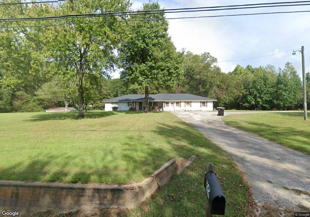
4085 Mount Zion Rd Carrollton, GA 30117
Estimated Value: $10,380 - $271,000
4
Beds
2
Baths
2,308
Sq Ft
$66/Sq Ft
Est. Value
About This Home
This home is located at 4085 Mount Zion Rd, Carrollton, GA 30117 and is currently estimated at $152,345, approximately $66 per square foot. 4085 Mount Zion Rd is a home located in Carroll County with nearby schools including Mt. Zion Elementary School, Mt. Zion Middle School, and Mt. Zion High School.
Ownership History
Date
Name
Owned For
Owner Type
Purchase Details
Closed on
Apr 6, 2022
Sold by
Robinson Jeanette
Bought by
Potts Matthew and Potts Krysta Roberts
Current Estimated Value
Purchase Details
Closed on
Apr 15, 2019
Sold by
Robinson Jeanette
Bought by
Holsomback Zachary Adam
Home Financials for this Owner
Home Financials are based on the most recent Mortgage that was taken out on this home.
Original Mortgage
$152,093
Interest Rate
4.3%
Mortgage Type
FHA
Purchase Details
Closed on
Jan 28, 2016
Sold by
Robinson William W
Bought by
Robinson Jeanette
Purchase Details
Closed on
Jun 30, 2004
Sold by
Robinson Jeanette
Bought by
Robinson W W
Purchase Details
Closed on
Mar 3, 1993
Bought by
Robinson
Create a Home Valuation Report for This Property
The Home Valuation Report is an in-depth analysis detailing your home's value as well as a comparison with similar homes in the area
Home Values in the Area
Average Home Value in this Area
Purchase History
| Date | Buyer | Sale Price | Title Company |
|---|---|---|---|
| Potts Matthew | $9,500 | -- | |
| Holsomback Zachary Adam | $154,900 | -- | |
| Holsomback Zachary Adam | -- | -- | |
| Robinson Jeanette | -- | -- | |
| Robinson W W | -- | -- | |
| Robinson | -- | -- |
Source: Public Records
Mortgage History
| Date | Status | Borrower | Loan Amount |
|---|---|---|---|
| Previous Owner | Holsomback Zachary Adam | $152,093 |
Source: Public Records
Tax History Compared to Growth
Tax History
| Year | Tax Paid | Tax Assessment Tax Assessment Total Assessment is a certain percentage of the fair market value that is determined by local assessors to be the total taxable value of land and additions on the property. | Land | Improvement |
|---|---|---|---|---|
| 2024 | $397 | $13,673 | $13,673 | -- |
| 2023 | $397 | $10,939 | $10,939 | $0 |
| 2022 | $234 | $7,292 | $7,292 | $0 |
| 2021 | $191 | $5,834 | $5,834 | $0 |
| 2020 | $136 | $5,304 | $5,304 | $0 |
| 2019 | $1,087 | $41,989 | $10,025 | $31,964 |
| 2018 | $1,019 | $38,815 | $9,369 | $29,446 |
| 2017 | $1,022 | $38,815 | $9,369 | $29,446 |
| 2016 | $1,023 | $38,815 | $9,369 | $29,446 |
| 2015 | $1,357 | $48,529 | $11,347 | $37,182 |
| 2014 | $1,363 | $48,530 | $11,347 | $37,182 |
Source: Public Records
Map
Nearby Homes
- 436 S Prospect Ave
- 292 S Prospect Ave
- 206 Randall Dr
- 153 Anita Blvd
- 141 Anita Blvd
- 313 Lucy Ln
- 33 Armstrong Dr
- 778 Harrison Rd
- 46 Gammon Rd
- 10 Joshua Way
- 30 Joshua Way
- 245 Delia Peace Rd
- 2994 Mount Zion Rd
- 2994 Mount Zion Rd Unit 1
- 2994 Mount Zion Rd Unit 3
- 898 Bowdon Junction Rd
- 85 Eureka Church Rd Unit 152
- The Thomas 2 Plan at Lambert Overlook
- The Thomas Plan at Lambert Overlook
- The Brook Plan at Lambert Overlook
- 4122 Mount Zion Rd
- 4047 Mount Zion Rd
- 4147 Mount Zion Rd
- 4155 Mount Zion Rd
- 4141 Mount Zion Rd
- 4030 Mount Zion Rd
- 4166 Mount Zion Rd
- 4166 Mount Zion Rd
- 3993 Mount Zion Rd
- 4185 Mount Zion Rd
- 3980 Mount Zion Rd
- 3980 Mt T Zion Rd
- 3970 Mount Zion Rd
- 4211 Mount Zion Rd
- 3960 Mount Zion Rd
- 0 Bowdon Jct Rd Unit 6030542
- 0 Bowdon Jct Rd Unit 8402396
- 0 Bowdon Jct Rd Unit 8111555
- 0 Bowdon Jct Rd Unit 7135424
- 110 Rachels Place