Estimated Value: $88,354 - $110,000
2
Beds
1
Bath
880
Sq Ft
$111/Sq Ft
Est. Value
About This Home
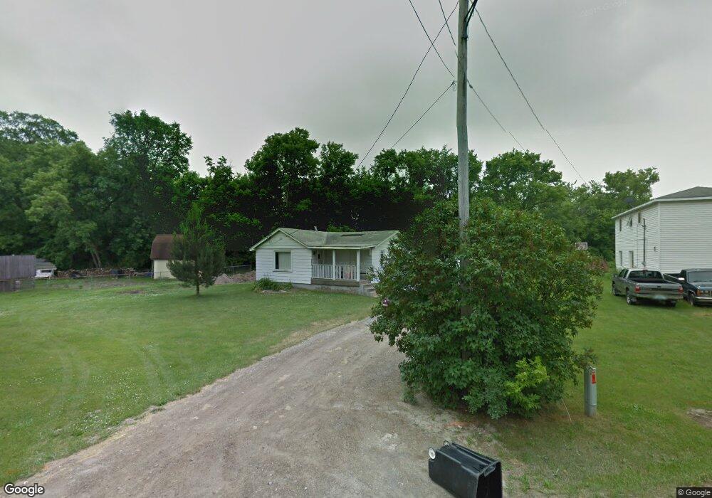
This home is located at 4089 Corbin Dr, Flint, MI 48532 and is currently estimated at $98,089, approximately $111 per square foot. 4089 Corbin Dr is a home located in Genesee County with nearby schools including Carman-Ainsworth High School, Genesee STEM Academy, and St. Paul Lutheran School.
Ownership History
Date
Name
Owned For
Owner Type
Purchase Details
Closed on
Mar 10, 2011
Sold by
Federal Deposit Insurance Corporation
Bought by
Ral Realty Llc
Current Estimated Value
Purchase Details
Closed on
Nov 25, 2009
Sold by
Gebhardt Jennifer N
Bought by
Am Trust Bank
Purchase Details
Closed on
Feb 10, 2005
Sold by
Demoss Coleen and Conlan Terry
Bought by
Gebhardt Jennifer N
Home Financials for this Owner
Home Financials are based on the most recent Mortgage that was taken out on this home.
Original Mortgage
$52,000
Interest Rate
9.12%
Mortgage Type
Purchase Money Mortgage
Purchase Details
Closed on
Feb 21, 2002
Sold by
Gebhardt Donna M
Bought by
Long William M
Create a Home Valuation Report for This Property
The Home Valuation Report is an in-depth analysis detailing your home's value as well as a comparison with similar homes in the area
Home Values in the Area
Average Home Value in this Area
Purchase History
| Date | Buyer | Sale Price | Title Company |
|---|---|---|---|
| Ral Realty Llc | -- | First American Title | |
| Am Trust Bank | $43,683 | None Available | |
| Gebhardt Jennifer N | $52,000 | Lawyers Title | |
| Long William M | $35,000 | Sargents Title Company | |
| Gebhardt Donna M | $30,000 | Sargents Title Company |
Source: Public Records
Mortgage History
| Date | Status | Borrower | Loan Amount |
|---|---|---|---|
| Previous Owner | Gebhardt Jennifer N | $52,000 |
Source: Public Records
Tax History
| Year | Tax Paid | Tax Assessment Tax Assessment Total Assessment is a certain percentage of the fair market value that is determined by local assessors to be the total taxable value of land and additions on the property. | Land | Improvement |
|---|---|---|---|---|
| 2025 | $2,152 | $43,600 | $0 | $0 |
| 2024 | $1,250 | $37,800 | $0 | $0 |
| 2023 | $1,192 | $35,400 | $0 | $0 |
| 2022 | $802 | $26,900 | $0 | $0 |
| 2021 | $1,777 | $23,600 | $0 | $0 |
| 2020 | $815 | $22,500 | $0 | $0 |
| 2019 | $1,023 | $20,600 | $0 | $0 |
| 2018 | $1,495 | $20,700 | $0 | $0 |
| 2017 | $1,901 | $20,700 | $0 | $0 |
| 2016 | $1,701 | $20,600 | $0 | $0 |
| 2015 | $1,088 | $19,200 | $0 | $0 |
| 2014 | $779 | $18,600 | $0 | $0 |
| 2012 | -- | $21,300 | $21,300 | $0 |
Source: Public Records
Map
Nearby Homes
- 2033 Eberly Rd
- 18.41 Taft Rd
- 1512 Crescent Lane Dr Lot#46
- 10 Acres T A Mansour Blvd
- 3277 Whitney Ave
- VL Clairmont St
- 4199 Sheraton Dr
- 3365 Ridgecliffe Dr
- 3349 Ridgecliffe Dr
- 4474 Corunna Rd
- 4480 Corunna Rd
- 1455 S Linden Rd
- 3088 Curtis Dr
- 4335 Lennon Rd
- 0 Charter Dr Unit 50153638
- 3918 Larchmont St
- 3915 Augusta St
- 3320 Timberview St
- 3493 Ridgecliffe Dr
- 3825 Arlene Ave
Your Personal Tour Guide
Ask me questions while you tour the home.