Estimated Value: $208,000 - $256,000
3
Beds
2
Baths
1,551
Sq Ft
$144/Sq Ft
Est. Value
About This Home
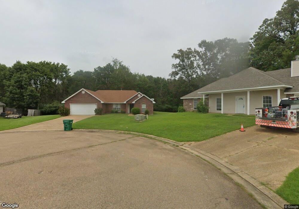
This home is located at 409 Anthony Cove, Byram, MS 39272 and is currently estimated at $223,035, approximately $143 per square foot. 409 Anthony Cove is a home located in Hinds County with nearby schools including Gary Road Elementary School, Gary Road Intermediate School, and Byram Middle School.
Ownership History
Date
Name
Owned For
Owner Type
Purchase Details
Closed on
Jul 31, 2007
Sold by
Highland Builders Inc
Bought by
Johnson Karynette H
Current Estimated Value
Home Financials for this Owner
Home Financials are based on the most recent Mortgage that was taken out on this home.
Original Mortgage
$141,382
Outstanding Balance
$89,057
Interest Rate
6.56%
Mortgage Type
FHA
Estimated Equity
$133,978
Create a Home Valuation Report for This Property
The Home Valuation Report is an in-depth analysis detailing your home's value as well as a comparison with similar homes in the area
Home Values in the Area
Average Home Value in this Area
Purchase History
| Date | Buyer | Sale Price | Title Company |
|---|---|---|---|
| Johnson Karynette H | -- | -- |
Source: Public Records
Mortgage History
| Date | Status | Borrower | Loan Amount |
|---|---|---|---|
| Open | Johnson Karynette H | $141,382 |
Source: Public Records
Tax History
| Year | Tax Paid | Tax Assessment Tax Assessment Total Assessment is a certain percentage of the fair market value that is determined by local assessors to be the total taxable value of land and additions on the property. | Land | Improvement |
|---|---|---|---|---|
| 2025 | $1,632 | $12,666 | $2,500 | $10,166 |
| 2024 | $1,632 | $12,352 | $2,500 | $9,852 |
| 2023 | $1,632 | $12,352 | $2,500 | $9,852 |
| 2022 | $1,900 | $12,352 | $2,500 | $9,852 |
| 2021 | $1,575 | $12,352 | $2,500 | $9,852 |
| 2020 | $1,524 | $12,171 | $2,500 | $9,671 |
| 2019 | $1,515 | $12,171 | $2,500 | $9,671 |
| 2018 | $1,515 | $12,171 | $2,500 | $9,671 |
| 2017 | $1,481 | $12,171 | $2,500 | $9,671 |
| 2016 | $1,481 | $12,171 | $2,500 | $9,671 |
| 2015 | $1,456 | $12,002 | $2,500 | $9,502 |
| 2014 | $1,432 | $12,002 | $2,500 | $9,502 |
Source: Public Records
Map
Nearby Homes
- 324 Martha Dr
- 224 Brannan Ave
- 201 Brannan Ave
- 816 Fairway Ave
- 820 Fairway Ave
- 824 Fairway Ave
- 100 Lucas Ct
- 109 Lucas Ct
- 504 Parker Dr
- 8834 Gary Rd
- 0 Terry Rd Unit 24270230
- 0 Terry Rd Unit 4135800
- 0 Terry Rd Unit 4130083
- 176 Winchester St
- 699 Meadow Ln
- 812 Fairway Ave
- 801 Fairway Ave
- 808 Fairway Ave
- 805 Fairway Ave
- 610 Ridge Place
- 408 Anthony Cove
- 405 Anthony Cove
- 404 Anthony Cove
- 0 Anthony Cove Unit Lot 13 1168003
- 0 Anthony Cove Unit Lot 14
- 140 Carl Cir
- 136 Carl Cir
- 144 Carl Cir
- 132 Carl Cir
- 127 Carol Ave
- 127 Carl Cir
- 131 Carl Cir
- 123 Carl Cir
- 148 Carl Cir
- 128 Carl Cir
- 119 Carl Cir
- 152 Carl Cir
- 115 Carl Cir
- 316 Martha Dr
- 320 Martha Dr
Your Personal Tour Guide
Ask me questions while you tour the home.