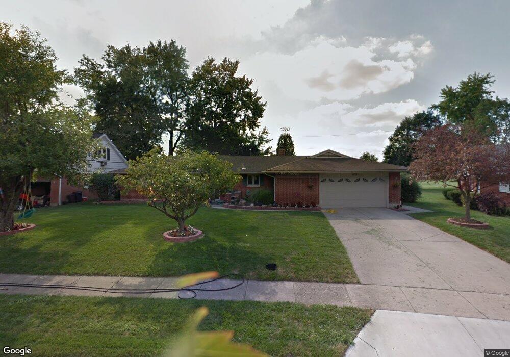
409 Bennert Dr Vandalia, OH 45377
Estimated Value: $256,910 - $305,000
3
Beds
2
Baths
1,927
Sq Ft
$147/Sq Ft
Est. Value
About This Home
This home is located at 409 Bennert Dr, Vandalia, OH 45377 and is currently estimated at $283,228, approximately $146 per square foot. 409 Bennert Dr is a home located in Montgomery County with nearby schools including Demmitt Elementary School, Smith Middle School, and Butler High School.
Ownership History
Date
Name
Owned For
Owner Type
Purchase Details
Closed on
Apr 7, 2021
Sold by
Pelfrey Amber N
Bought by
Pelfrey Nicholas R
Current Estimated Value
Home Financials for this Owner
Home Financials are based on the most recent Mortgage that was taken out on this home.
Original Mortgage
$140,000
Outstanding Balance
$125,578
Interest Rate
3%
Mortgage Type
New Conventional
Estimated Equity
$157,650
Purchase Details
Closed on
May 21, 2008
Sold by
Bone Orma C and Bone David L
Bought by
Pelfrey Nicholas R and Pelfrey Amber N
Home Financials for this Owner
Home Financials are based on the most recent Mortgage that was taken out on this home.
Original Mortgage
$140,000
Interest Rate
6.01%
Mortgage Type
Purchase Money Mortgage
Purchase Details
Closed on
Apr 24, 2007
Sold by
Bone Orma C
Bought by
Bone Orma C
Purchase Details
Closed on
Nov 21, 1997
Sold by
Bone David L and Bone Orma C
Bought by
Bone Orma C
Create a Home Valuation Report for This Property
The Home Valuation Report is an in-depth analysis detailing your home's value as well as a comparison with similar homes in the area
Home Values in the Area
Average Home Value in this Area
Purchase History
| Date | Buyer | Sale Price | Title Company |
|---|---|---|---|
| Pelfrey Nicholas R | -- | None Available | |
| Pelfrey Nicholas R | $160,000 | Evans Title Agency Inc | |
| Bone Orma C | -- | None Available | |
| Bone Orma C | -- | -- |
Source: Public Records
Mortgage History
| Date | Status | Borrower | Loan Amount |
|---|---|---|---|
| Open | Pelfrey Nicholas R | $140,000 | |
| Closed | Pelfrey Nicholas R | $140,000 |
Source: Public Records
Tax History
| Year | Tax Paid | Tax Assessment Tax Assessment Total Assessment is a certain percentage of the fair market value that is determined by local assessors to be the total taxable value of land and additions on the property. | Land | Improvement |
|---|---|---|---|---|
| 2025 | $4,079 | $75,720 | $17,790 | $57,930 |
| 2024 | $3,951 | $75,720 | $17,790 | $57,930 |
| 2023 | $3,951 | $75,720 | $17,790 | $57,930 |
| 2022 | $3,349 | $51,870 | $12,190 | $39,680 |
| 2021 | $3,352 | $51,870 | $12,190 | $39,680 |
| 2020 | $3,419 | $51,870 | $12,190 | $39,680 |
| 2019 | $3,622 | $50,390 | $12,190 | $38,200 |
| 2018 | $3,629 | $50,390 | $12,190 | $38,200 |
| 2017 | $3,605 | $50,390 | $12,190 | $38,200 |
| 2016 | $3,358 | $47,240 | $12,190 | $35,050 |
| 2015 | $3,316 | $47,240 | $12,190 | $35,050 |
| 2014 | $3,316 | $47,240 | $12,190 | $35,050 |
| 2012 | -- | $53,090 | $12,160 | $40,930 |
Source: Public Records
Map
Nearby Homes
- 322 Reichard Dr
- 861 Kenbrook Dr
- 528 Blue Jay Dr
- 314 N American Blvd
- 284 N American Blvd
- 1119 Birchton Place
- 117 Westhafer Rd
- 270 Inverness Ave
- 177 Larry Ave Unit 177
- 246 Crest Hill Ave
- 846 Maridon Ct
- 112 Colebrook Dr
- 465 Pilot Point Unit 1-302
- 626 W National Rd
- 77 S Brown School Rd
- 485 Pilot Point Unit 1-301
- 408 Bent Twig Dr
- 860 Helke Rd
- 475 Pilot Point Unit 1-300
- 620 Thoma Place Unit D17
Your Personal Tour Guide
Ask me questions while you tour the home.