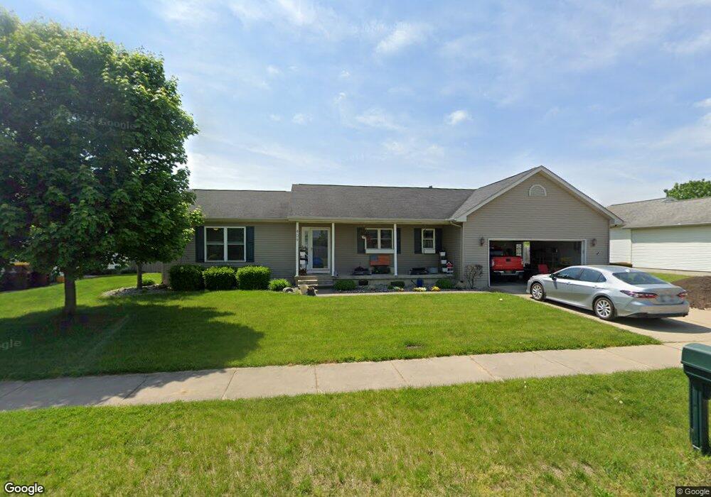
409 Daisy Dr St Update, MI 48879
Estimated Value: $299,000 - $347,000
3
Beds
2
Baths
1,656
Sq Ft
$192/Sq Ft
Est. Value
About This Home
This home is located at 409 Daisy Dr St, Update, MI 48879 and is currently estimated at $318,742, approximately $192 per square foot. 409 Daisy Dr St is a home located in Clinton County with nearby schools including St. Johns High School and St Joseph Catholic School.
Ownership History
Date
Name
Owned For
Owner Type
Purchase Details
Closed on
Jan 12, 2017
Sold by
Douglas L Sturgis Revocable Trust
Bought by
Zolnai Julie
Current Estimated Value
Home Financials for this Owner
Home Financials are based on the most recent Mortgage that was taken out on this home.
Original Mortgage
$180,133
Outstanding Balance
$148,615
Interest Rate
4.16%
Mortgage Type
New Conventional
Estimated Equity
$170,127
Purchase Details
Closed on
Jan 17, 2015
Sold by
Sturgis Douglas L
Bought by
Sturgis Douglas L and Douglas L Sturgis Revocable Trust
Purchase Details
Closed on
Oct 31, 2011
Sold by
Sally M Pratt Revocable Trust Agreement and Pratt Sally M
Bought by
Strugis Douglas L
Home Financials for this Owner
Home Financials are based on the most recent Mortgage that was taken out on this home.
Original Mortgage
$143,273
Interest Rate
4.25%
Mortgage Type
FHA
Create a Home Valuation Report for This Property
The Home Valuation Report is an in-depth analysis detailing your home's value as well as a comparison with similar homes in the area
Home Values in the Area
Average Home Value in this Area
Purchase History
| Date | Buyer | Sale Price | Title Company |
|---|---|---|---|
| Zolnai Julie | $184,800 | Fatic | |
| Sturgis Douglas L | -- | None Available | |
| Strugis Douglas L | $147,000 | Tri Title Agency Llc |
Source: Public Records
Mortgage History
| Date | Status | Borrower | Loan Amount |
|---|---|---|---|
| Open | Zolnai Julie | $180,133 | |
| Previous Owner | Strugis Douglas L | $143,273 |
Source: Public Records
Tax History
| Year | Tax Paid | Tax Assessment Tax Assessment Total Assessment is a certain percentage of the fair market value that is determined by local assessors to be the total taxable value of land and additions on the property. | Land | Improvement |
|---|---|---|---|---|
| 2025 | $4,795 | $161,900 | $15,100 | $146,800 |
| 2024 | $33 | $154,400 | $15,100 | $139,300 |
| 2023 | $3,066 | $141,600 | $0 | $0 |
| 2022 | $4,303 | $129,900 | $13,200 | $116,700 |
| 2021 | $4,204 | $122,300 | $11,300 | $111,000 |
| 2020 | $4,062 | $115,800 | $10,400 | $105,400 |
| 2019 | $3,926 | $105,100 | $10,400 | $94,700 |
| 2018 | $3,493 | $96,800 | $10,400 | $86,400 |
| 2017 | -- | $89,700 | $10,400 | $79,300 |
| 2016 | -- | $85,600 | $11,000 | $74,600 |
| 2015 | -- | $84,600 | $0 | $0 |
| 2011 | -- | $82,100 | $0 | $0 |
Source: Public Records
Map
Nearby Homes
- 1103 Kelcrasta Dr
- 1110 Lois Ln
- 606 W Gibbs St
- 509 W Gibbs St
- 608 N Morton St
- 719 N Clinton Ave
- 609 N Morton St Unit 13
- 609 N Morton St Unit 80
- 609 N Morton St Unit 57
- 609 N Morton St Unit 17
- 905 W Gibbs St Unit 28
- 111 W Steel St
- 107 W Steel St
- 810 Joyce Ln
- 808 Joyce Ln
- 705 N Us127
- 1021 Randy Ln Unit 34
- 502 W State St
- 308 N Swegles St
- 912 Randy Ln Unit 6
Your Personal Tour Guide
Ask me questions while you tour the home.