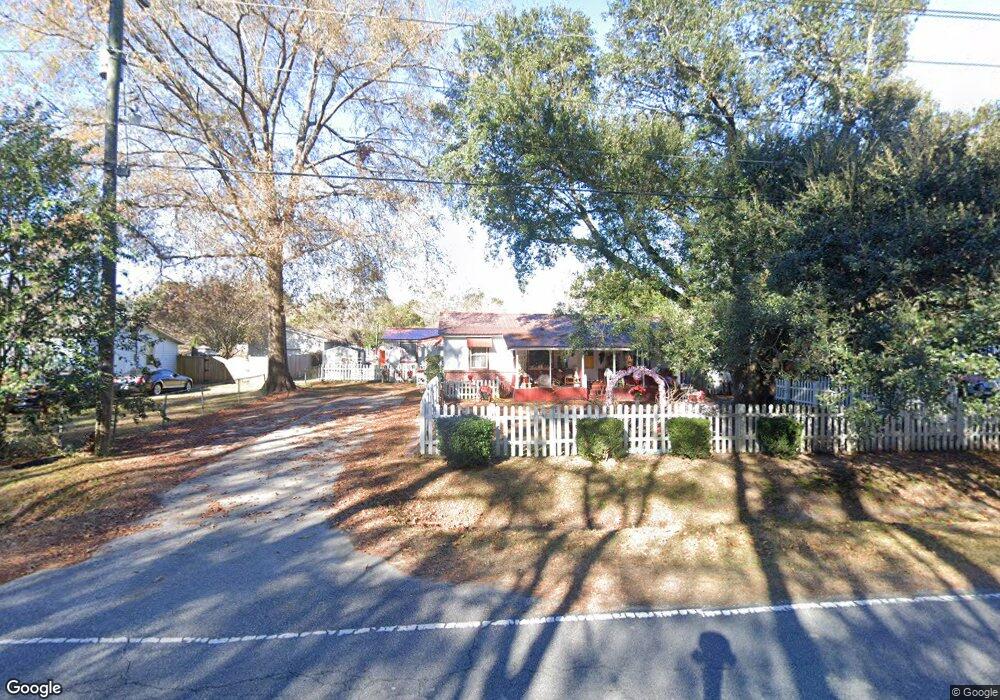
409 Embassy Dr Summerville, SC 29483
Estimated Value: $248,000 - $327,000
2
Beds
1
Bath
889
Sq Ft
$308/Sq Ft
Est. Value
About This Home
This home is located at 409 Embassy Dr, Summerville, SC 29483 and is currently estimated at $273,515, approximately $307 per square foot. 409 Embassy Dr is a home with nearby schools including Newington Elementary School, Charles B. DuBose Middle School, and Summerville High School.
Ownership History
Date
Name
Owned For
Owner Type
Purchase Details
Closed on
Sep 9, 2019
Sold by
Rudd Sylvia W and Watson James L
Bought by
Watson James L
Current Estimated Value
Purchase Details
Closed on
Jun 19, 2019
Sold by
Rudd Sylvia W and Watson James L
Bought by
Watson Pamela
Purchase Details
Closed on
Apr 18, 2012
Sold by
Estate Of Ermine T Watson
Bought by
Rudd Sylvia W and Autry Pamela W
Purchase Details
Closed on
Jan 20, 2010
Sold by
Watson James L
Bought by
Watson Ermine T
Purchase Details
Closed on
Feb 14, 2008
Sold by
Watson Ermine T
Bought by
Brown Brian and Brown Michelle
Create a Home Valuation Report for This Property
The Home Valuation Report is an in-depth analysis detailing your home's value as well as a comparison with similar homes in the area
Home Values in the Area
Average Home Value in this Area
Purchase History
| Date | Buyer | Sale Price | Title Company |
|---|---|---|---|
| Watson James L | -- | None Available | |
| Watson Pamela | -- | None Available | |
| Rudd Sylvia W | -- | -- | |
| Watson Ermine T | -- | -- | |
| Rudd Sylvia W | -- | -- | |
| Brown Brian | -- | Attorney |
Source: Public Records
Tax History Compared to Growth
Tax History
| Year | Tax Paid | Tax Assessment Tax Assessment Total Assessment is a certain percentage of the fair market value that is determined by local assessors to be the total taxable value of land and additions on the property. | Land | Improvement |
|---|---|---|---|---|
| 2024 | $573 | $7,781 | $3,600 | $4,181 |
| 2023 | $573 | $3,221 | $720 | $2,501 |
| 2022 | $701 | $3,790 | $720 | $3,070 |
| 2021 | $556 | $3,790 | $720 | $3,070 |
| 2020 | $3,279 | $10,010 | $2,610 | $7,400 |
| 2019 | $4,182 | $10,010 | $2,610 | $7,400 |
| 2018 | $3,487 | $10,010 | $2,610 | $7,400 |
| 2017 | $3,476 | $10,010 | $2,610 | $7,400 |
| 2016 | $3,426 | $10,010 | $2,610 | $7,400 |
| 2015 | $3,420 | $10,010 | $2,610 | $7,400 |
| 2014 | $3,570 | $177,500 | $0 | $0 |
| 2013 | -- | $10,650 | $0 | $0 |
Source: Public Records
Map
Nearby Homes
- 385 Embassy Dr
- 120 Greenhill Pastures
- 133 Stephanie Cir
- 131 County Road S-18-409
- 302 Embassy Dr
- 105 Ruth Anne Dr
- 218 Whippoorwill Dr
- 145 Center St
- 224 Ruth Anne Dr
- 4021 Sanderson Ln
- 5021 Blair Rd
- 139 Reed St
- 10001 Begovich Ct
- Sumter Plan at Central Estates
- Ludington Plan at Central Estates
- Morgan Plan at Central Estates
- Brewster Plan at Central Estates
- Putnam Plan at Central Estates
- Mercer Plan at Central Estates
- Adams Plan at Central Estates