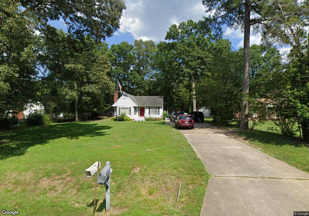
409 Evanrude Ln Sandston, VA 23150
Estimated Value: $287,000 - $310,000
3
Beds
2
Baths
1,367
Sq Ft
$217/Sq Ft
Est. Value
About This Home
This home is located at 409 Evanrude Ln, Sandston, VA 23150 and is currently estimated at $297,227, approximately $217 per square foot. 409 Evanrude Ln is a home located in Henrico County with nearby schools including Donahoe Elementary School, Elko Middle School, and Highland Springs High School.
Ownership History
Date
Name
Owned For
Owner Type
Purchase Details
Closed on
Sep 14, 2006
Sold by
Trading Dirt L L C
Bought by
Holmes Louis W
Current Estimated Value
Home Financials for this Owner
Home Financials are based on the most recent Mortgage that was taken out on this home.
Original Mortgage
$179,000
Outstanding Balance
$107,027
Interest Rate
6.59%
Mortgage Type
VA
Estimated Equity
$190,200
Purchase Details
Closed on
Mar 16, 2006
Sold by
Green Kurt P
Bought by
Trading Dirt L L C
Home Financials for this Owner
Home Financials are based on the most recent Mortgage that was taken out on this home.
Original Mortgage
$130,000
Interest Rate
6.27%
Mortgage Type
New Conventional
Purchase Details
Closed on
Dec 7, 1998
Sold by
Murphy William E and Murphy M
Bought by
Green Kurt P and Green Amy R
Home Financials for this Owner
Home Financials are based on the most recent Mortgage that was taken out on this home.
Original Mortgage
$97,546
Interest Rate
6.68%
Mortgage Type
FHA
Create a Home Valuation Report for This Property
The Home Valuation Report is an in-depth analysis detailing your home's value as well as a comparison with similar homes in the area
Home Values in the Area
Average Home Value in this Area
Purchase History
| Date | Buyer | Sale Price | Title Company |
|---|---|---|---|
| Holmes Louis W | $179,000 | -- | |
| Trading Dirt L L C | $102,496 | -- | |
| Green Kurt P | $106,000 | -- |
Source: Public Records
Mortgage History
| Date | Status | Borrower | Loan Amount |
|---|---|---|---|
| Open | Holmes Louis W | $179,000 | |
| Previous Owner | Trading Dirt L L C | $130,000 | |
| Previous Owner | Green Kurt P | $97,546 |
Source: Public Records
Tax History Compared to Growth
Tax History
| Year | Tax Paid | Tax Assessment Tax Assessment Total Assessment is a certain percentage of the fair market value that is determined by local assessors to be the total taxable value of land and additions on the property. | Land | Improvement |
|---|---|---|---|---|
| 2025 | $2,400 | $266,900 | $47,000 | $219,900 |
| 2024 | $2,400 | $266,900 | $47,000 | $219,900 |
| 2023 | $2,269 | $266,900 | $47,000 | $219,900 |
| 2022 | $2,101 | $247,200 | $45,000 | $202,200 |
| 2021 | $1,651 | $177,800 | $40,000 | $137,800 |
| 2020 | $1,547 | $177,800 | $40,000 | $137,800 |
| 2019 | $1,482 | $170,300 | $40,000 | $130,300 |
| 2018 | $1,363 | $156,700 | $40,000 | $116,700 |
| 2017 | $1,323 | $152,100 | $40,000 | $112,100 |
| 2016 | $1,270 | $146,000 | $40,000 | $106,000 |
| 2015 | $1,231 | $146,000 | $40,000 | $106,000 |
| 2014 | $1,231 | $141,500 | $40,000 | $101,500 |
Source: Public Records
Map
Nearby Homes
- 1920 Meadow Rd
- 1290 Grapevine Rd
- 149 York River Rd
- 1649 Meadow Rd
- 1712 N Airport Dr
- 670 N Airport Dr
- 2500 Meadow Rd
- 300 Carlstone Dr
- 621 N Airport Dr
- 203 Meadow Rd
- 428 Roxana Rd
- 219 Defense Ave
- 1928 Repp Cir
- 405 Roxana Rd
- 204 Cornett St
- 206 Naglee Ave
- 121 E Magruder St
- 305 E Union St
- 5501 Whiteside Rd
- 1517 Sir William Ct
- 405 Evanrude Ln
- 413 Evanrude Ln
- 1905 Evanrude Ct
- 1904 Graves Rd
- 1900 Graves Rd
- 1909 Evanrude Ct
- 408 Evanrude Ln
- 421 Evanrude Ln
- 412 Evanrude Ln
- 1908 Graves Rd
- 416 Evanrude Ln
- 1904 Evanrude Ct
- 1864 Graves Rd
- 425 Evanrude Ln
- 1913 Evanrude Ct
- 420 Evanrude Ln
- 1908 Evanrude Ct
- 1912 Graves Rd
- 1860 Graves Rd
- 429 Evanrude Ln