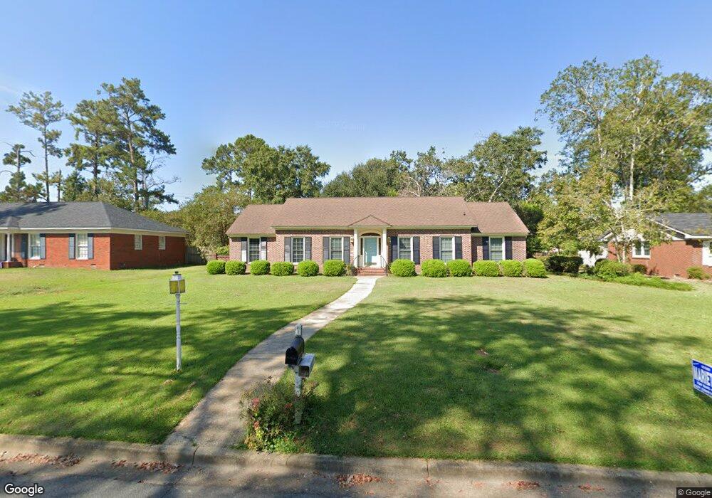
409 Forest Glen Dr Albany, GA 31707
Westover NeighborhoodEstimated Value: $195,642 - $249,000
3
Beds
2
Baths
1,968
Sq Ft
$111/Sq Ft
Est. Value
About This Home
This home is located at 409 Forest Glen Dr, Albany, GA 31707 and is currently estimated at $217,661, approximately $110 per square foot. 409 Forest Glen Dr is a home located in Dougherty County with nearby schools including Lake Park Elementary School, Merry Acres Middle School, and Westover High School.
Ownership History
Date
Name
Owned For
Owner Type
Purchase Details
Closed on
Jul 12, 2007
Sold by
Toole Mack
Bought by
Toole Joan E
Current Estimated Value
Purchase Details
Closed on
Oct 3, 1995
Sold by
Mcginnis Elizabeth J
Bought by
Toole Mack and Toole Joan E
Purchase Details
Closed on
Jan 3, 1995
Sold by
Mcginnis Robert D By Exec Of Will
Bought by
Mcginnis Elizabeth J
Purchase Details
Closed on
Jan 27, 1993
Sold by
Dumpis Peter J and S J
Bought by
Mcginnis Robert D and Mcginnis Elizabeth J
Purchase Details
Closed on
Mar 1, 1991
Sold by
Dumpis Peter J
Bought by
Dumpis Susan J
Purchase Details
Closed on
Feb 19, 1975
Sold by
Thurston Robert
Bought by
Durham Melvin Etal
Create a Home Valuation Report for This Property
The Home Valuation Report is an in-depth analysis detailing your home's value as well as a comparison with similar homes in the area
Home Values in the Area
Average Home Value in this Area
Purchase History
| Date | Buyer | Sale Price | Title Company |
|---|---|---|---|
| Toole Joan E | -- | -- | |
| Toole Mack | $91,500 | -- | |
| Mcginnis Elizabeth J | -- | -- | |
| Mcginnis Robert D | $87,500 | -- | |
| Dumpis Susan J | -- | -- | |
| Dumpis Peter J | $87,300 | -- | |
| Durham Melvin Etal | -- | -- |
Source: Public Records
Tax History Compared to Growth
Tax History
| Year | Tax Paid | Tax Assessment Tax Assessment Total Assessment is a certain percentage of the fair market value that is determined by local assessors to be the total taxable value of land and additions on the property. | Land | Improvement |
|---|---|---|---|---|
| 2024 | $2,326 | $48,760 | $9,600 | $39,160 |
| 2023 | $2,272 | $48,760 | $9,600 | $39,160 |
| 2022 | $2,167 | $48,760 | $9,600 | $39,160 |
| 2021 | $2,008 | $48,760 | $9,600 | $39,160 |
| 2020 | $2,013 | $48,760 | $9,600 | $39,160 |
| 2019 | $2,020 | $48,760 | $9,600 | $39,160 |
| 2018 | $2,029 | $48,760 | $9,600 | $39,160 |
| 2017 | $1,888 | $48,760 | $9,600 | $39,160 |
| 2016 | $1,890 | $48,760 | $9,600 | $39,160 |
| 2015 | $1,892 | $48,760 | $9,600 | $39,160 |
| 2014 | $1,953 | $50,920 | $11,760 | $39,160 |
Source: Public Records
Map
Nearby Homes
- 415 Forest Glen Dr
- 427 S Audubon Dr
- 1813 Gillionville Rd
- 2613 Partridge Dr
- 418 Meadowlark Dr
- 607 Summit Dr
- 1826 Green Valley Ln
- 1814 Green Valley Ln
- 2508 Pheasant Dr
- 00 Gillionville Rd
- 2506 Ridgewood Ln
- 2200 Gillionville Rd
- 2807 Stonewater Dr
- 2814 Reeves Ln
- 1812 Robinhood Rd
- 2802 Stonewater Dr
- 120 Mossydale Ln
- 1914 W Lakeridge Dr
- 2205 Star Ln
- 1802 W Lakeridge Dr
- 411 Forest Glen Dr
- 407 Forest Glen Dr
- 413 Forest Glen Dr
- 405 Forest Glen Dr
- 440 Kingswood Ct
- 416 Clarendon Ct
- 442 Kingswood Ct
- 408 Forest Glen Dr
- 410 Forest Glen Dr
- 406 Forest Glen Dr
- 446 Kingswood Ct
- 412 Forest Glen Dr
- 403 Forest Glen Dr
- 437 Kingswood Ct
- 448 Kingswood Ct
- 415 Clarendon Ct
- 404 Forest Glen Dr
- 435 Kingswood Ct
- 450 Kingswood Ct
- 433 Kingswood Dr