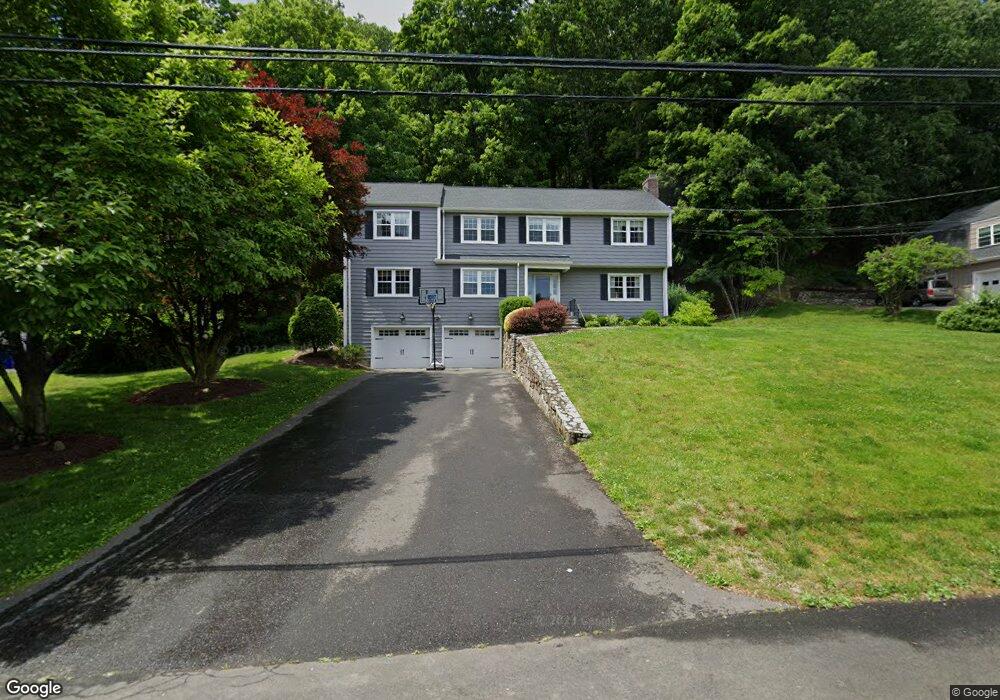
409 Mountain Laurel Rd Fairfield, CT 06824
Greenfield Hill NeighborhoodEstimated Value: $1,117,138 - $1,474,000
4
Beds
4
Baths
2,420
Sq Ft
$547/Sq Ft
Est. Value
About This Home
This home is located at 409 Mountain Laurel Rd, Fairfield, CT 06824 and is currently estimated at $1,324,035, approximately $547 per square foot. 409 Mountain Laurel Rd is a home located in Fairfield County with nearby schools including Burr Elementary School, Tomlinson Middle School, and Fairfield Warde High School.
Ownership History
Date
Name
Owned For
Owner Type
Purchase Details
Closed on
Jun 26, 1995
Sold by
Hervey Paul M and Hervey Kathryn S
Bought by
Warman Marc J and Warman Amy E
Current Estimated Value
Purchase Details
Closed on
Apr 2, 1990
Sold by
Obrien James E
Bought by
Hervey Paul M
Create a Home Valuation Report for This Property
The Home Valuation Report is an in-depth analysis detailing your home's value as well as a comparison with similar homes in the area
Home Values in the Area
Average Home Value in this Area
Purchase History
| Date | Buyer | Sale Price | Title Company |
|---|---|---|---|
| Warman Marc J | $377,000 | -- | |
| Warman Marc J | $377,000 | -- | |
| Hervey Paul M | $300,000 | -- |
Source: Public Records
Mortgage History
| Date | Status | Borrower | Loan Amount |
|---|---|---|---|
| Open | Hervey Paul M | $250,000 | |
| Closed | Hervey Paul M | $250,000 |
Source: Public Records
Tax History
| Year | Tax Paid | Tax Assessment Tax Assessment Total Assessment is a certain percentage of the fair market value that is determined by local assessors to be the total taxable value of land and additions on the property. | Land | Improvement |
|---|---|---|---|---|
| 2025 | $11,004 | $387,590 | $197,680 | $189,910 |
| 2024 | $10,814 | $387,590 | $197,680 | $189,910 |
| 2023 | $10,663 | $387,590 | $197,680 | $189,910 |
| 2022 | $10,558 | $387,590 | $197,680 | $189,910 |
| 2021 | $10,457 | $387,590 | $197,680 | $189,910 |
| 2020 | $10,494 | $391,720 | $171,500 | $220,220 |
| 2019 | $10,494 | $391,720 | $171,500 | $220,220 |
| 2018 | $10,326 | $391,720 | $171,500 | $220,220 |
| 2017 | $10,114 | $391,720 | $171,500 | $220,220 |
| 2016 | $9,969 | $391,720 | $171,500 | $220,220 |
| 2015 | $10,002 | $403,480 | $190,960 | $212,520 |
| 2014 | $9,845 | $403,480 | $190,960 | $212,520 |
Source: Public Records
Map
Nearby Homes
- 54 Ridgedale Rd
- 210 Pansy Rd
- 1115 Galloping Hill Rd
- 10 Pansy Rd
- 218 Lower Farm Rd
- 706 Judd St
- 148 Millspaugh Dr
- 6 Buckboard Ln
- 158 Mayfair Rd
- 115 Mayfair Rd
- 31 High Ridge Rd
- 205 Winnepoge Dr
- 175 Winnepoge Dr
- 280 Tuckahoe Ln
- 164 Farist Rd
- 11 Tuckahoe Ln
- 109 Katona Dr Unit 18
- 359 Reid St
- 204 Glen Ridge Rd
- 217 Fairland Dr
- 431 Mountain Laurel Rd
- 408 Mountain Laurel Rd
- 385 Mountain Laurel Rd
- 380 Mountain Laurel Rd
- 363 Mountain Laurel Rd
- 436 Mountain Laurel Rd
- 352 Mountain Laurel Rd
- 335 Mountain Laurel Rd
- 455 Mountain Laurel Rd
- 480 Mountain Laurel Rd
- 35 Stroll Rock Common
- 410 Galloping Hill Rd
- 320 Mountain Laurel Rd
- 15 Stroll Rock Common
- 485 Mountain Laurel Rd
- 542 Mountain Laurel Rd
- 55 Stroll Rock Common
- 58 Brighton View Rd
- 305 Mountain Laurel Rd
- 428 Galloping Hill Rd
Your Personal Tour Guide
Ask me questions while you tour the home.