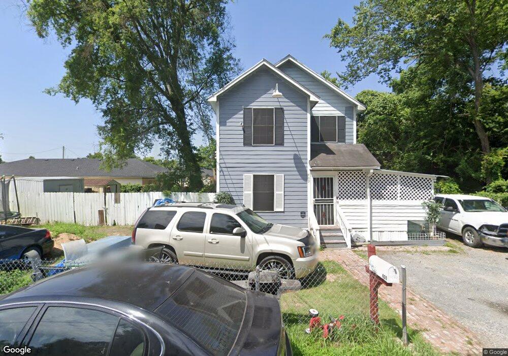
409 N 13th St Monroe, LA 71201
Midtown NeighborhoodEstimated Value: $86,000 - $132,000
--
Bed
--
Bath
1,136
Sq Ft
$94/Sq Ft
Est. Value
About This Home
This home is located at 409 N 13th St, Monroe, LA 71201 and is currently estimated at $106,482, approximately $93 per square foot. 409 N 13th St is a home located in Ouachita Parish with nearby schools including Carver Elementary School, Carroll Junior High School, and Carroll High School.
Ownership History
Date
Name
Owned For
Owner Type
Purchase Details
Closed on
Jan 14, 2023
Sold by
Fletcher Shanterika
Bought by
Mcelveen Donald
Current Estimated Value
Purchase Details
Closed on
Aug 26, 2022
Sold by
Donald Mcelveen Sr
Bought by
Mcelveen Donald and Fletcher Shanterika
Home Financials for this Owner
Home Financials are based on the most recent Mortgage that was taken out on this home.
Original Mortgage
$71,632
Interest Rate
5.3%
Mortgage Type
New Conventional
Purchase Details
Closed on
Mar 6, 2019
Sold by
Mcfarland-Mcelveen C
Bought by
Mcelveen Donald
Create a Home Valuation Report for This Property
The Home Valuation Report is an in-depth analysis detailing your home's value as well as a comparison with similar homes in the area
Home Values in the Area
Average Home Value in this Area
Purchase History
| Date | Buyer | Sale Price | Title Company |
|---|---|---|---|
| Mcelveen Donald | -- | -- | |
| Mcelveen Donald | -- | New Title Company Name | |
| Mcelveen Donald | -- | -- |
Source: Public Records
Mortgage History
| Date | Status | Borrower | Loan Amount |
|---|---|---|---|
| Previous Owner | Mcelveen Donald | $71,632 |
Source: Public Records
Tax History Compared to Growth
Tax History
| Year | Tax Paid | Tax Assessment Tax Assessment Total Assessment is a certain percentage of the fair market value that is determined by local assessors to be the total taxable value of land and additions on the property. | Land | Improvement |
|---|---|---|---|---|
| 2024 | $163 | $5,792 | $245 | $5,547 |
| 2023 | $163 | $5,792 | $245 | $5,547 |
| 2022 | $613 | $5,792 | $245 | $5,547 |
| 2021 | $611 | $5,792 | $245 | $5,547 |
| 2020 | $611 | $5,792 | $245 | $5,547 |
| 2019 | $618 | $5,893 | $250 | $5,643 |
| 2018 | $160 | $5,893 | $250 | $5,643 |
| 2017 | $652 | $5,893 | $250 | $5,643 |
| 2016 | $652 | $5,893 | $250 | $5,643 |
| 2015 | $160 | $5,893 | $250 | $5,643 |
| 2014 | $160 | $5,893 | $250 | $5,643 |
| 2013 | $160 | $5,893 | $250 | $5,643 |
Source: Public Records
Map
Nearby Homes
- 116 Powells Alley
- 1611 Breard St
- 611 Bres Ave
- 1000 N 7th St
- 1601 Stubbs Ave
- 0 Louisville Ave Unit 1.4 AC 212195
- 0 U S 80
- 1603 Royal Ave
- 611 Stubbs Ave
- 2020 Louisville Ave Unit Outparcel
- 000 Aaron St
- 1304 Glenmar Ave
- 1010 Glenmar Ave
- 400 N 24th St
- 400 N 25th St
- 505 Auburn Ave
- 429 N 26th St
- 0 Wayne St Unit 214427
- 209 Stubbs Ave
- 1208 Stone Ave
- 405 N 13th St
- 415 N 13th St
- 1205 Breard St
- 1305 Breard St
- 1201 Breard St
- 1311 Breard St
- 1303 Olive St
- 1309 Olive St
- 411 N 12th St
- 411 N 12th St
- 1315 Breard St
- 1117 Breard St
- 1406 Breard St Unit Washington Street
- 1317 Breard St
- 1113 Olive St
- 1403 Olive St
- 1109 Breard St
- 1109 Breard St
- 506 N Congo St
- 124 Powells Alley