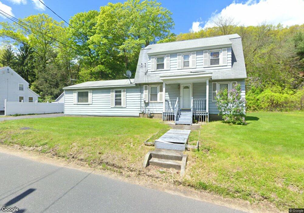
409 Reynolds Bridge Rd Thomaston, CT 06787
Estimated Value: $292,000 - $346,000
3
Beds
2
Baths
1,684
Sq Ft
$193/Sq Ft
Est. Value
About This Home
This home is located at 409 Reynolds Bridge Rd, Thomaston, CT 06787 and is currently estimated at $324,276, approximately $192 per square foot. 409 Reynolds Bridge Rd is a home located in Litchfield County with nearby schools including Black Rock School, Thomaston Center School, and Thomaston High School.
Ownership History
Date
Name
Owned For
Owner Type
Purchase Details
Closed on
Aug 11, 2021
Sold by
Johnson Christopher A and Johnson Delina M
Bought by
Off Grid Properties Llc
Current Estimated Value
Purchase Details
Closed on
Jun 30, 1993
Sold by
Assoc Fin Svc Of Ameri
Bought by
Johnson Charles and Johnson Patricia
Home Financials for this Owner
Home Financials are based on the most recent Mortgage that was taken out on this home.
Original Mortgage
$60,000
Interest Rate
7.46%
Mortgage Type
Unknown
Create a Home Valuation Report for This Property
The Home Valuation Report is an in-depth analysis detailing your home's value as well as a comparison with similar homes in the area
Home Values in the Area
Average Home Value in this Area
Purchase History
| Date | Buyer | Sale Price | Title Company |
|---|---|---|---|
| Off Grid Properties Llc | -- | None Available | |
| Johnson Charles | $90,000 | -- |
Source: Public Records
Mortgage History
| Date | Status | Borrower | Loan Amount |
|---|---|---|---|
| Previous Owner | Johnson Charles | $60,000 |
Source: Public Records
Tax History Compared to Growth
Tax History
| Year | Tax Paid | Tax Assessment Tax Assessment Total Assessment is a certain percentage of the fair market value that is determined by local assessors to be the total taxable value of land and additions on the property. | Land | Improvement |
|---|---|---|---|---|
| 2025 | $4,517 | $126,140 | $44,940 | $81,200 |
| 2024 | $4,334 | $126,140 | $44,940 | $81,200 |
| 2023 | $4,242 | $126,140 | $44,940 | $81,200 |
| 2022 | $4,050 | $126,140 | $44,940 | $81,200 |
| 2021 | $3,821 | $105,770 | $44,940 | $60,830 |
| 2020 | $3,821 | $105,770 | $44,940 | $60,830 |
| 2019 | $3,864 | $105,770 | $44,940 | $60,830 |
| 2018 | $3,786 | $105,770 | $44,940 | $60,830 |
| 2017 | $3,707 | $105,770 | $44,940 | $60,830 |
| 2016 | $3,608 | $105,910 | $45,080 | $60,830 |
| 2015 | $3,562 | $105,910 | $45,080 | $60,830 |
| 2014 | $3,562 | $105,910 | $45,080 | $60,830 |
Source: Public Records
Map
Nearby Homes
- 143 Pine Hill Rd Unit 15F
- 43 Pine Hill Rd
- 197 Pine Hill Rd Unit 2D
- 34 Warner Ln
- 147 Cedar Mountain Rd
- 60 Cedar Mountain Rd
- 203 Branch Rd Unit 5C
- 212 Branch Rd
- 49 Center St
- 96 Elm St
- 42 Litchfield St
- 24 W Lakeview Rd
- 17 Lake Plymouth Blvd
- 22 Park St
- 174 Litchfield St
- 56 Hillside Ave
- 211 Pine Hill Blvd Unit 211
- 785 Main St
- 214 Pine Hill Blvd Unit 214
- 104 Judson St
- 403 Reynolds Bridge Rd
- 68 Old Waterbury Rd
- 395 Reynolds Bridge Rd
- 390 Reynolds Bridge Rd
- 80 Old Waterbury Rd
- 383 Reynolds Bridge Rd
- 71 Old Waterbury Rd
- 79 Old Waterbury Rd
- 380 Reynolds Bridge Rd
- 94 Old Waterbury Rd
- 303 Reynolds Bridge Rd
- 93 W Hill Rd
- 267 Reynolds Bridge Rd
- 143 Pine Hill Rd Unit 9B
- 143 Pine Hill Rd Unit 13A
- 143 Pine Hill Rd Unit 18C
- 143 Pine Hill Rd Unit 15A
- 143 Pine Hill Rd Unit 15E
- 143 Pine Hill Rd Unit 7D
- 143 Pine Hill Rd Unit 11D