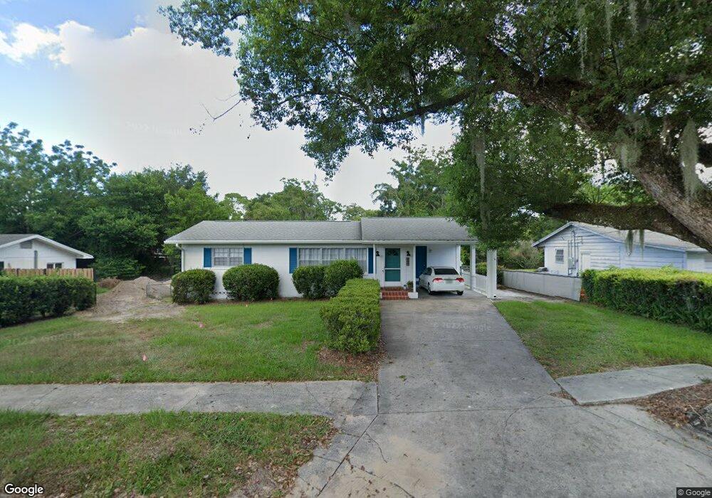
409 S Montgomery Ave Deland, FL 32720
Estimated Value: $212,274 - $243,000
2
Beds
2
Baths
1,000
Sq Ft
$222/Sq Ft
Est. Value
About This Home
This home is located at 409 S Montgomery Ave, Deland, FL 32720 and is currently estimated at $222,319, approximately $222 per square foot. 409 S Montgomery Ave is a home located in Volusia County with nearby schools including Edith I. Starke Elementary School, Deland High School, and Southwestern Middle School.
Ownership History
Date
Name
Owned For
Owner Type
Purchase Details
Closed on
Jun 23, 2014
Sold by
Neri Jordan R and Neri Terry L
Bought by
Neri Trust
Current Estimated Value
Purchase Details
Closed on
Feb 28, 2008
Sold by
Prescott Virginia K
Bought by
Neri Jordan R and Neri Terry L
Purchase Details
Closed on
Nov 18, 2002
Sold by
Prescott Richard O and Prescott Virginia K
Bought by
Prescott Virginia K
Purchase Details
Closed on
Dec 15, 1970
Bought by
Neri Jordan R Tr
Create a Home Valuation Report for This Property
The Home Valuation Report is an in-depth analysis detailing your home's value as well as a comparison with similar homes in the area
Home Values in the Area
Average Home Value in this Area
Purchase History
| Date | Buyer | Sale Price | Title Company |
|---|---|---|---|
| Neri Trust | -- | None Available | |
| Neri Jordan R | $100,000 | Vision Title Of Deland Llc | |
| Prescott Virginia K | -- | -- | |
| Neri Jordan R Tr | $13,900 | -- |
Source: Public Records
Tax History Compared to Growth
Tax History
| Year | Tax Paid | Tax Assessment Tax Assessment Total Assessment is a certain percentage of the fair market value that is determined by local assessors to be the total taxable value of land and additions on the property. | Land | Improvement |
|---|---|---|---|---|
| 2025 | $2,899 | $171,619 | $42,000 | $129,619 |
| 2024 | $2,899 | $174,437 | $42,000 | $132,437 |
| 2023 | $2,899 | $163,689 | $31,875 | $131,814 |
| 2022 | $2,695 | $148,207 | $29,250 | $118,957 |
| 2021 | $2,535 | $114,576 | $21,750 | $92,826 |
| 2020 | $2,339 | $104,938 | $16,500 | $88,438 |
| 2019 | $2,306 | $99,576 | $16,500 | $83,076 |
| 2018 | $2,145 | $88,329 | $12,375 | $75,954 |
| 2017 | $1,984 | $75,430 | $10,097 | $65,333 |
| 2016 | $1,827 | $72,058 | $0 | $0 |
| 2015 | $1,746 | $68,121 | $0 | $0 |
| 2014 | $1,583 | $58,311 | $0 | $0 |
Source: Public Records
Map
Nearby Homes
- 817 W Euclid Ave
- 536 W Hubbard Ave
- 731 W Voorhis Ave
- 800 W Hubbard Ave
- 247 S Marydell Ave
- 128 S Montgomery Ave
- 305 S Stone St
- 241 S Marydell Ave
- 624 W Euclid Ave
- W SR 44, New York Ave W
- 632 W Hubbard Ave
- 816 W Franklin Ave
- 0 N Spring Garden Ave Unit MFRO6340602
- 0 N Spring Garden Ave Unit 1112700
- 0 N Spring Garden Ave Unit V4920996
- 736 S Stone St
- 706 W Franklin Ave
- 541 Rhodes Dr
- 526 W Hubbard Ave
- 111 N Stone St
- 407 S Montgomery Ave
- 411 S Montgomery Ave
- 410 S Boundary Ave
- 415 S Montgomery Ave
- 408 S Boundary Ave
- 412 S Boundary Ave
- 906 Camphor Ln
- 410 S Montgomery Ave
- 904 Camphor Ln
- 414 S Montgomery Ave
- 408 S Montgomery Ave
- 414 S Boundary Ave
- 421 S Montgomery Ave
- 1004 Camphor Ln
- 418 S Montgomery Ave
- 902 Camphor Ln
- 416 S Boundary Ave
- 1006 Camphor Ln
- 820 W Highland Ave
- 411 S Brooks Ave