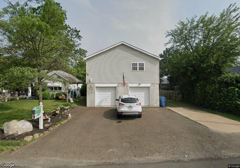
409 State Rd Croydon, PA 19021
Estimated Value: $407,000 - $483,000
3
Beds
2
Baths
1,988
Sq Ft
$226/Sq Ft
Est. Value
About This Home
This home is located at 409 State Rd, Croydon, PA 19021 and is currently estimated at $449,978, approximately $226 per square foot. 409 State Rd is a home located in Bucks County with nearby schools including Truman Senior High School, School Lane Charter School, and St Charles Borromeo School.
Ownership History
Date
Name
Owned For
Owner Type
Purchase Details
Closed on
Nov 4, 2004
Sold by
Mitchell Samuel T
Bought by
Hunt Marlyn S and Hunt Nicole M
Current Estimated Value
Purchase Details
Closed on
Oct 13, 1948
Bought by
Mitchell Samuel H and Mitchell Frances S
Create a Home Valuation Report for This Property
The Home Valuation Report is an in-depth analysis detailing your home's value as well as a comparison with similar homes in the area
Home Values in the Area
Average Home Value in this Area
Purchase History
| Date | Buyer | Sale Price | Title Company |
|---|---|---|---|
| Hunt Marlyn S | -- | -- | |
| Mitchell Samuel H | -- | -- |
Source: Public Records
Tax History Compared to Growth
Tax History
| Year | Tax Paid | Tax Assessment Tax Assessment Total Assessment is a certain percentage of the fair market value that is determined by local assessors to be the total taxable value of land and additions on the property. | Land | Improvement |
|---|---|---|---|---|
| 2025 | $6,816 | $25,100 | $1,840 | $23,260 |
| 2024 | $6,816 | $25,100 | $1,840 | $23,260 |
| 2023 | $6,766 | $25,100 | $1,840 | $23,260 |
| 2022 | $6,766 | $25,100 | $1,840 | $23,260 |
| 2021 | $6,766 | $25,100 | $1,840 | $23,260 |
| 2020 | $6,766 | $25,100 | $1,840 | $23,260 |
| 2019 | $6,741 | $25,100 | $1,840 | $23,260 |
| 2018 | $6,633 | $25,100 | $1,840 | $23,260 |
| 2017 | $6,532 | $25,100 | $1,840 | $23,260 |
| 2016 | $6,532 | $25,100 | $1,840 | $23,260 |
| 2015 | $4,792 | $25,100 | $1,840 | $23,260 |
| 2014 | $4,792 | $25,100 | $1,840 | $23,260 |
Source: Public Records
Map
Nearby Homes
- 718 Second Ave
- 222 New York Ave
- 817 Fifth Ave
- 619 First Ave
- 305 Miller Ave
- 618 Cedar Ave
- 518 Main Ave
- 414 Delaware Ave
- 434 Sycamore Ave
- 1005 Maryland Ave
- 1000 Main Ave
- 1138 Fourth Ave
- 910 Magnolia Ave
- 500 Wyoming Ave
- 1041 Rosa Ave
- 0 Neshaminy St Unit PABU2089046
- 906 Stephen Ave
- 1901 Summit Ave
- 0 Allen Ave
- 509 Neshaminy Rd