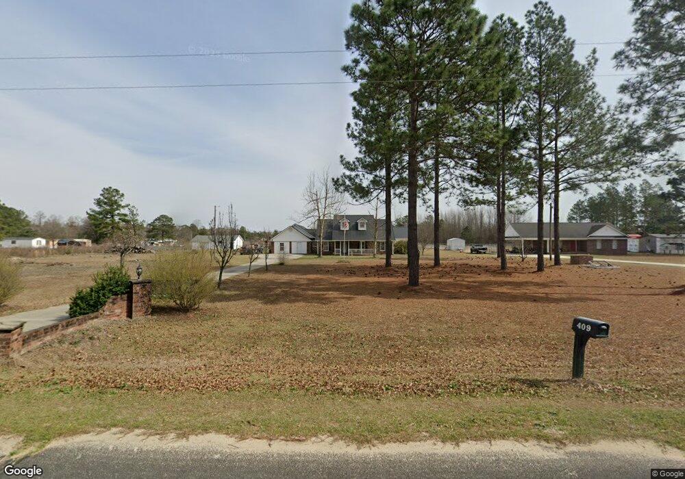
409 Sutton Rd Saint Pauls, NC 28384
Estimated Value: $283,000 - $458,000
3
Beds
3
Baths
2,701
Sq Ft
$138/Sq Ft
Est. Value
About This Home
This home is located at 409 Sutton Rd, Saint Pauls, NC 28384 and is currently estimated at $372,429, approximately $137 per square foot. 409 Sutton Rd is a home located in Robeson County with nearby schools including Saint Pauls Elementary School, Parkton Elementary School, and Saint Pauls Middle School.
Ownership History
Date
Name
Owned For
Owner Type
Purchase Details
Closed on
Jan 17, 2019
Sold by
Johnson Robert Wayne and Johnson Pamela Sue
Bought by
Parker David Anthony and Parker Tracy Brooke
Current Estimated Value
Home Financials for this Owner
Home Financials are based on the most recent Mortgage that was taken out on this home.
Original Mortgage
$280,400
Outstanding Balance
$246,529
Interest Rate
4.6%
Mortgage Type
VA
Estimated Equity
$125,900
Purchase Details
Closed on
Dec 4, 2007
Sold by
Meaut Michael L and Meaut Karen L
Bought by
Johnson Robert Wayne and Johnson Pamela Sue
Home Financials for this Owner
Home Financials are based on the most recent Mortgage that was taken out on this home.
Original Mortgage
$204,300
Interest Rate
6.22%
Mortgage Type
New Conventional
Create a Home Valuation Report for This Property
The Home Valuation Report is an in-depth analysis detailing your home's value as well as a comparison with similar homes in the area
Home Values in the Area
Average Home Value in this Area
Purchase History
| Date | Buyer | Sale Price | Title Company |
|---|---|---|---|
| Parker David Anthony | $275,000 | None Available | |
| Johnson Robert Wayne | $240,000 | -- |
Source: Public Records
Mortgage History
| Date | Status | Borrower | Loan Amount |
|---|---|---|---|
| Open | Parker David Anthony | $280,400 | |
| Previous Owner | Johnson Robert Wayne | $204,300 |
Source: Public Records
Tax History Compared to Growth
Tax History
| Year | Tax Paid | Tax Assessment Tax Assessment Total Assessment is a certain percentage of the fair market value that is determined by local assessors to be the total taxable value of land and additions on the property. | Land | Improvement |
|---|---|---|---|---|
| 2025 | $2,405 | $252,800 | $39,300 | $213,500 |
| 2024 | $2,395 | $252,800 | $39,300 | $213,500 |
| 2023 | $1,969 | $205,000 | $38,000 | $167,000 |
| 2022 | $1,966 | $205,000 | $38,000 | $167,000 |
| 2021 | $1,865 | $205,000 | $38,000 | $167,000 |
| 2020 | $1,836 | $185,000 | $38,000 | $147,000 |
| 2018 | $2,900 | $310,600 | $66,400 | $244,200 |
| 2017 | $2,882 | $310,600 | $66,400 | $244,200 |
| 2016 | $2,882 | $310,600 | $66,400 | $244,200 |
| 2015 | $2,882 | $310,600 | $66,400 | $244,200 |
| 2014 | $2,882 | $310,600 | $66,400 | $244,200 |
Source: Public Records
Map
Nearby Homes
- 7166 Chicken Foot Rd
- 7136 Chicken Foot Rd
- 7196 Chicken Foot Rd
- 0 Joshua St
- 223 Broadwell Rd
- 84 Ryegrass Rd
- 28 Bermuda Dr
- 2677 N Carolina 20
- 2641 N Carolina 20
- 270 Monroe Rd
- 1234 Sirius (Lot 24) Dr
- 65 King Farm Rd
- 5518 Tolarsville Rd
- 736 Tobermory Rd
- 7840 Rufus Johnson Rd
- 7820 Rufus Johnson Rd
- 944 Cain Rd
- 427 Sutton Rd
- 483 Sutton Rd
- 257 Sutton Rd
- 200 Register Rd
- 4764 Nc Highway 20 E
- 4728 Nc Highway 20 E
- 4110 N Carolina 20
- 4647 Nc Highway 20 E
- 4341 Nc Highway 20 E
- 4341 Nc 20 Hwy
- 4315 Nc Highway 20 E
- 4211 Nc Highway 20 E
- 4197 Nc Highway 20 E
- 4175 Nc Highway 20 E
- 4159 Nc Highway 20 E
- 4110 Nc Highway 20 E
- 4139 Nc Highway 20 E
- 218 Caulder Rd
- 216 Caulder Rd
- 222 Caulder Rd