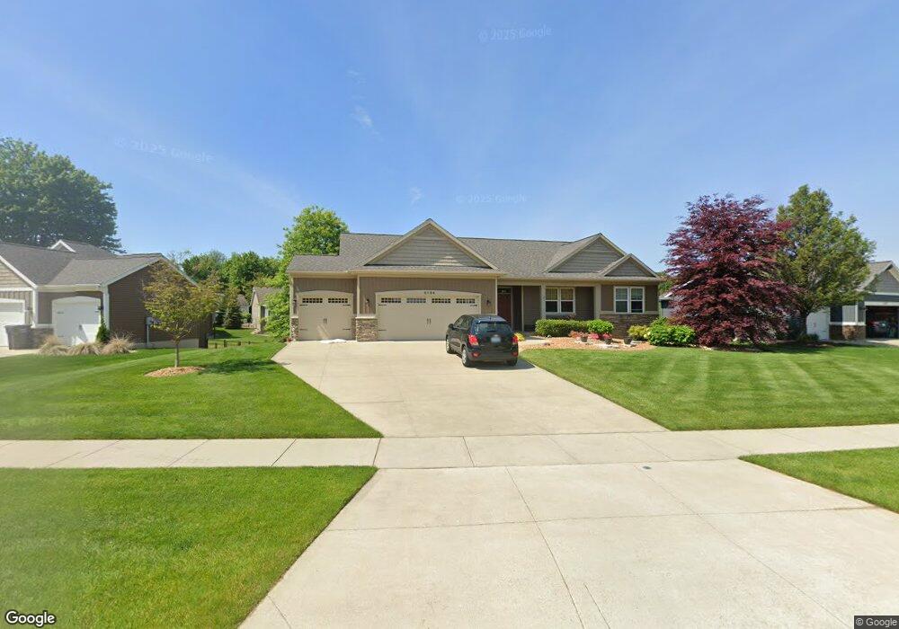
4094 Unity Dr Hudsonville, MI 49426
Estimated Value: $454,319 - $553,000
2
Beds
3
Baths
14,810
Sq Ft
$34/Sq Ft
Est. Value
About This Home
This home is located at 4094 Unity Dr, Hudsonville, MI 49426 and is currently estimated at $508,330, approximately $34 per square foot. 4094 Unity Dr is a home located in Ottawa County with nearby schools including Park Elementary School, Hudsonville Freshman Campus, and Hudsonville High School.
Ownership History
Date
Name
Owned For
Owner Type
Purchase Details
Closed on
Mar 9, 2015
Sold by
Wrona Gregory and Wrona Cherlie
Bought by
Gregory J & Cherie B Wrona Trust
Current Estimated Value
Purchase Details
Closed on
Oct 22, 2014
Sold by
Koetje Builders & Developers Llc
Bought by
Wrona Gregory and Wrona Cherie
Home Financials for this Owner
Home Financials are based on the most recent Mortgage that was taken out on this home.
Original Mortgage
$225,935
Outstanding Balance
$173,403
Interest Rate
4.13%
Mortgage Type
Construction
Estimated Equity
$334,927
Create a Home Valuation Report for This Property
The Home Valuation Report is an in-depth analysis detailing your home's value as well as a comparison with similar homes in the area
Home Values in the Area
Average Home Value in this Area
Purchase History
| Date | Buyer | Sale Price | Title Company |
|---|---|---|---|
| Gregory J & Cherie B Wrona Trust | -- | None Available | |
| Wrona Gregory | $42,800 | Lighthouse Title Inc |
Source: Public Records
Mortgage History
| Date | Status | Borrower | Loan Amount |
|---|---|---|---|
| Open | Wrona Gregory | $225,935 |
Source: Public Records
Tax History Compared to Growth
Tax History
| Year | Tax Paid | Tax Assessment Tax Assessment Total Assessment is a certain percentage of the fair market value that is determined by local assessors to be the total taxable value of land and additions on the property. | Land | Improvement |
|---|---|---|---|---|
| 2025 | $4,768 | $198,100 | $0 | $0 |
| 2024 | $4,126 | $202,900 | $0 | $0 |
| 2023 | $3,940 | $183,900 | $0 | $0 |
| 2022 | $4,330 | $174,700 | $0 | $0 |
| 2021 | $4,207 | $161,500 | $0 | $0 |
| 2020 | $4,163 | $152,300 | $0 | $0 |
| 2019 | $4,169 | $152,200 | $0 | $0 |
| 2018 | $3,887 | $151,100 | $0 | $0 |
| 2017 | $3,816 | $148,700 | $0 | $0 |
| 2016 | $3,794 | $140,200 | $0 | $0 |
| 2015 | $113 | $51,400 | $0 | $0 |
| 2014 | $113 | $23,000 | $0 | $0 |
Source: Public Records
Map
Nearby Homes
- 3979 Grant St
- 3824 Grant St
- Bay Harbor Plan at Valley Point - Landmark Series
- Sequoia Plan at Valley Point - Woodland Series
- Redwood Plan at Valley Point - Woodland Series
- Oakwood Plan at Valley Point - Woodland Series
- Ashton Plan at Valley Point
- Cascade Plan at Valley Point
- Camden Plan at Valley Point - Cottage Series
- Northport Plan at Valley Point - Landmark Series
- Cedarwood Plan at Valley Point - Woodland Series
- Elmwood Plan at Valley Point - Woodland Series
- Enclave Plan at Valley Point
- Whitby Plan at Valley Point - Cottage Series
- Carson Plan at Valley Point
- Remington Plan at Valley Point
- Sycamore Plan at Valley Point - Woodland Series
- Harbor Springs Plan at Valley Point - Landmark Series
- Avery Plan at Valley Point
- Maplewood Plan at Valley Point - Woodland Series
- 4108 Unity Dr
- 4080 Unity Dr
- 4124 Unity Dr
- 4087 Unity Dr
- 4075 Unity Dr
- 4081 Unity Dr
- 4103 Cottage Trail
- 4105 Cottage Trail
- 4105 Cottage Trail Unit 6
- 4107 Unity Dr
- 4121 Cottage Trail
- 4140 Unity Dr
- 4140 Unity Dr Unit 22
- 4123 Cottage Trail
- 4137 Cottage Trail
- 4139 Cottage Trail
- 4115 Unity Dr
- 4067 Unity Dr
- 4153 Cottage Trail
- 4154 Unity Dr