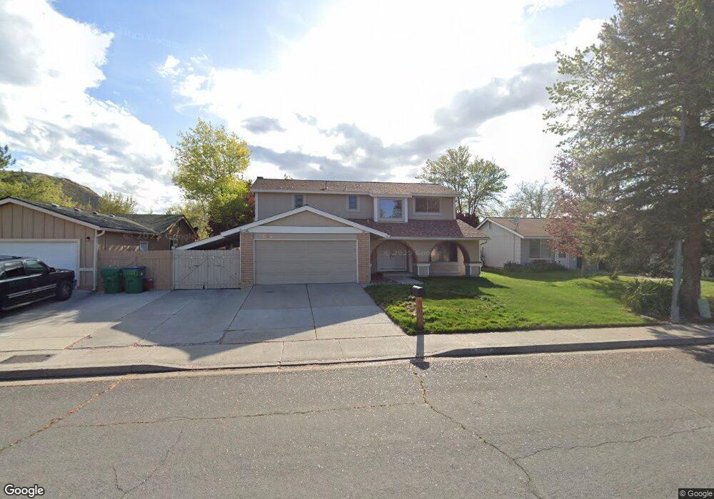
4095 Parque Verde Ln Reno, NV 89502
Hidden Valley NeighborhoodEstimated Value: $524,191 - $605,000
4
Beds
3
Baths
2,212
Sq Ft
$254/Sq Ft
Est. Value
About This Home
This home is located at 4095 Parque Verde Ln, Reno, NV 89502 and is currently estimated at $562,548, approximately $254 per square foot. 4095 Parque Verde Ln is a home located in Washoe County with nearby schools including Edwin S. Dodson Elementary School, Edward L Pine Middle School, and Earl Wooster High School.
Ownership History
Date
Name
Owned For
Owner Type
Purchase Details
Closed on
Jun 25, 2015
Sold by
Koch Michael J and Koch Lisa L
Bought by
Koch Living Trust
Current Estimated Value
Purchase Details
Closed on
Oct 12, 1998
Sold by
Koch Living Trust
Bought by
Franz Llc Series 1
Purchase Details
Closed on
May 19, 1994
Sold by
Sabatini Gary and Sabatini Patricia
Bought by
Koch A Christopher and Koch Shereen
Home Financials for this Owner
Home Financials are based on the most recent Mortgage that was taken out on this home.
Original Mortgage
$6,496
Interest Rate
8.35%
Mortgage Type
Seller Take Back
Create a Home Valuation Report for This Property
The Home Valuation Report is an in-depth analysis detailing your home's value as well as a comparison with similar homes in the area
Home Values in the Area
Average Home Value in this Area
Purchase History
| Date | Buyer | Sale Price | Title Company |
|---|---|---|---|
| Koch Living Trust | -- | First American Title Reno | |
| Koch Michael J | -- | First American Title Reno | |
| Franz Llc Series 1 | -- | None Listed On Document | |
| Koch Mike | -- | -- | |
| Koch A Christopher | -- | Stewart Title |
Source: Public Records
Mortgage History
| Date | Status | Borrower | Loan Amount |
|---|---|---|---|
| Previous Owner | Koch A Christopher | $6,496 |
Source: Public Records
Tax History Compared to Growth
Tax History
| Year | Tax Paid | Tax Assessment Tax Assessment Total Assessment is a certain percentage of the fair market value that is determined by local assessors to be the total taxable value of land and additions on the property. | Land | Improvement |
|---|---|---|---|---|
| 2025 | $2,150 | $74,675 | $37,135 | $37,540 |
| 2024 | $2,150 | $71,352 | $32,550 | $38,802 |
| 2023 | $1,992 | $71,855 | $34,230 | $37,625 |
| 2022 | $1,849 | $60,429 | $28,420 | $32,009 |
| 2021 | $1,794 | $53,135 | $20,650 | $32,485 |
| 2020 | $1,738 | $53,821 | $20,650 | $33,171 |
| 2019 | $1,687 | $53,446 | $20,965 | $32,481 |
| 2018 | $1,642 | $47,156 | $14,805 | $32,351 |
| 2017 | $1,593 | $46,770 | $13,860 | $32,910 |
| 2016 | $1,554 | $45,376 | $11,340 | $34,036 |
| 2015 | $1,546 | $44,611 | $10,115 | $34,496 |
| 2014 | $1,501 | $42,343 | $8,890 | $33,453 |
| 2013 | -- | $39,651 | $6,300 | $33,351 |
Source: Public Records
Map
Nearby Homes
- 4550 Noche Ln
- 4120 Vivian Ct
- 4405 Primavera Ave
- 320 Lucky Ln
- 4160 Mira Loma Dr Unit 2B
- 56 Lucky Ln
- 3170 Santa Ana Dr
- 4071 Snowshoe Ln
- 4066 Snowshoe Ln
- 4318 Leeward Ln
- 65 Lucky Ln
- 4465 Boca Way Unit 36
- 4465 Boca Way Unit 22
- 4465 Boca Way Unit 31
- 4465 Boca Way Unit 177
- 4465 Boca Way Unit 173
- 4465 Boca Way
- 4465 Boca Way Unit 220
- 3040 Chavez Dr
- 3095 Randolph Dr
- 4055 Parque Verde Ln
- 4115 Parque Verde Ln
- 4150 San Marcos Ln
- 4140 San Marcos Ln
- 4015 Parque Verde Ln
- 4100 San Marcos Ln
- 4125 Parque Verde Ln
- 4160 San Marcos Ln
- 4090 Parque Verde Ln
- 4050 Parque Verde Ln
- 4170 San Marcos Ln
- 4100 Parque Verde Ln
- 3965 Parque Verde Ln
- 4070 San Marcos Ln
- 4000 Parque Verde Ln
- 3925 Parque Verde Ln
- 4060 San Marcos Ln
- 4145 San Marcos Ln
- 3960 Parque Verde Ln
- 4055 Bolivar Ct