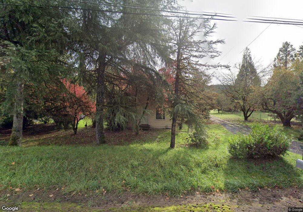
40974 Mckenzie Hwy Springfield, OR 97478
Estimated Value: $522,000 - $572,000
2
Beds
2
Baths
1,160
Sq Ft
$463/Sq Ft
Est. Value
About This Home
This home is located at 40974 Mckenzie Hwy, Springfield, OR 97478 and is currently estimated at $537,059, approximately $462 per square foot. 40974 Mckenzie Hwy is a home located in Lane County with nearby schools including Walterville Elementary School, Briggs Middle School, and Thurston High School.
Ownership History
Date
Name
Owned For
Owner Type
Purchase Details
Closed on
Dec 29, 2003
Sold by
Knight Carolyn G and Knight Daemon A
Bought by
Mathews Mitchell S and Mathews Valerie G
Current Estimated Value
Home Financials for this Owner
Home Financials are based on the most recent Mortgage that was taken out on this home.
Original Mortgage
$199,920
Outstanding Balance
$91,910
Interest Rate
5.88%
Mortgage Type
VA
Estimated Equity
$445,149
Purchase Details
Closed on
Dec 7, 1998
Sold by
Bowers Constance A
Bought by
Knight Daemon A
Home Financials for this Owner
Home Financials are based on the most recent Mortgage that was taken out on this home.
Original Mortgage
$110,400
Interest Rate
9.2%
Purchase Details
Closed on
Sep 16, 1982
Sold by
Demoss Charles P
Bought by
Kernutt Joseph D and Kernutt Esther L
Purchase Details
Closed on
Jan 18, 1979
Sold by
Demoss Charlotte L
Bought by
Kernutt Joseph D and Kernutt Esther L
Create a Home Valuation Report for This Property
The Home Valuation Report is an in-depth analysis detailing your home's value as well as a comparison with similar homes in the area
Purchase History
| Date | Buyer | Sale Price | Title Company |
|---|---|---|---|
| Mathews Mitchell S | $196,000 | American Title Group | |
| Knight Daemon A | $138,000 | Cascade Title Co | |
| Kernutt Joseph D | $43,470 | Key Title Company | |
| Kernutt Joseph D | $59,500 | Key Title Company |
Source: Public Records
Mortgage History
| Date | Status | Borrower | Loan Amount |
|---|---|---|---|
| Open | Mathews Mitchell S | $199,920 | |
| Previous Owner | Knight Daemon A | $110,400 |
Source: Public Records
Tax History
| Year | Tax Paid | Tax Assessment Tax Assessment Total Assessment is a certain percentage of the fair market value that is determined by local assessors to be the total taxable value of land and additions on the property. | Land | Improvement |
|---|---|---|---|---|
| 2025 | $2,766 | $243,327 | -- | -- |
| 2024 | $2,582 | $236,240 | -- | -- |
| 2023 | $2,582 | $229,360 | -- | -- |
| 2022 | $2,460 | $222,680 | $0 | $0 |
| 2021 | $2,403 | $216,195 | $0 | $0 |
| 2020 | $2,328 | $209,899 | $0 | $0 |
| 2019 | $2,205 | $203,786 | $0 | $0 |
| 2018 | $2,132 | $192,088 | $0 | $0 |
| 2017 | $2,053 | $192,088 | $0 | $0 |
| 2016 | $1,999 | $186,493 | $0 | $0 |
| 2015 | $1,946 | $181,061 | $0 | $0 |
| 2014 | $1,886 | $175,787 | $0 | $0 |
Source: Public Records
Map
Nearby Homes
- 40971 Deerhorn Rd
- 41886 Deerhorn Rd
- 40064 Mckenzie Hwy
- 40211 Deerhorn Rd
- 89011 Bridge St
- 41925 Deerhorn Rd
- 88152 Keola Ln
- 41929 Deerhorn Rd
- 0 Tonga Ln
- 40153 Booth Kelly Rd
- 39464 Walterville Ln
- 17-1-3 Road
- 39125 Easton Ln
- 42799 Leaburg Dr
- 42986 Mckenzie Hwy
- 38730 Natures Garden St
- 87851 Cedar Flat Rd
- 0 Upper Camp Creek Rd Unit 734099093
- 0 Upper Camp Creek Rd Unit 473471921
- 38350 Mckenzie Hwy
- 41000 Mckenzie Hwy
- 40956 Mckenzie Hwy
- 40968 Mckenzie Hwy
- 41001 Mckenzie Hwy
- 40983 Mckenzie Hwy
- 41039 Mckenzie Hwy
- 41064 Mckenzie Hwy
- 40914 Mckenzie Hwy
- 41045 Mckenzie Hwy
- 41063 Mckenzie Hwy
- 88943 Ross Ln
- 40882 Mckenzie Hwy
- 88970 Ross Ln
- 41082 Mckenzie Hwy
- 88981 Ross Ln
- 40870 Mckenzie Hwy
- 88883 Ross Ln
- 41120 Mckenzie Hwy
- 88869 Ross Ln
- 88909 Ross Ln
Your Personal Tour Guide
Ask me questions while you tour the home.