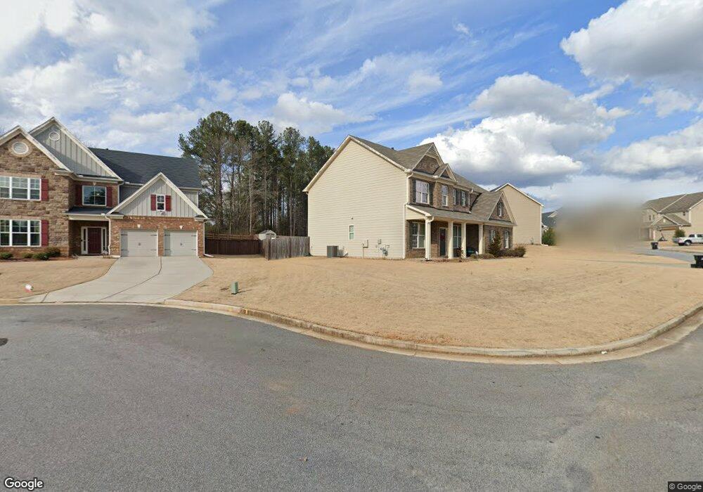
4098 Bunker Dr SW Unit 61 Austell, GA 30106
Estimated Value: $464,015 - $510,000
5
Beds
3
Baths
3,026
Sq Ft
$162/Sq Ft
Est. Value
About This Home
This home is located at 4098 Bunker Dr SW Unit 61, Austell, GA 30106 and is currently estimated at $489,254, approximately $161 per square foot. 4098 Bunker Dr SW Unit 61 is a home located in Cobb County with nearby schools including Deerwood Elementary School, Clarkdale Elementary School, and Cooper Middle School.
Ownership History
Date
Name
Owned For
Owner Type
Purchase Details
Closed on
Dec 14, 2016
Sold by
Venture Homes Inc
Bought by
Roberts Barry and Roberts Panayotta Delinois
Current Estimated Value
Home Financials for this Owner
Home Financials are based on the most recent Mortgage that was taken out on this home.
Original Mortgage
$244,720
Outstanding Balance
$199,623
Interest Rate
3.94%
Mortgage Type
New Conventional
Estimated Equity
$289,631
Create a Home Valuation Report for This Property
The Home Valuation Report is an in-depth analysis detailing your home's value as well as a comparison with similar homes in the area
Home Values in the Area
Average Home Value in this Area
Purchase History
| Date | Buyer | Sale Price | Title Company |
|---|---|---|---|
| Roberts Barry | $257,600 | -- |
Source: Public Records
Mortgage History
| Date | Status | Borrower | Loan Amount |
|---|---|---|---|
| Open | Roberts Barry | $244,720 |
Source: Public Records
Tax History Compared to Growth
Tax History
| Year | Tax Paid | Tax Assessment Tax Assessment Total Assessment is a certain percentage of the fair market value that is determined by local assessors to be the total taxable value of land and additions on the property. | Land | Improvement |
|---|---|---|---|---|
| 2025 | $5,077 | $208,336 | $34,000 | $174,336 |
| 2024 | $5,081 | $208,336 | $34,000 | $174,336 |
| 2023 | $3,759 | $172,376 | $20,000 | $152,376 |
| 2022 | $3,407 | $130,052 | $20,000 | $110,052 |
| 2021 | $3,064 | $114,380 | $20,000 | $94,380 |
| 2020 | $3,064 | $114,380 | $20,000 | $94,380 |
| 2019 | $2,945 | $108,956 | $20,000 | $88,956 |
| 2018 | $2,799 | $102,256 | $22,000 | $80,256 |
| 2017 | $2,578 | $98,580 | $24,000 | $74,580 |
| 2016 | $460 | $16,000 | $16,000 | $0 |
Source: Public Records
Map
Nearby Homes
- 4099 Bunker Dr SW
- 4079 Broadmoor Ct SW
- 2774 Eloquent Ln
- 2855 Brass Ct
- 2867 Ash St SW
- 3989 Flint Hill Rd
- 2473 Greenside Ct
- 2402 Greenside Ct
- 4598 Flint Hill Rd
- 2539 Dogwood Hills Ct
- 3832 Abbott Ln Unit 1
- 2300 Anderson Mill Rd
- 3916 Abbott Way Unit 2
- 4287 Keats Ct
- 4280 Creek Crest Trail
- 3807 Abbott Ln SW Unit 15
- 2415 Wales Dr
- 4098 Bunker Dr SW
- 4098 Bunker Dr SW
- 4088 Bunker Dr SW
- 4102 Bunker Dr SW
- 4084 Bunker Dr SW
- 4103 Bunker Dr SW
- 4095 Bunker Dr SW
- 4095 Bunker Dr SW
- 4106 Bunker Dr SW
- 0 Bunker Dr SW Unit 8671275
- 0 Bunker Dr SW Unit 8920047
- 4091 Bunker Dr SW
- 4109 Bunker Dr SW
- 4110 Bunker Dr SW
- 4080R SW Bunker Dr SW
- 4080 Bunker Dr SW
- 4080 Bunker Dr SW
- 4080 Bunker
- 4087 Bunker Dr SW
- 4087 Bunker Dr SW