
40Ac M/L S M-129 Unit 40Ac M/L Sault Ste Marie, MI 49783
Estimated payment $166/month
Total Views
271
40
Acres
$625
Price per Acre
1,742,400
Sq Ft Lot
About This Lot
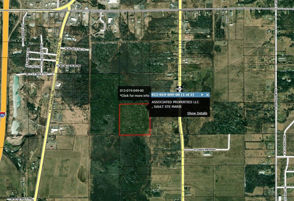
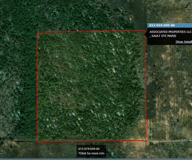
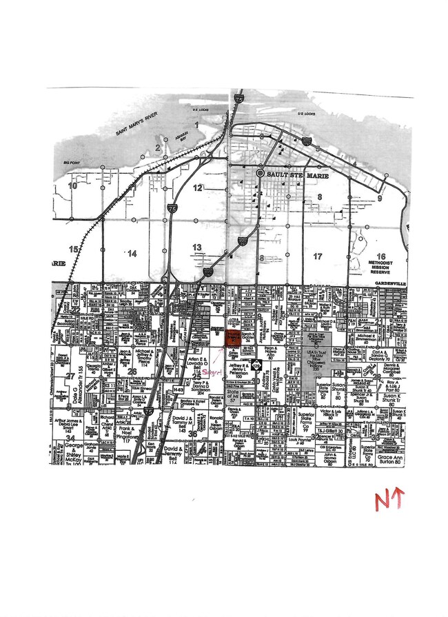
40 acres wooded property south of Sault Ste. Marie. Parcel is landlocked thus no legal access.
Map
Property Details
Property Type
Land
Lot Details
0
Listing Details
- Cleared Acreage: 21 - 40 Acres
- Directions: PROPERTY IS LANDLOCKED From 3 Mile Road, south on M-129 approx 1 mile, west 1/4 mile.
- Listing Member Name: Andrea M. McDonald
- Listing Office Short Id: 073
- Prop. Type: C
- Tax Year: 2024
- Lot Description Waterfront: No
- Special Features: None
- Property Sub Type: LotsLands
Schools
- School District: Sault Ste Marie
- Junior High Dist: Sault Ste Marie
Lot Info
- Lot Description: Wooded Lot
- Lot Size: 1320 x 1320
- Estimated Number of Acres: 40.00
Rental Info
- Lease V: 17000
- Lease Terms: Cash
Create a Home Valuation Report for This Property
The Home Valuation Report is an in-depth analysis detailing your home's value as well as a comparison with similar homes in the area
Home Values in the Area
Average Home Value in this Area
Property History
Date | Event | Price | Change | Sq Ft Price |
---|---|---|---|---|
05/29/2025 05/29/25 | For Sale | $25,000 | -- | -- |
Source: Fayette-Nicholas Board of REALTORS®
Similar Property in Sault Ste Marie, MI
Source: Fayette-Nicholas Board of REALTORS®
MLS Number: 25-403
Nearby Homes
- 40Ac M/L S M-129 Unit 40Ac M/L
- 647 W Ford Dr
- 647 W Ford Dr Unit 647
- 3357 S Oakwood Dr
- 620 W Osborn Dr
- 620 W Osborn Dr Unit 620
- 3805 I 75 Business Spur
- 3601 S Radar Rd
- 198 E 26th Ave
- 198 E 26th Ave Unit 198
- 0 W 25th Ave
- 102 25th Ave E Unit 322E
- 0 W 24th Ave
- 0 W Cedar Dr Unit 24-1105
- 0 W 24th St
- 1605 S Mulligan Row
- 1605 S Mulligan Row Unit 1605
- 3281 S Shunk Rd
- 3281 S Shunk Rd Unit 3281
- 122 W 14th Ave