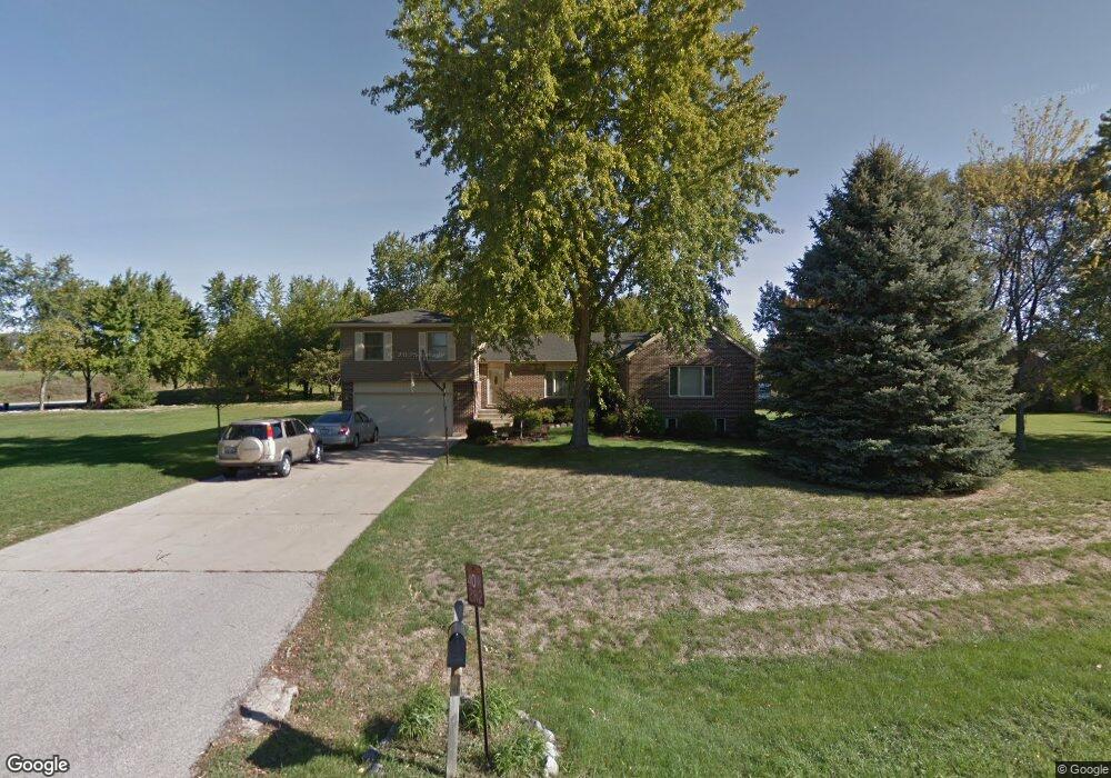
40W282 Sturbridge Way Elgin, IL 60124
Bowes NeighborhoodEstimated Value: $603,165 - $649,000
5
Beds
4
Baths
3,332
Sq Ft
$189/Sq Ft
Est. Value
About This Home
This home is located at 40W282 Sturbridge Way, Elgin, IL 60124 and is currently estimated at $629,041, approximately $188 per square foot. 40W282 Sturbridge Way is a home located in Kane County with nearby schools including Howard B. Thomas Grade School, Prairie Knolls Middle School, and Central Middle School.
Ownership History
Date
Name
Owned For
Owner Type
Purchase Details
Closed on
Dec 20, 2023
Sold by
Valentini Frank P and Valentini Kathy L
Bought by
Valentini Family Living Trust and Valentini
Current Estimated Value
Purchase Details
Closed on
Dec 19, 2023
Sold by
Valentini Family Living Trust
Bought by
Valentini Frank P and Valentini Kathy L
Purchase Details
Closed on
Feb 14, 2018
Sold by
Valentini Frank P and Valentini Kathy L
Bought by
Valentini Frank and Valentini Kathy L
Create a Home Valuation Report for This Property
The Home Valuation Report is an in-depth analysis detailing your home's value as well as a comparison with similar homes in the area
Home Values in the Area
Average Home Value in this Area
Purchase History
| Date | Buyer | Sale Price | Title Company |
|---|---|---|---|
| Valentini Family Living Trust | -- | None Listed On Document | |
| Valentini Frank P | -- | None Listed On Document | |
| Valentini Frank | -- | Attorney |
Source: Public Records
Tax History
| Year | Tax Paid | Tax Assessment Tax Assessment Total Assessment is a certain percentage of the fair market value that is determined by local assessors to be the total taxable value of land and additions on the property. | Land | Improvement |
|---|---|---|---|---|
| 2024 | $11,759 | $166,368 | $31,322 | $135,046 |
| 2023 | $11,267 | $150,491 | $28,333 | $122,158 |
| 2022 | $9,866 | $125,053 | $24,917 | $100,136 |
| 2021 | $9,763 | $120,812 | $24,072 | $96,740 |
| 2020 | $9,728 | $118,640 | $23,639 | $95,001 |
| 2019 | $9,912 | $114,111 | $23,333 | $90,778 |
| 2018 | $9,802 | $113,509 | $24,107 | $89,402 |
| 2017 | $9,340 | $109,459 | $23,496 | $85,963 |
| 2016 | $9,894 | $106,863 | $22,939 | $83,924 |
| 2015 | -- | $102,086 | $22,939 | $79,147 |
| 2014 | -- | $97,244 | $22,939 | $74,305 |
| 2013 | -- | $100,844 | $23,331 | $77,513 |
Source: Public Records
Map
Nearby Homes
- 3681 Congressional Pkwy
- 3660 Thornhill Dr
- 4378 John Milton Rd
- 3553 Doral Dr
- 1146 Falcon Ridge Dr
- 3539 Crosswater Ct
- 3545 S Riding Ridge
- 1127 Pine Valley Ct
- 1846 Chandolin Ln
- 1850 Chandolin Ln
- 3620 Sahara Rd
- 3579 Emerald Rd
- 1842 Coralito Ln
- 9N954 Heatherington Place
- 1121 Iron Horse Ct
- 3613 Sandstone Cir
- 1848 Chandolin Ln
- 1849 Diamond Dr
- 3587 Sandstone Cir
- 1851 Diamond Dr
- 40W222 Sturbridge Way
- 40W287 Sturbridge Way
- 8N875 Corron Rd
- 40W221 Sturbridge Way
- 3678 Open Pkwy
- 40W180 Sturbridge Way
- 3680 Open Pkwy
- 3676 Open Pkwy
- 3674 Open Pkwy
- 40W175 Sturbridge Way
- 3672 Open Pkwy
- 3684 Open Pkwy
- 3670 Open Pkwy
- 3677 Open Pkwy
- 3683 Open Pkwy
- 3675 Open Pkwy
- 3673 Open Pkwy
- 3668 Open Pkwy
- 40W134 Sturbridge Way
- 3686 Open Pkwy
Your Personal Tour Guide
Ask me questions while you tour the home.