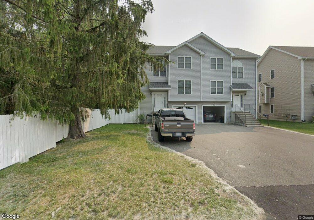
41 Allston Ave Worcester, MA 01604
Broadmeadow Brook NeighborhoodEstimated Value: $506,000 - $537,000
2
Beds
3
Baths
1,584
Sq Ft
$329/Sq Ft
Est. Value
About This Home
This home is located at 41 Allston Ave, Worcester, MA 01604 and is currently estimated at $521,297, approximately $329 per square foot. 41 Allston Ave is a home located in Worcester County with nearby schools including Jacob Hiatt Magnet School, Chandler Magnet, and Rice Square Elementary School.
Ownership History
Date
Name
Owned For
Owner Type
Purchase Details
Closed on
Oct 2, 2006
Sold by
Morrone Diane and Morrone Frank T
Bought by
Morrone Matthew
Current Estimated Value
Home Financials for this Owner
Home Financials are based on the most recent Mortgage that was taken out on this home.
Original Mortgage
$232,000
Outstanding Balance
$138,898
Interest Rate
6.52%
Mortgage Type
Purchase Money Mortgage
Estimated Equity
$382,399
Create a Home Valuation Report for This Property
The Home Valuation Report is an in-depth analysis detailing your home's value as well as a comparison with similar homes in the area
Home Values in the Area
Average Home Value in this Area
Purchase History
| Date | Buyer | Sale Price | Title Company |
|---|---|---|---|
| Morrone Matthew | -- | -- | |
| Morrone Matthew | -- | -- |
Source: Public Records
Mortgage History
| Date | Status | Borrower | Loan Amount |
|---|---|---|---|
| Open | Morrone Matthew | $232,000 | |
| Closed | Morrone Matthew | $106,000 | |
| Closed | Morrone Matthew | $232,000 |
Source: Public Records
Tax History Compared to Growth
Tax History
| Year | Tax Paid | Tax Assessment Tax Assessment Total Assessment is a certain percentage of the fair market value that is determined by local assessors to be the total taxable value of land and additions on the property. | Land | Improvement |
|---|---|---|---|---|
| 2025 | $5,965 | $452,200 | $119,400 | $332,800 |
| 2024 | $5,724 | $416,300 | $119,400 | $296,900 |
| 2023 | $5,525 | $385,300 | $103,800 | $281,500 |
| 2022 | $5,024 | $330,300 | $83,000 | $247,300 |
| 2021 | $4,894 | $300,600 | $66,400 | $234,200 |
| 2020 | $4,823 | $283,700 | $66,300 | $217,400 |
| 2019 | $4,828 | $268,200 | $60,000 | $208,200 |
| 2018 | $4,839 | $255,900 | $60,000 | $195,900 |
| 2017 | $4,588 | $238,700 | $60,000 | $178,700 |
| 2016 | $4,540 | $220,300 | $45,400 | $174,900 |
| 2015 | $4,421 | $220,300 | $45,400 | $174,900 |
| 2014 | $4,305 | $220,300 | $45,400 | $174,900 |
Source: Public Records
Map
Nearby Homes
- 62 Allston Ave
- 83 Massasoit Rd
- 91 Standish St
- 5 Everton Ave
- 4 Everton Ave
- 11 Benson St
- 16 Arborwood Dr
- 247 Pilgrim Ave
- 55 Standish St
- 53 Denver Terrace
- 55 Greencourt St
- 25 Stoneham Rd
- 10 County St
- 259 Massasoit Rd
- 173 Fairmont Ave
- 46 Vincent Cir
- 63 Progressive St
- 36,38,38.5 Houghton St
- 41 Bridgeport St
- 42 Bridgeport St
- 43 Allston Ave
- 45 Allston Ave
- 47 Allston Ave
- 47 Allston Ave Unit 47
- 33 Allston Ave
- 53 Allston Ave
- 46 Allston Ave
- 40 Allston Ave
- 28 Allston Ave
- 27 Allston Ave
- 61 Allston Ave
- 30 Allston Ave
- 5A Greenfield St
- 5 Greenfield St
- 5 Greenfield St Unit A
- 13 Brightwood Ave
- 9 Brightwood Ave
- 21 Allston Ave
- 67 Allston Ave
- 104 Massasoit Rd