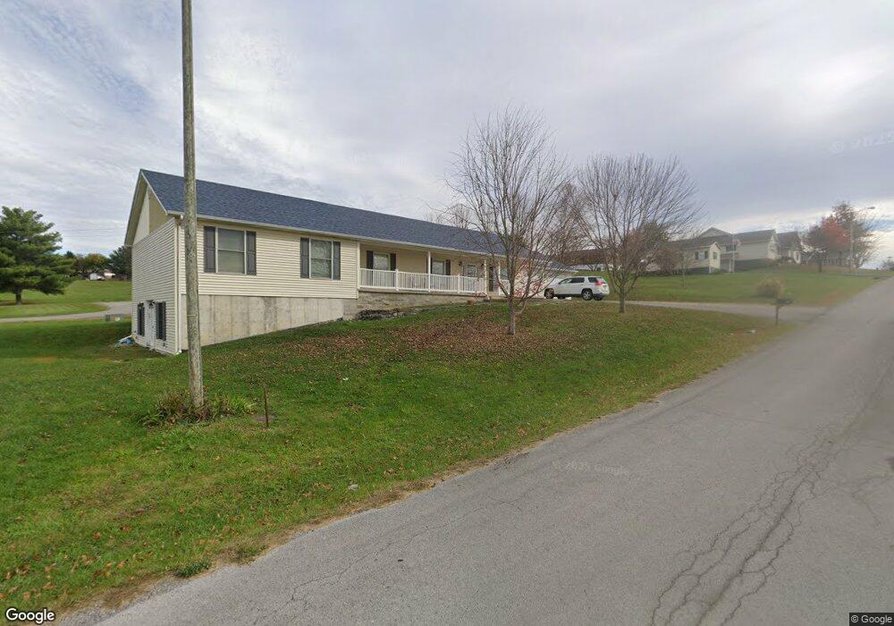
41 Amanda Brook Dr Flemingsburg, KY 41041
Estimated Value: $287,000 - $331,000
4
Beds
3
Baths
2,016
Sq Ft
$151/Sq Ft
Est. Value
About This Home
This home is located at 41 Amanda Brook Dr, Flemingsburg, KY 41041 and is currently estimated at $304,975, approximately $151 per square foot. 41 Amanda Brook Dr is a home located in Fleming County with nearby schools including Fleming County High School.
Ownership History
Date
Name
Owned For
Owner Type
Purchase Details
Closed on
Apr 20, 2021
Sold by
Lowe Duane and Lowe April
Bought by
Harmon Blake A and Harmon Elizabeth
Current Estimated Value
Home Financials for this Owner
Home Financials are based on the most recent Mortgage that was taken out on this home.
Original Mortgage
$427,500
Outstanding Balance
$385,458
Interest Rate
3.05%
Mortgage Type
New Conventional
Estimated Equity
-$80,483
Purchase Details
Closed on
Jan 17, 2017
Sold by
Donovan Debra
Bought by
Harmon Blake A and Harmon Elizabeth A
Purchase Details
Closed on
Mar 12, 2014
Sold by
Danny Danny and Vice Mary Lynn
Bought by
Harmon Blake and Harmon Elizabeth
Purchase Details
Closed on
Jun 8, 2010
Sold by
Robinson Glen N and Robinson Rhonda
Bought by
Harmon Blake A and Jackson Elizabeth A
Home Financials for this Owner
Home Financials are based on the most recent Mortgage that was taken out on this home.
Original Mortgage
$104,550
Interest Rate
4.91%
Mortgage Type
Purchase Money Mortgage
Create a Home Valuation Report for This Property
The Home Valuation Report is an in-depth analysis detailing your home's value as well as a comparison with similar homes in the area
Home Values in the Area
Average Home Value in this Area
Purchase History
| Date | Buyer | Sale Price | Title Company |
|---|---|---|---|
| Harmon Blake A | $277,500 | None Available | |
| Harmon Blake A | $43,500 | None Available | |
| Harmon Blake | $5,000 | -- | |
| Harmon Blake A | $105,000 | -- |
Source: Public Records
Mortgage History
| Date | Status | Borrower | Loan Amount |
|---|---|---|---|
| Open | Harmon Blake A | $427,500 | |
| Previous Owner | Harmon Blake A | $104,550 |
Source: Public Records
Tax History Compared to Growth
Tax History
| Year | Tax Paid | Tax Assessment Tax Assessment Total Assessment is a certain percentage of the fair market value that is determined by local assessors to be the total taxable value of land and additions on the property. | Land | Improvement |
|---|---|---|---|---|
| 2025 | $2,571 | $230,000 | $20,000 | $210,000 |
| 2024 | $2,594 | $230,000 | $20,000 | $210,000 |
| 2023 | $2,305 | $230,000 | $20,000 | $210,000 |
| 2022 | $2,300 | $230,000 | $20,000 | $210,000 |
| 2021 | $1,544 | $150,000 | $16,000 | $134,000 |
| 2020 | $1,546 | $150,000 | $16,000 | $134,000 |
| 2019 | $1,527 | $150,000 | $16,000 | $134,000 |
| 2018 | $1,454 | $150,000 | $16,000 | $134,000 |
| 2017 | $1,451 | $150,000 | $16,000 | $134,000 |
| 2016 | $1,448 | $150,000 | $16,000 | $134,000 |
| 2015 | $1,295 | $150,000 | $16,000 | $134,000 |
| 2012 | $948 | $105,000 | $16,000 | $89,000 |
Source: Public Records
Map
Nearby Homes
- 205 Highridge Dr
- 57 Dorothy St
- 19 Russell St
- 330 Crest Ave
- 61 Emmons Ln
- 904 W Water St
- 115 Highland Dr
- 294 W Water St
- 294 W West Water St
- 0 Cherry Grove Rd
- 133 Tulip Poplar - Lot 5 Ln
- 659 Cherry Grove Rd
- 70 Sunflower Rd
- 128 Crestview Rd
- 222 Mary Ave
- 232 Mills Ave
- 418 Dye St
- 528 Foxspring Ave
- 320 S Main Cross St
- 127 Mills Ave
- 22 Amanda Brook Dr
- 91 Amanda Brook Dr
- 11 Cardinal Ln
- 12 Dorothy St
- 195 High Ridge Dr
- 102 Amanda Brook Dr
- 20 Cardinal Ln
- 13 Dorothy St
- 30 Dorothy St
- 201 High Ridge Dr
- 220 Crest Ave
- 161 Crest Ave
- 29 Dorothy St
- 44 Dorothy St
- 8 Russell St
- 200 High Ridge Dr
- 186 Crest Ave
- 205 High Ridge Dr
- 47 Cardinal Ln
- 157 Crest Ave