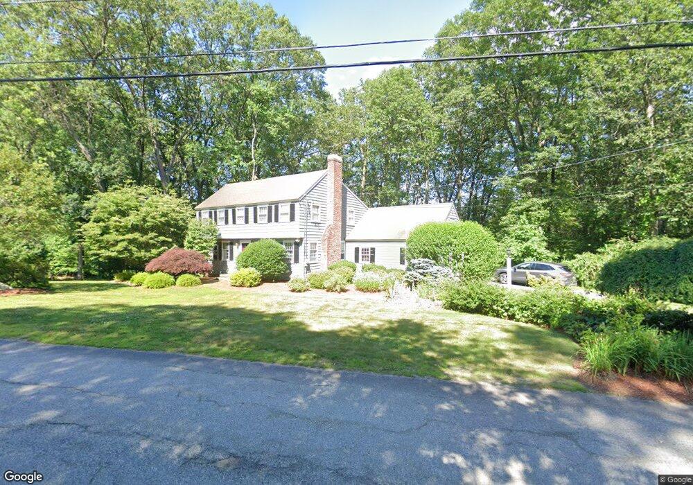
41 Amble Rd Chelmsford, MA 01824
Hitchinpost NeighborhoodEstimated Value: $823,000 - $941,000
About This Home
This home is located at 41 Amble Rd, Chelmsford, MA 01824 and is currently estimated at $866,719, approximately $341 per square foot. 41 Amble Rd is a home located in Middlesex County with nearby schools including Parker Middle School, Byam Elementary School, and Chelmsford High School.
Ownership History
We collect this data history from publicly available records. To have your information removed, we recommend requesting removal directly through your county’s website.
Purchase Details
Home Values in the Area
Average Home Value in this Area
Purchase History
We collect this data history from publicly available records. To have your information removed, we recommend requesting removal directly through your county’s website.
| Date | Buyer | Sale Price | Title Company |
|---|---|---|---|
| $345,000 | -- | ||
| $345,000 | -- |
Mortgage History
We collect this data history from publicly available records. To have your information removed, we recommend requesting removal directly through your county’s website.
| Date | Status | Borrower | Loan Amount |
|---|---|---|---|
| Open | $300,700 | ||
| Closed | $300,700 |
Tax History
We collect this data history from publicly available records. To have your information removed, we recommend requesting removal directly through your county’s website.
| Year | Tax Paid | Tax Assessment Tax Assessment Total Assessment is a certain percentage of the fair market value that is determined by local assessors to be the total taxable value of land and additions on the property. | Land | Improvement |
|---|---|---|---|---|
| 2025 | $10,647 | $766,000 | $357,300 | $408,700 |
| 2024 | $10,426 | $765,500 | $357,300 | $408,200 |
| 2023 | $9,899 | $688,900 | $367,600 | $321,300 |
| 2022 | $9,259 | $587,100 | $317,500 | $269,600 |
| 2021 | $9,049 | $574,900 | $291,200 | $283,700 |
| 2020 | $8,745 | $531,600 | $258,200 | $273,400 |
| 2019 | $8,312 | $508,400 | $264,700 | $243,700 |
| 2018 | $8,474 | $471,800 | $228,100 | $243,700 |
| 2017 | $8,231 | $459,300 | $213,600 | $245,700 |
| 2016 | $7,821 | $433,800 | $203,700 | $230,100 |
| 2015 | $7,701 | $411,800 | $185,000 | $226,800 |
| 2014 | $7,482 | $394,200 | $177,500 | $216,700 |
Map
- 3 Jonathan Ln
- 8 Pennock Rd
- 8 Galloway Rd
- 189 Littleton Rd Unit 19
- 189 Littleton Rd Unit 7
- 261 Pine Hill Rd
- 2 Bartlett Rd
- 71 Chamberlain Rd
- 181 Littleton Rd Unit 123
- 19 Frances Hill Rd
- 12 Abbott Ln
- 10 Baldwin Rd
- 14 Frances Hill Rd
- 26 Clover Hill Dr
- 175 Littleton Rd Unit A-2
- 111 Locke Rd
- 360 Littleton Rd Unit E5
- 360 Littleton Rd Unit C7
- 69 Byam Rd
- 84 Robin Hill Rd
Ask me questions while you tour the home.