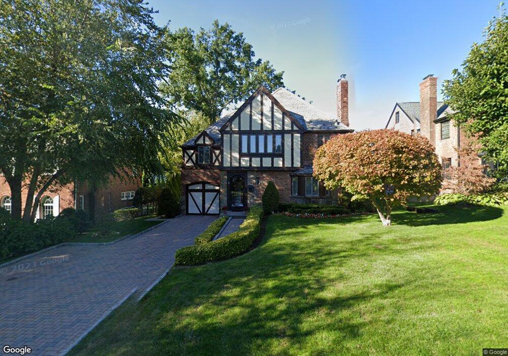
41 Andrew Rd Manhasset, NY 11030
Estimated Value: $1,268,000 - $1,426,640
Studio
3
Baths
1,741
Sq Ft
$774/Sq Ft
Est. Value
About This Home
This home is located at 41 Andrew Rd, Manhasset, NY 11030 and is currently estimated at $1,347,320, approximately $773 per square foot. 41 Andrew Rd is a home located in Nassau County with nearby schools including Manhasset Secondary School, St Mary's Elementary School, and Our Lady of Grace Montessori School.
Ownership History
Date
Name
Owned For
Owner Type
Purchase Details
Closed on
Feb 12, 2025
Sold by
Athy Joseph and Sullivan Margaret
Bought by
Athy John M and Athy Elizabeth C
Current Estimated Value
Purchase Details
Closed on
Oct 12, 2006
Sold by
Devins Doreen
Bought by
Athy Joseph
Purchase Details
Closed on
Nov 3, 1997
Sold by
Oh Yong H
Bought by
Devins Doreen
Create a Home Valuation Report for This Property
The Home Valuation Report is an in-depth analysis detailing your home's value as well as a comparison with similar homes in the area
Home Values in the Area
Average Home Value in this Area
Purchase History
| Date | Buyer | Sale Price | Title Company |
|---|---|---|---|
| Athy John M | -- | None Available | |
| Athy John M | -- | None Available | |
| Athy John M | -- | None Available | |
| Athy Joseph | $955,000 | -- | |
| Athy Joseph | $955,000 | -- | |
| Devins Doreen | $460,000 | -- | |
| Devins Doreen | $460,000 | -- |
Source: Public Records
Tax History
| Year | Tax Paid | Tax Assessment Tax Assessment Total Assessment is a certain percentage of the fair market value that is determined by local assessors to be the total taxable value of land and additions on the property. | Land | Improvement |
|---|---|---|---|---|
| 2025 | $15,433 | $985 | $463 | $522 |
| 2024 | $5,670 | $1,080 | $508 | $572 |
| 2023 | $17,056 | $1,165 | $548 | $617 |
| 2022 | $17,056 | $1,140 | $536 | $604 |
| 2021 | $16,232 | $1,168 | $549 | $619 |
| 2020 | $16,520 | $1,691 | $1,605 | $86 |
| 2019 | $16,097 | $1,812 | $1,673 | $139 |
| 2018 | $16,340 | $1,863 | $0 | $0 |
| 2017 | $9,522 | $1,863 | $1,720 | $143 |
| 2016 | $15,408 | $1,863 | $1,720 | $143 |
| 2015 | $5,614 | $1,863 | $1,720 | $143 |
| 2014 | $5,614 | $1,863 | $1,720 | $143 |
| 2013 | $5,340 | $1,863 | $1,720 | $143 |
Source: Public Records
Map
Nearby Homes
- 138 Hillcrest Ave
- 71 Beechwood Ave
- 44 Old ox Rd
- 21 George St
- 106 Thayer Rd
- 97 Vanderbilt Ave
- 30 4th St
- 65 Old Mill Rd
- 38 Mason Dr
- 96 Quaker Ridge Rd
- 350 Dogwood Ln
- 54 Summit Dr
- 64 Plandome Ct
- 25 Shelter Rock Rd
- 88 Plandome Ct
- 15 Hilltop Dr
- 50 South Dr
- 207 Mill Spring Rd
- 183 Mill Spring Rd
- 145 Shore Rd
Your Personal Tour Guide
Ask me questions while you tour the home.