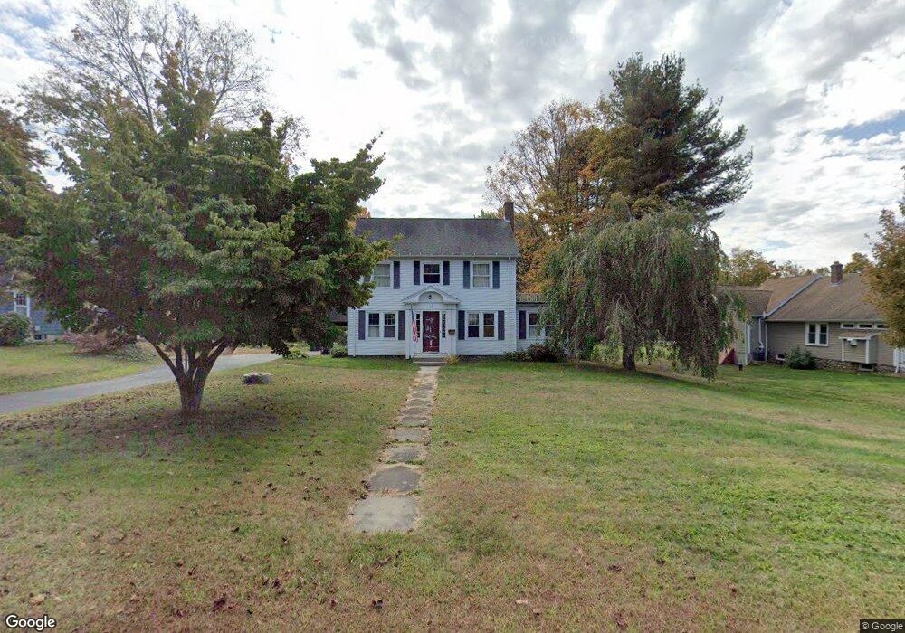
41 Barton Hill Rd East Hampton, CT 06424
Estimated Value: $429,000 - $480,000
3
Beds
2
Baths
1,930
Sq Ft
$236/Sq Ft
Est. Value
About This Home
This home is located at 41 Barton Hill Rd, East Hampton, CT 06424 and is currently estimated at $454,540, approximately $235 per square foot. 41 Barton Hill Rd is a home located in Middlesex County with nearby schools including Memorial School, Center Elementary School, and East Hampton Middle School.
Ownership History
Date
Name
Owned For
Owner Type
Purchase Details
Closed on
Jun 27, 2005
Sold by
Pawlak Alan C and Branciforte Aimee L
Bought by
Golanski Christopher
Current Estimated Value
Purchase Details
Closed on
Jun 30, 1997
Sold by
Boone Christopher N and Boone Diane L
Bought by
Pawlak Alan C and Branciforte Aimee L
Purchase Details
Closed on
Jun 1, 1994
Sold by
Walsh Thomas J and Walsh Lisa M
Bought by
Boone Christopher M and Boone Diane L
Purchase Details
Closed on
May 27, 1988
Sold by
Prichard Paul
Bought by
Walsh Thomas J
Create a Home Valuation Report for This Property
The Home Valuation Report is an in-depth analysis detailing your home's value as well as a comparison with similar homes in the area
Home Values in the Area
Average Home Value in this Area
Purchase History
| Date | Buyer | Sale Price | Title Company |
|---|---|---|---|
| Golanski Christopher | $319,000 | -- | |
| Golanski Christopher | $319,000 | -- | |
| Pawlak Alan C | $156,000 | -- | |
| Pawlak Alan C | $156,000 | -- | |
| Boone Christopher M | $157,500 | -- | |
| Boone Christopher M | $157,500 | -- | |
| Walsh Thomas J | $175,000 | -- |
Source: Public Records
Mortgage History
| Date | Status | Borrower | Loan Amount |
|---|---|---|---|
| Open | Walsh Thomas J | $241,750 | |
| Closed | Walsh Thomas J | $25,000 |
Source: Public Records
Tax History Compared to Growth
Tax History
| Year | Tax Paid | Tax Assessment Tax Assessment Total Assessment is a certain percentage of the fair market value that is determined by local assessors to be the total taxable value of land and additions on the property. | Land | Improvement |
|---|---|---|---|---|
| 2025 | $7,021 | $176,800 | $39,810 | $136,990 |
| 2024 | $6,725 | $176,800 | $39,810 | $136,990 |
| 2023 | $6,375 | $176,800 | $39,810 | $136,990 |
| 2022 | $6,128 | $176,800 | $39,810 | $136,990 |
| 2021 | $6,105 | $176,800 | $39,810 | $136,990 |
| 2020 | $5,958 | $179,790 | $39,810 | $139,980 |
| 2019 | $5,891 | $177,770 | $39,810 | $137,960 |
| 2018 | $5,568 | $177,770 | $39,810 | $137,960 |
| 2017 | $5,568 | $177,770 | $39,810 | $137,960 |
| 2016 | $5,234 | $177,770 | $39,810 | $137,960 |
| 2015 | $5,097 | $183,490 | $48,810 | $134,680 |
| 2014 | $4,435 | $183,490 | $48,810 | $134,680 |
Source: Public Records
Map
Nearby Homes
- 43 Barton Hill Rd
- 39 Barton Hill Rd
- 45 Barton Hill Rd
- 37 Barton Hill Rd
- 24 Hayes Rd
- 17 Hyde Farm Terrace
- 51 Barton Hill Rd
- 21 Hyde Farm Terrace
- 42 Barton Hill Rd
- 40 Barton Hill Rd
- 38 Barton Hill Rd
- 25 Hayes Rd
- 44 Barton Hill Rd
- 15 Hyde Farm Terrace
- 33 Barton Hill Rd
- 48 Barton Hill Rd
- 53 Barton Hill Rd
- 22 Hayes Rd
- 1 Maple St