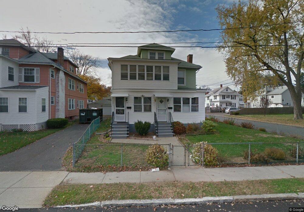
41 Bay State Rd Unit 43 Holyoke, MA 01040
Estimated Value: $320,000 - $416,000
4
Beds
2
Baths
2,576
Sq Ft
$146/Sq Ft
Est. Value
About This Home
This home is located at 41 Bay State Rd Unit 43, Holyoke, MA 01040 and is currently estimated at $376,036, approximately $145 per square foot. 41 Bay State Rd Unit 43 is a home located in Hampden County with nearby schools including Maurice A. Donahue Elementary School, Holyoke High School, and Holyoke Community Charter School.
Ownership History
Date
Name
Owned For
Owner Type
Purchase Details
Closed on
Jul 1, 2019
Sold by
Sulikowski George and Mclaughlin Hedy
Bought by
Lafortune Adam S and Vieu Katelyn M
Current Estimated Value
Home Financials for this Owner
Home Financials are based on the most recent Mortgage that was taken out on this home.
Original Mortgage
$239,089
Outstanding Balance
$210,232
Interest Rate
4%
Mortgage Type
FHA
Estimated Equity
$165,804
Purchase Details
Closed on
Jul 19, 1963
Bought by
Sulikowski Maria and Sulikowski George
Create a Home Valuation Report for This Property
The Home Valuation Report is an in-depth analysis detailing your home's value as well as a comparison with similar homes in the area
Home Values in the Area
Average Home Value in this Area
Purchase History
| Date | Buyer | Sale Price | Title Company |
|---|---|---|---|
| Lafortune Adam S | $243,500 | -- | |
| Sulikowski Maria | -- | -- |
Source: Public Records
Mortgage History
| Date | Status | Borrower | Loan Amount |
|---|---|---|---|
| Open | Lafortune Adam S | $239,089 |
Source: Public Records
Tax History
| Year | Tax Paid | Tax Assessment Tax Assessment Total Assessment is a certain percentage of the fair market value that is determined by local assessors to be the total taxable value of land and additions on the property. | Land | Improvement |
|---|---|---|---|---|
| 2025 | $6,216 | $356,000 | $47,300 | $308,700 |
| 2024 | $5,810 | $306,600 | $45,200 | $261,400 |
| 2023 | $5,350 | $285,200 | $45,200 | $240,000 |
| 2022 | $5,370 | $278,800 | $45,200 | $233,600 |
| 2021 | $4,646 | $241,100 | $41,200 | $199,900 |
| 2020 | $3,560 | $186,600 | $41,200 | $145,400 |
| 2019 | $3,490 | $180,900 | $41,200 | $139,700 |
| 2018 | $3,273 | $171,100 | $41,200 | $129,900 |
| 2017 | $3,280 | $171,100 | $41,200 | $129,900 |
| 2016 | $3,183 | $166,500 | $42,300 | $124,200 |
| 2015 | $3,170 | $166,500 | $42,300 | $124,200 |
Source: Public Records
Map
Nearby Homes
- 1705-1707 Northampton St
- 141 Saint Jerome Ave
- 1684 Northampton St
- 60 Chapin St Unit D
- 69 Gates St
- 21 Francis Ave
- 42 Lawler St
- 18 Harrison Ave
- 301-303 Linden St
- 41 Lynwood Ave
- 329 Beech St
- 15 Maple Crest Cir Unit D
- 25-27 Elmwood Ave
- 133-135 Brown Ave
- 10 View St
- 0 High St
- 1225 Hampden St
- 225 Beech St Unit 227
- 286 Westfield Rd
- 26 Vernon St
- 41-43 Bay State Rd
- 45 Bay State Rd Unit 47
- 49 Bay State Rd
- 48 Calumet Rd Unit 50
- 48 Calumet Rd Unit 2
- 48 Calumet Rd Unit 3
- 12 Winthrop St
- 44 Bay State Rd
- 37 Bay State Rd
- 44 Calumet Rd
- 56 Calumet Rd Unit 58
- 53 Bay State Rd Unit 55
- 56-58 Calumet Rd Unit 58
- 56-58 Calumet Rd
- 50 Bay State Rd
- 15 Winthrop St
- 60 Calumet Rd Unit 62
- 59 Bay State Rd
- 54 Bay State Rd
- 38 Calumet Rd Unit 40
Your Personal Tour Guide
Ask me questions while you tour the home.