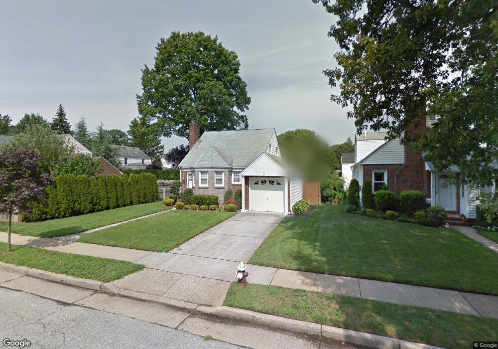
41 Beatrice Ct Hempstead, NY 11550
Estimated Value: $342,000 - $593,603
--
Bed
1
Bath
1,238
Sq Ft
$378/Sq Ft
Est. Value
About This Home
This home is located at 41 Beatrice Ct, Hempstead, NY 11550 and is currently estimated at $467,802, approximately $377 per square foot. 41 Beatrice Ct is a home located in Nassau County with nearby schools including The Academy Charter School, Evergreen Charter School, and Crescent School.
Ownership History
Date
Name
Owned For
Owner Type
Purchase Details
Closed on
Aug 31, 2005
Sold by
Api Properties 355 Llc
Bought by
Caravello Antonio
Current Estimated Value
Purchase Details
Closed on
Apr 26, 2005
Sold by
Arsell Lesster
Bought by
Api Properties 355 Llc
Purchase Details
Closed on
Jun 23, 1999
Sold by
Sweet Virginia
Bought by
Arsell Lester J and Kiley Courtney A
Create a Home Valuation Report for This Property
The Home Valuation Report is an in-depth analysis detailing your home's value as well as a comparison with similar homes in the area
Home Values in the Area
Average Home Value in this Area
Purchase History
| Date | Buyer | Sale Price | Title Company |
|---|---|---|---|
| Caravello Antonio | $221,342 | -- | |
| Api Properties 355 Llc | $418,000 | -- | |
| Arsell Lester J | $185,000 | -- |
Source: Public Records
Tax History Compared to Growth
Tax History
| Year | Tax Paid | Tax Assessment Tax Assessment Total Assessment is a certain percentage of the fair market value that is determined by local assessors to be the total taxable value of land and additions on the property. | Land | Improvement |
|---|---|---|---|---|
| 2025 | $8,840 | $393 | $155 | $238 |
| 2024 | $1,041 | $393 | $155 | $238 |
| 2023 | $8,624 | $393 | $155 | $238 |
| 2022 | $8,624 | $393 | $155 | $238 |
| 2021 | $12,919 | $381 | $150 | $231 |
| 2020 | $9,463 | $644 | $540 | $104 |
| 2019 | $9,361 | $644 | $540 | $104 |
| 2018 | $8,939 | $644 | $0 | $0 |
| 2017 | $6,969 | $644 | $540 | $104 |
| 2016 | $8,096 | $644 | $540 | $104 |
| 2015 | $1,078 | $644 | $540 | $104 |
| 2014 | $1,078 | $644 | $540 | $104 |
| 2013 | $998 | $644 | $540 | $104 |
Source: Public Records
Map
Nearby Homes
- 39 Hilbert St
- 47 Stratford Rd
- 35 Mulford Place
- 144 Hilton Ave
- 22 Mulford Place Unit 2D
- 22 Mulford Place Unit 6C
- 30 Cathedral Ave Unit 4A
- 82 Hilton Ave
- 200 Hilton Ave Unit 55
- 20 Wendell St Unit A16
- 20 Wendell St Unit E2
- 20 Wendell St Unit 39C
- 44 Saint Pauls Rd S
- 50 Mayfair Ave
- 170 Ivy St
- 252 Lexington Ave
- 60 Long Dr
- 253 William St
- 67 3rd St
- 144 N Franklin St