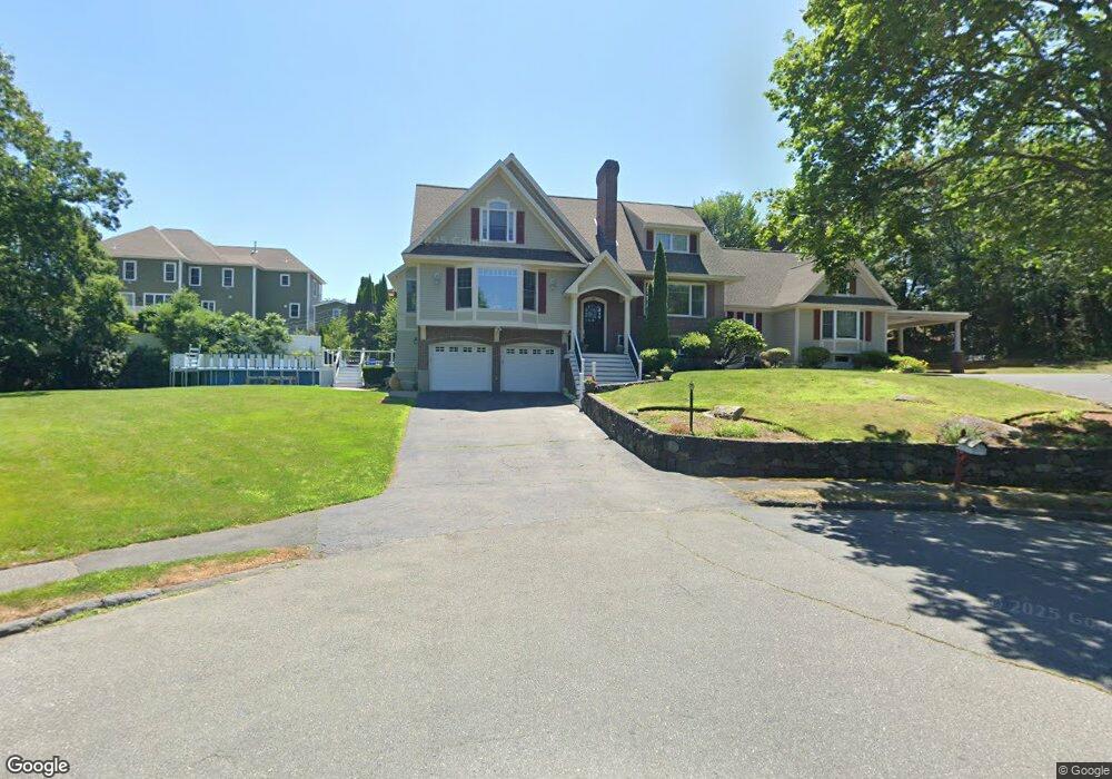
41 Biscayne Ave Saugus, MA 01906
Lynnhurst NeighborhoodEstimated Value: $1,002,000 - $1,409,000
4
Beds
6
Baths
4,704
Sq Ft
$273/Sq Ft
Est. Value
About This Home
This home is located at 41 Biscayne Ave, Saugus, MA 01906 and is currently estimated at $1,284,578, approximately $273 per square foot. 41 Biscayne Ave is a home located in Essex County with nearby schools including Saugus High School and Pioneer Charter School Of Science II.
Ownership History
Date
Name
Owned For
Owner Type
Purchase Details
Closed on
Dec 21, 1998
Sold by
Pizzano Robert E
Bought by
Nigro Kevin L
Current Estimated Value
Home Financials for this Owner
Home Financials are based on the most recent Mortgage that was taken out on this home.
Original Mortgage
$70,000
Outstanding Balance
$15,997
Interest Rate
6.85%
Mortgage Type
Purchase Money Mortgage
Estimated Equity
$1,268,581
Create a Home Valuation Report for This Property
The Home Valuation Report is an in-depth analysis detailing your home's value as well as a comparison with similar homes in the area
Home Values in the Area
Average Home Value in this Area
Purchase History
| Date | Buyer | Sale Price | Title Company |
|---|---|---|---|
| Nigro Kevin L | $272,000 | -- |
Source: Public Records
Mortgage History
| Date | Status | Borrower | Loan Amount |
|---|---|---|---|
| Open | Nigro Kevin L | $70,000 |
Source: Public Records
Tax History
| Year | Tax Paid | Tax Assessment Tax Assessment Total Assessment is a certain percentage of the fair market value that is determined by local assessors to be the total taxable value of land and additions on the property. | Land | Improvement |
|---|---|---|---|---|
| 2025 | $13,577 | $1,271,300 | $368,500 | $902,800 |
| 2024 | $12,588 | $1,182,000 | $349,400 | $832,600 |
| 2023 | $12,156 | $1,079,600 | $319,900 | $759,700 |
| 2022 | $11,497 | $957,300 | $273,200 | $684,100 |
| 2021 | $11,196 | $907,300 | $238,000 | $669,300 |
| 2020 | $10,462 | $877,700 | $216,200 | $661,500 |
| 2019 | $10,403 | $854,100 | $216,200 | $637,900 |
| 2018 | $9,617 | $830,500 | $216,200 | $614,300 |
| 2017 | $8,677 | $720,100 | $201,900 | $518,200 |
| 2016 | $9,561 | $783,700 | $172,000 | $611,700 |
| 2015 | $8,972 | $746,400 | $163,900 | $582,500 |
| 2014 | $8,422 | $725,400 | $163,900 | $561,500 |
Source: Public Records
Map
Nearby Homes
- 52 Hesper St
- 4 Oneil Way
- 67 Saville St
- 27 Garfield Ave
- 22 Blueridge Ave
- 36 Jasper St
- 25 Auburn St
- 24 Palmetto St
- 43 W Sigourney St
- 187 Hamilton St
- 43 Taylor St
- 34 Summer St
- 8 Menlo Terrace Unit A
- 189 Holyoke St
- 7 Adams Ave
- 5 Springdale Ave
- 32 Birch Brook Landing Unit 23
- 32 Birch Brook Landing Unit 25
- 32 Birch Brook Landing Unit 22
- 32 Birch Brook Rd Unit 13
- 20 Hitching Hill Rd
- 2 Ironworks Way
- 2 Iron Works Way
- 18 Hitching Hill Rd
- 39 Biscayne Ave
- 40 Biscayne Ave
- 3 Iron Works Way
- 4 Iron Works Way
- 0 Iron Works Way
- 2 Hillside Ave
- 16 Hitching Hill Rd
- 11 Cider Mill Rd
- 6 Iron Works Way
- 5 Iron Works Way
- 37 Biscayne Ave
- 38 Biscayne Ave
- 15 Charles St
- 8 Bellevue St
- 12 Cider Mill Rd
- 7 Ironworks Way
Your Personal Tour Guide
Ask me questions while you tour the home.