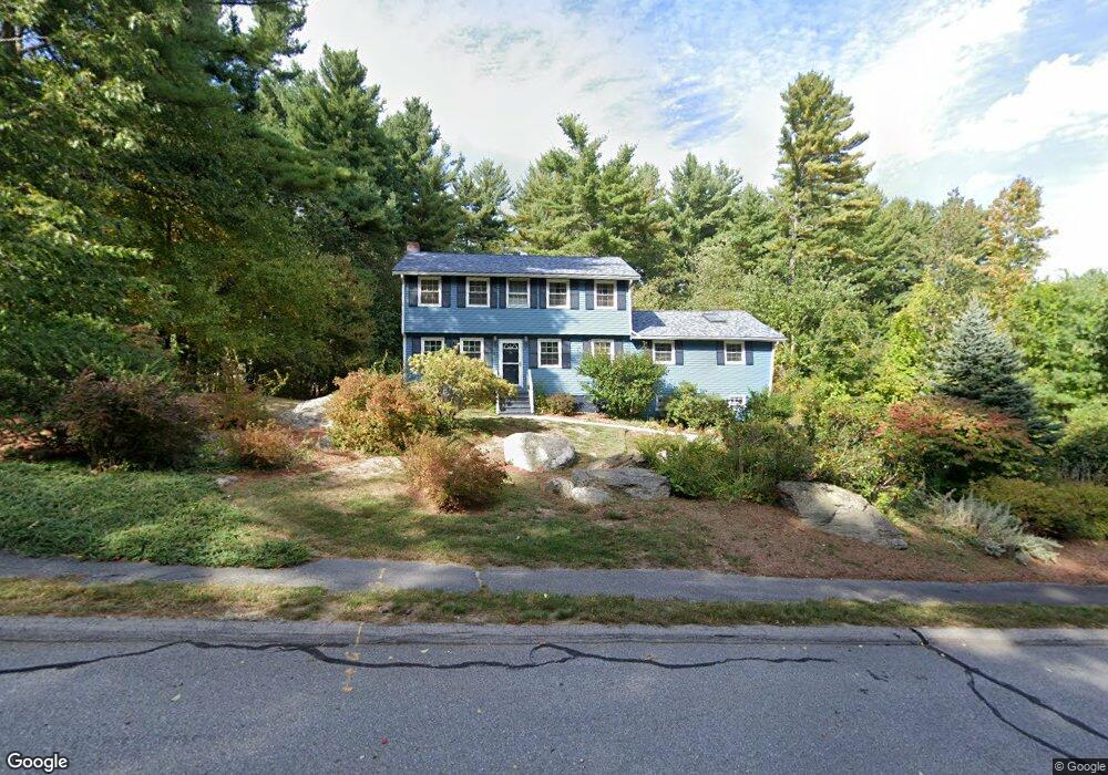
41 Box Mill Rd Boxborough, MA 01719
Estimated Value: $747,000 - $919,000
4
Beds
2
Baths
2,096
Sq Ft
$396/Sq Ft
Est. Value
About This Home
This home is located at 41 Box Mill Rd, Boxborough, MA 01719 and is currently estimated at $830,362, approximately $396 per square foot. 41 Box Mill Rd is a home located in Middlesex County with nearby schools including Acton-Boxborough Regional High School.
Ownership History
Date
Name
Owned For
Owner Type
Purchase Details
Closed on
Dec 12, 2006
Sold by
Barari Tirthankar
Bought by
Barari Mausumi and Barari Tirthankar
Current Estimated Value
Purchase Details
Closed on
Oct 27, 2006
Sold by
Box Mill Rt and Pacelli Anthony V
Bought by
Barari Tirthankar
Purchase Details
Closed on
Jan 18, 2005
Sold by
Pacelli Patricia A
Bought by
Box Mill Road Rt and Pacelli Anthony V
Create a Home Valuation Report for This Property
The Home Valuation Report is an in-depth analysis detailing your home's value as well as a comparison with similar homes in the area
Home Values in the Area
Average Home Value in this Area
Purchase History
| Date | Buyer | Sale Price | Title Company |
|---|---|---|---|
| Barari Mausumi | -- | -- | |
| Barari Tirthankar | $455,000 | -- | |
| Box Mill Road Rt | -- | -- |
Source: Public Records
Tax History
| Year | Tax Paid | Tax Assessment Tax Assessment Total Assessment is a certain percentage of the fair market value that is determined by local assessors to be the total taxable value of land and additions on the property. | Land | Improvement |
|---|---|---|---|---|
| 2025 | $10,292 | $679,800 | $282,900 | $396,900 |
| 2024 | $9,532 | $635,900 | $271,400 | $364,500 |
| 2023 | $9,180 | $591,500 | $244,000 | $347,500 |
| 2022 | $9,032 | $518,500 | $244,000 | $274,500 |
| 2020 | $8,225 | $491,900 | $244,000 | $247,900 |
| 2019 | $8,077 | $491,900 | $244,000 | $247,900 |
| 2018 | $5,171 | $467,400 | $232,600 | $234,800 |
| 2017 | $5,082 | $456,300 | $232,600 | $223,700 |
| 2016 | $7,251 | $443,200 | $232,600 | $210,600 |
| 2015 | $6,856 | $411,800 | $204,000 | $207,800 |
| 2014 | $6,931 | $391,800 | $200,000 | $191,800 |
Source: Public Records
Map
Nearby Homes
- 134 Russet Ln Unit 134
- 4 Littlefield Rd
- 79 Old Orchard Ln
- 631 Massachusetts Ave Unit 631
- 77 Wheeler Dr Unit 77
- 20 Lyons Ln Unit 20
- 235 Arlington St
- 959 Hill Rd
- 92 Willow St Unit 3
- 92 Willow St Unit 2
- 5 Perkins Ln
- 90 Willow St Unit 1
- 20 Joseph Reed Ln
- 40 Fifers Ln
- 36 Leonard Rd
- 79 Charter Rd
- 280 W Acton Rd
- 247 W Acton Rd
- 4 Omega Way
- 58 Spencer Rd Unit 32K
- 55 Box Mill Rd
- 183 Guggins Ln
- LOT A Whitcomb Rd
- LOT 1 Sadler Farm Ln
- LOT 3 Sadler Farm Ln
- L-20 Hill Rd
- LOT 1 Barteau Ln
- Lot 1 Hughes Ln
- 284 Liberty Square Rd
- 298 Liberty Square Rd
- 71 Box Mill Rd
- 310 Liberty Square Rd
- 70 Box Mill Rd
- 256 Liberty Square Rd
- 169 Guggins Ln
- 85 Box Mill Rd
- 275 Liberty Square Rd
- 153 Guggins Ln
- 80 Box Mill Rd
- 291 Liberty Square Rd
Your Personal Tour Guide
Ask me questions while you tour the home.