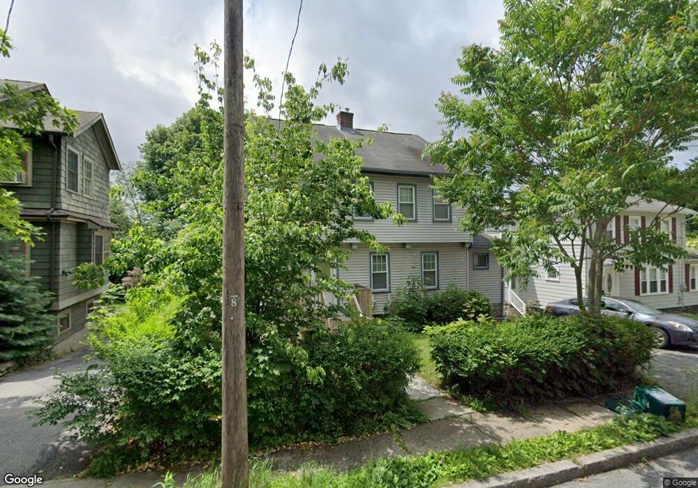
41 Burncoat Terrace Worcester, MA 01605
North Lincoln Street NeighborhoodEstimated Value: $450,499 - $474,000
5
Beds
2
Baths
1,632
Sq Ft
$282/Sq Ft
Est. Value
About This Home
This home is located at 41 Burncoat Terrace, Worcester, MA 01605 and is currently estimated at $459,875, approximately $281 per square foot. 41 Burncoat Terrace is a home located in Worcester County with nearby schools including Jacob Hiatt Magnet School, Chandler Magnet, and Wawecus Road School.
Ownership History
Date
Name
Owned For
Owner Type
Purchase Details
Closed on
Jun 17, 2010
Sold by
Camoreyt Anthony A and Camoreyt Christine J
Bought by
Zenon Widline
Current Estimated Value
Home Financials for this Owner
Home Financials are based on the most recent Mortgage that was taken out on this home.
Original Mortgage
$179,704
Outstanding Balance
$116,106
Interest Rate
4.25%
Mortgage Type
FHA
Estimated Equity
$343,769
Purchase Details
Closed on
Aug 2, 1996
Sold by
Guglielmello Gary and Guglielmello Karen
Bought by
Camoreyt Anthony and Camoreyt Christine
Create a Home Valuation Report for This Property
The Home Valuation Report is an in-depth analysis detailing your home's value as well as a comparison with similar homes in the area
Home Values in the Area
Average Home Value in this Area
Purchase History
| Date | Buyer | Sale Price | Title Company |
|---|---|---|---|
| Zenon Widline | $185,000 | -- | |
| Camoreyt Anthony | $92,000 | -- |
Source: Public Records
Mortgage History
| Date | Status | Borrower | Loan Amount |
|---|---|---|---|
| Open | Zenon Widline | $179,704 | |
| Previous Owner | Camoreyt Anthony | $134,400 | |
| Previous Owner | Camoreyt Anthony | $30,000 | |
| Previous Owner | Camoreyt Anthony | $90,438 |
Source: Public Records
Tax History Compared to Growth
Tax History
| Year | Tax Paid | Tax Assessment Tax Assessment Total Assessment is a certain percentage of the fair market value that is determined by local assessors to be the total taxable value of land and additions on the property. | Land | Improvement |
|---|---|---|---|---|
| 2025 | $4,837 | $366,700 | $114,700 | $252,000 |
| 2024 | $4,751 | $345,500 | $114,700 | $230,800 |
| 2023 | $4,550 | $317,300 | $99,700 | $217,600 |
| 2022 | $4,180 | $274,800 | $79,800 | $195,000 |
| 2021 | $4,049 | $248,700 | $63,800 | $184,900 |
| 2020 | $3,934 | $231,400 | $63,800 | $167,600 |
| 2019 | $3,784 | $210,200 | $57,400 | $152,800 |
| 2018 | $3,769 | $199,300 | $57,400 | $141,900 |
| 2017 | $3,633 | $189,000 | $57,400 | $131,600 |
| 2016 | $3,574 | $173,400 | $42,200 | $131,200 |
| 2015 | $3,480 | $173,400 | $42,200 | $131,200 |
| 2014 | $3,388 | $173,400 | $42,200 | $131,200 |
Source: Public Records
Map
Nearby Homes
- 37 Kenwood Ave
- 36 Melrose St
- 3 Selden St
- 23 Ashton St
- 2 Selden St
- 19 Mckinley Rd
- 33 Denmark St
- 73 Paine St
- 14 Mary Ann Dr
- 93 W Boylston St
- 87 W Boylston St
- 89 W Boylston St Unit 4
- 10 Hemans St Unit 9
- 30 Boardman St
- 15 Boardman St
- 10 Dryden St Unit 7
- 23 Dryden St
- 44 Boardman St
- 26 Tower St
- 11 Gifford Dr
- 43 Burncoat Terrace
- 37 Burncoat Terrace
- 15 Merton Rd
- 46 Burncoat Heights
- 35 Burncoat Terrace
- 40 Burncoat Heights
- 161 Millbrook St
- 33 Burncoat Terrace
- 159 Millbrook St
- 44 Burncoat Terrace
- 18 Merton Rd
- 157 Millbrook St
- 167 Millbrook St
- 16 Merton Rd
- 42 Burncoat Terrace
- 14 Merton Rd
- 31 Burncoat Terrace
- 169 Millbrook St
- 34 Burncoat Terrace
- 12 Merton Rd