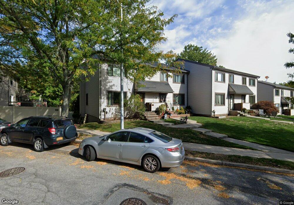
41 Charleston Ave Unit 116 Staten Island, NY 10309
Rossville NeighborhoodEstimated Value: $589,000 - $660,000
3
Beds
3
Baths
1,400
Sq Ft
$451/Sq Ft
Est. Value
About This Home
This home is located at 41 Charleston Ave Unit 116, Staten Island, NY 10309 and is currently estimated at $631,405, approximately $451 per square foot. 41 Charleston Ave Unit 116 is a home located in Richmond County with nearby schools including P.S. 56 - The Louis Desario School, Is 34 Tottenville, and Tottenville High School.
Ownership History
Date
Name
Owned For
Owner Type
Purchase Details
Closed on
Jul 12, 2002
Sold by
Leschack Carole
Bought by
Bergrin Gary C and Bergrin Donna J
Current Estimated Value
Home Financials for this Owner
Home Financials are based on the most recent Mortgage that was taken out on this home.
Original Mortgage
$90,000
Interest Rate
6.39%
Mortgage Type
Purchase Money Mortgage
Create a Home Valuation Report for This Property
The Home Valuation Report is an in-depth analysis detailing your home's value as well as a comparison with similar homes in the area
Home Values in the Area
Average Home Value in this Area
Purchase History
| Date | Buyer | Sale Price | Title Company |
|---|---|---|---|
| Bergrin Gary C | $240,000 | First American Title Ins Co |
Source: Public Records
Mortgage History
| Date | Status | Borrower | Loan Amount |
|---|---|---|---|
| Previous Owner | Bergrin Gary C | $90,000 |
Source: Public Records
Tax History Compared to Growth
Tax History
| Year | Tax Paid | Tax Assessment Tax Assessment Total Assessment is a certain percentage of the fair market value that is determined by local assessors to be the total taxable value of land and additions on the property. | Land | Improvement |
|---|---|---|---|---|
| 2025 | $4,873 | $38,723 | $2,144 | $36,579 |
| 2024 | $4,873 | $34,795 | $2,318 | $32,477 |
| 2023 | $4,927 | $24,262 | $2,488 | $21,774 |
| 2022 | $4,669 | $28,872 | $3,324 | $25,548 |
| 2021 | $4,643 | $25,072 | $3,324 | $21,748 |
| 2020 | $4,406 | $25,407 | $3,324 | $22,083 |
| 2019 | $4,229 | $22,108 | $3,324 | $18,784 |
| 2018 | $4,121 | $20,218 | $3,100 | $17,118 |
| 2017 | $3,973 | $19,488 | $3,241 | $16,247 |
| 2016 | $3,675 | $18,385 | $2,960 | $15,425 |
| 2015 | $3,233 | $17,346 | $2,617 | $14,729 |
| 2014 | $3,233 | $16,849 | $2,780 | $14,069 |
Source: Public Records
Map
Nearby Homes
- 37 Charleston Ave
- 97 Bower Ct Unit 1
- 97 Bower Ct Unit 74
- 22 Charleston Ave Unit 168
- 39 Hemlock Ct Unit 152
- 76 Lucille Ave
- 40 Bower Ct
- 38 Cypress Loop
- 5 Wirt Ave
- 87 Cypress Loop Unit 243
- 85 Cypress Loop
- 494 Winant Ave
- 125 Wirt Ave
- 149 Lucille Ave
- 45 Redwood Loop
- 62 Arrowood Ct Unit 601
- 27 Berry Ct Unit 565
- 28 Berry Ct Unit 576
- 24 Berry Ct Unit 574
- 159 Wirt Ave
- 39 Charleston Ave Unit 115
- 35 Charleston Ave
- 3 Hickory Ct Unit 117
- 5 Hickory Ct Unit 118
- 7 Hickory Ct
- 31 Charleston Ave Unit 112
- 124 Bower Ct Unit 75
- 37 Hickory Ct
- 122 Bower Ct
- 9 Hickory Ct
- 6 Hemlock Ct
- 29 Charleston Ave Unit 29
- 120 Bower Ct Unit 77
- 8 Hemlock Ct Unit 132
- 8 Hemlock Ct
- 27 Charleston Ave Unit 110
- 118 Bower Ct Unit 78
- 11 Hickory Ct
- 25 Charleston Ave Unit 109
- 10 Hemlock Ct