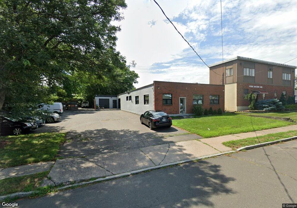
41 Custer St West Hartford, CT 06110
Estimated Value: $321,425
--
Bed
--
Bath
4,700
Sq Ft
$68/Sq Ft
Est. Value
About This Home
This home is located at 41 Custer St, West Hartford, CT 06110 and is currently estimated at $321,425, approximately $68 per square foot. 41 Custer St is a home located in Hartford County with nearby schools including Wolcott School, Duffy School, and Sedgwick Middle School.
Ownership History
Date
Name
Owned For
Owner Type
Purchase Details
Closed on
Jan 7, 2025
Sold by
Sarnese Michael
Bought by
Bamm Llc
Current Estimated Value
Purchase Details
Closed on
Jul 26, 2011
Sold by
Har 41 Custer Street W
Bought by
Sarnese Richard
Purchase Details
Closed on
May 31, 2011
Sold by
Lin Hai Ming and Wu Rong Fang
Bought by
Sarnese Richard
Purchase Details
Closed on
Jun 7, 2001
Sold by
Papa John T
Bought by
Custer St Llc
Home Financials for this Owner
Home Financials are based on the most recent Mortgage that was taken out on this home.
Original Mortgage
$180,000
Interest Rate
7.08%
Mortgage Type
Commercial
Create a Home Valuation Report for This Property
The Home Valuation Report is an in-depth analysis detailing your home's value as well as a comparison with similar homes in the area
Home Values in the Area
Average Home Value in this Area
Purchase History
| Date | Buyer | Sale Price | Title Company |
|---|---|---|---|
| Bamm Llc | -- | None Available | |
| Sarnese Michael | -- | None Available | |
| Sarnese Michael | -- | None Available | |
| Sarnese Richard | $170,000 | -- | |
| Sarnese Richard | $170,000 | -- | |
| Sarnese Richard | $170,000 | -- | |
| Sarnese Richard | $170,000 | -- | |
| Custer St Llc | $230,000 | -- | |
| Custer St Llc | $230,000 | -- |
Source: Public Records
Mortgage History
| Date | Status | Borrower | Loan Amount |
|---|---|---|---|
| Previous Owner | Custer St Llc | $180,000 | |
| Previous Owner | Custer St Llc | $200,000 |
Source: Public Records
Tax History Compared to Growth
Tax History
| Year | Tax Paid | Tax Assessment Tax Assessment Total Assessment is a certain percentage of the fair market value that is determined by local assessors to be the total taxable value of land and additions on the property. | Land | Improvement |
|---|---|---|---|---|
| 2025 | $7,514 | $167,790 | $71,750 | $96,040 |
| 2024 | $7,106 | $167,790 | $71,750 | $96,040 |
| 2023 | $6,866 | $167,790 | $71,750 | $96,040 |
| 2022 | $6,826 | $167,790 | $71,750 | $96,040 |
| 2021 | $6,236 | $147,000 | $55,580 | $91,420 |
| 2020 | $6,145 | $147,000 | $55,580 | $91,420 |
| 2019 | $6,145 | $147,000 | $55,580 | $91,420 |
| 2018 | $6,027 | $147,000 | $55,580 | $91,420 |
| 2017 | $6,033 | $147,000 | $55,580 | $91,420 |
| 2016 | $4,851 | $122,780 | $56,070 | $66,710 |
| 2015 | $4,704 | $122,780 | $56,070 | $66,710 |
| 2014 | $4,588 | $122,780 | $56,070 | $66,710 |
Source: Public Records
Map
Nearby Homes
- 161 Abbotsford Ave
- 90 Meriline Ave
- 127 Hollywood Ave
- 93 Stanwood St
- 93 Marion St Unit 3
- 29 Sunnyside Rd
- 937 New Britain Ave
- 121 Cambridge St
- 43 Marion St
- 41 Page Ave
- 559 Mountain Rd
- 263 Williamstown Ct
- 82 Nepaug St
- 131 Williamstown Ct Unit 131
- 5 Brinley Ave
- 148 Colonial St
- 11 Nepaug St
- 1145 New Britain Ave
- 47 Francis Dr
- 49 Somerset St
- 48 Cody St
- 38 Cody St
- 24 Custer St
- 43 Cody St
- 16 Custer St
- 12 Cody St
- 100 Shield St
- 49 Shield St
- 106 South St Unit B
- 106 South St Unit D
- 106 South St Unit E
- 106 South St Unit C
- 106 South St
- 106 South St Unit Suite A
- 106 South St Unit Suite B
- 87 Custer St
- 20 Hurlbut St
- 20 Hurlbut St Unit 100
- 20 Hurlbut St Unit 102
- 20 Hurlbut St Unit 202