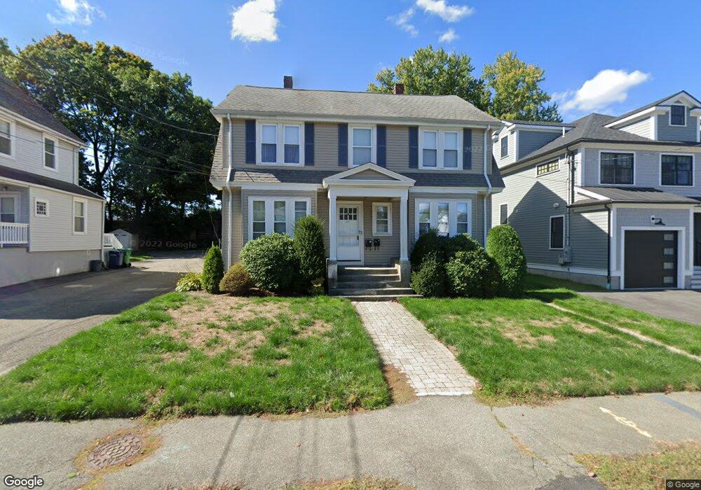
41 Dalby St Newton, MA 02458
Nonantum NeighborhoodEstimated Value: $1,003,000 - $1,501,000
4
Beds
2
Baths
2,048
Sq Ft
$618/Sq Ft
Est. Value
About This Home
This home is located at 41 Dalby St, Newton, MA 02458 and is currently estimated at $1,265,368, approximately $617 per square foot. 41 Dalby St is a home located in Middlesex County with nearby schools including Lincoln-Eliot Elementary School, Bigelow Middle School, and Newton North High School.
Ownership History
Date
Name
Owned For
Owner Type
Purchase Details
Closed on
Nov 3, 1989
Sold by
Considine Est A
Bought by
Negrotti Robert J
Current Estimated Value
Home Financials for this Owner
Home Financials are based on the most recent Mortgage that was taken out on this home.
Original Mortgage
$156,000
Interest Rate
9.9%
Mortgage Type
Purchase Money Mortgage
Create a Home Valuation Report for This Property
The Home Valuation Report is an in-depth analysis detailing your home's value as well as a comparison with similar homes in the area
Home Values in the Area
Average Home Value in this Area
Purchase History
| Date | Buyer | Sale Price | Title Company |
|---|---|---|---|
| Negrotti Robert J | $195,000 | -- |
Source: Public Records
Mortgage History
| Date | Status | Borrower | Loan Amount |
|---|---|---|---|
| Closed | Negrotti Robert J | $156,000 |
Source: Public Records
Tax History
| Year | Tax Paid | Tax Assessment Tax Assessment Total Assessment is a certain percentage of the fair market value that is determined by local assessors to be the total taxable value of land and additions on the property. | Land | Improvement |
|---|---|---|---|---|
| 2025 | $10,188 | $1,039,600 | $686,200 | $353,400 |
| 2024 | $9,851 | $1,009,300 | $666,200 | $343,100 |
| 2023 | $9,344 | $917,900 | $534,000 | $383,900 |
| 2022 | $9,208 | $875,300 | $494,400 | $380,900 |
| 2021 | $8,640 | $803,000 | $453,600 | $349,400 |
| 2020 | $8,383 | $803,000 | $453,600 | $349,400 |
| 2019 | $7,843 | $750,500 | $423,900 | $326,600 |
| 2018 | $7,669 | $708,800 | $398,100 | $310,700 |
| 2017 | $7,231 | $650,300 | $365,200 | $285,100 |
| 2016 | $6,789 | $596,600 | $335,000 | $261,600 |
| 2015 | $6,474 | $557,600 | $313,100 | $244,500 |
Source: Public Records
Map
Nearby Homes
- 237 California St
- 235 California St
- 235 California St Unit 235
- 290 Watertown St Unit 2
- 290 Watertown St Unit 3
- 290 Pleasant St Unit 113
- 36 Brandley Rd Unit 38
- 68 Los Angeles St Unit 306
- 68 Los Angeles St Unit 205
- 34 West St Unit B
- 34 West St Unit A
- 189 Linwood Ave Unit 1
- 188-190 Adams St
- 41 Capital St
- 11 Pond St Unit 11
- 49 Hawthorn St
- 33 Howard St Unit 35-1
- 95 Rutland St
- 27 Oakland St
- 3 Ashmont Ave
- 43-45 Dalby St Unit 43
- 43 Dalby St Unit 45
- 43 Dalby St Unit 43
- 43 Dalby St Unit 1
- 45 Dalby St
- 43-45 Dalby St
- 45 Dalby St Unit 1
- 35 Dalby St
- 35 Dalby St Unit B
- 35 Dalby St Unit 2
- 35 Dalby St Unit 1
- 29 Dalby St
- 29 Dalby St Unit 1
- 56 Chapel St
- 50 Chapel St
- 38 Dalby St
- 40 Dalby St Unit 42
- 40 Dalby St Unit 2
- 23 Dalby St Unit 25
- 44 Dalby St
Your Personal Tour Guide
Ask me questions while you tour the home.