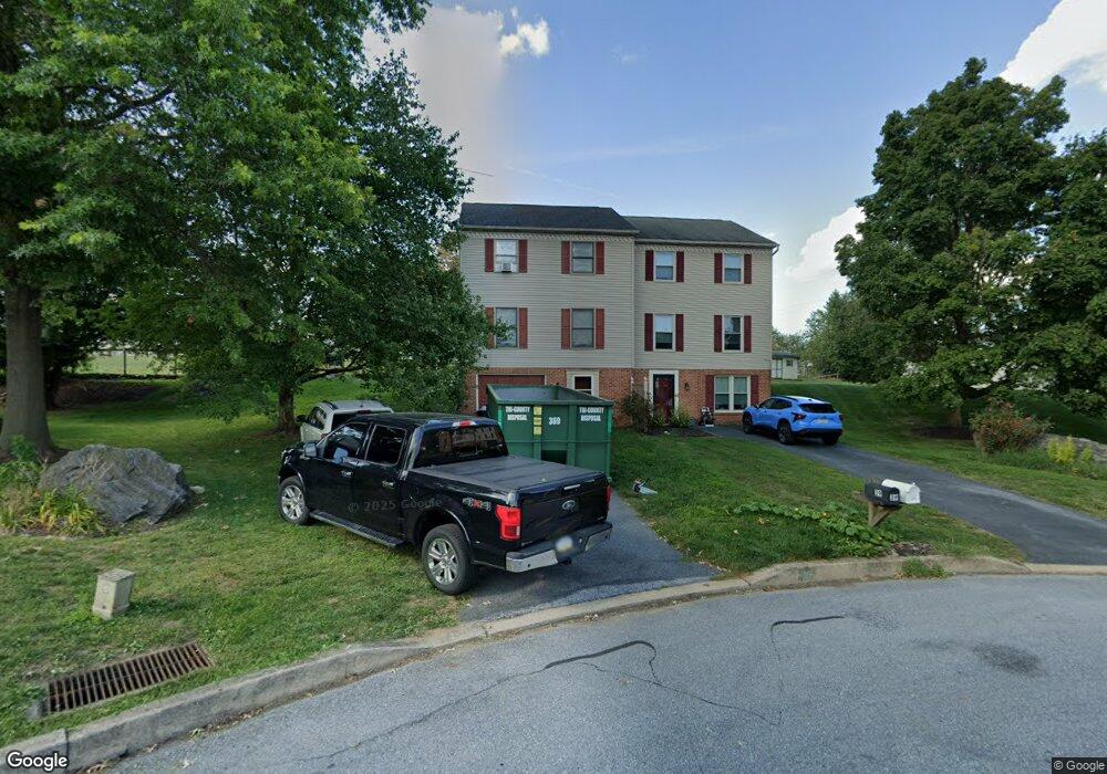
41 Derby Ln Lancaster, PA 17603
Blue Rock NeighborhoodEstimated Value: $257,000 - $316,939
4
Beds
2
Baths
1,738
Sq Ft
$164/Sq Ft
Est. Value
About This Home
This home is located at 41 Derby Ln, Lancaster, PA 17603 and is currently estimated at $285,235, approximately $164 per square foot. 41 Derby Ln is a home located in Lancaster County with nearby schools including Central Manor Elementary School, Manor Middle School, and Penn Manor High School.
Ownership History
Date
Name
Owned For
Owner Type
Purchase Details
Closed on
Feb 22, 2023
Sold by
Fhg 92 Llc
Bought by
Eavey Amy
Current Estimated Value
Home Financials for this Owner
Home Financials are based on the most recent Mortgage that was taken out on this home.
Original Mortgage
$225,834
Outstanding Balance
$217,394
Interest Rate
6.09%
Mortgage Type
FHA
Estimated Equity
$67,841
Purchase Details
Closed on
May 30, 2018
Sold by
Koser Clinton and Gall Chrystin
Bought by
Fhg 92 Llc
Purchase Details
Closed on
Dec 9, 2013
Sold by
Koser Jeffrey S and Koser Lois A
Bought by
Koser Jeffrey S
Home Financials for this Owner
Home Financials are based on the most recent Mortgage that was taken out on this home.
Original Mortgage
$128,250
Interest Rate
4.35%
Mortgage Type
New Conventional
Create a Home Valuation Report for This Property
The Home Valuation Report is an in-depth analysis detailing your home's value as well as a comparison with similar homes in the area
Home Values in the Area
Average Home Value in this Area
Purchase History
| Date | Buyer | Sale Price | Title Company |
|---|---|---|---|
| Eavey Amy | $230,000 | -- | |
| Fhg 92 Llc | $121,500 | None Available | |
| Koser Jeffrey S | -- | None Available |
Source: Public Records
Mortgage History
| Date | Status | Borrower | Loan Amount |
|---|---|---|---|
| Open | Eavey Amy | $225,834 | |
| Previous Owner | Koser Jeffrey S | $128,250 |
Source: Public Records
Tax History
| Year | Tax Paid | Tax Assessment Tax Assessment Total Assessment is a certain percentage of the fair market value that is determined by local assessors to be the total taxable value of land and additions on the property. | Land | Improvement |
|---|---|---|---|---|
| 2025 | $3,479 | $159,300 | $45,100 | $114,200 |
| 2024 | $3,479 | $159,300 | $45,100 | $114,200 |
| 2023 | $3,479 | $159,300 | $45,100 | $114,200 |
| 2022 | $3,413 | $159,300 | $45,100 | $114,200 |
| 2021 | $3,326 | $159,300 | $45,100 | $114,200 |
| 2020 | $3,326 | $159,300 | $45,100 | $114,200 |
| 2019 | $3,234 | $159,300 | $45,100 | $114,200 |
| 2018 | $2,613 | $159,300 | $45,100 | $114,200 |
| 2017 | $2,448 | $100,900 | $38,400 | $62,500 |
| 2016 | $2,448 | $100,900 | $38,400 | $62,500 |
| 2015 | $504 | $100,900 | $38,400 | $62,500 |
| 2014 | $1,658 | $100,900 | $38,400 | $62,500 |
Source: Public Records
Map
Nearby Homes
- 1038 Monticello Ln
- 1522 Manor Blvd
- 254 Blue Rock Rd
- 101 Townhouse Ln
- 3 Amber Ct
- 129 Townhouse Ln
- 524 White Chapel Rd
- 1014 Shadowstone Dr
- 116 Joseph Rd
- 2210 Berkshire Rd
- 31 Manor Ave
- 455 N George St
- 23 Bradford St
- 30 Knollwood Rd
- 217 Stone Creek Rd
- 14 Chamberlain Ln
- 549 Oak Ridge Dr
- 408 Fairway Dr
- 323 Millersville Rd
- 2731 Sherwood Ln
Your Personal Tour Guide
Ask me questions while you tour the home.