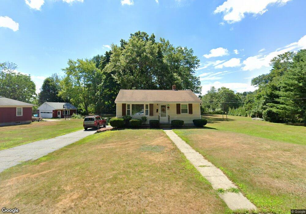
41 Dudley Ave Whitinsville, MA 01588
Estimated Value: $335,000 - $352,765
2
Beds
1
Bath
768
Sq Ft
$450/Sq Ft
Est. Value
About This Home
This home is located at 41 Dudley Ave, Whitinsville, MA 01588 and is currently estimated at $345,941, approximately $450 per square foot. 41 Dudley Ave is a home located in Worcester County with nearby schools including Northbridge Elementary School, Northbridge Middle School, and Northbridge High School.
Ownership History
Date
Name
Owned For
Owner Type
Purchase Details
Closed on
Jun 25, 2025
Sold by
Poznanski Eugene E
Bought by
Poznanski Llc
Current Estimated Value
Purchase Details
Closed on
Aug 6, 2024
Sold by
Poznanski Carol V and Poznanski Eugene E
Bought by
Poznanski Michael H
Create a Home Valuation Report for This Property
The Home Valuation Report is an in-depth analysis detailing your home's value as well as a comparison with similar homes in the area
Home Values in the Area
Average Home Value in this Area
Purchase History
| Date | Buyer | Sale Price | Title Company |
|---|---|---|---|
| Poznanski Llc | -- | None Available | |
| Poznanski Llc | -- | None Available | |
| Poznanski Eugene E | -- | None Available | |
| Poznanski Eugene E | -- | None Available | |
| Poznanski Michael H | -- | None Available | |
| Poznanski Michael H | -- | None Available | |
| Poznanski Michael H | -- | None Available |
Source: Public Records
Tax History Compared to Growth
Tax History
| Year | Tax Paid | Tax Assessment Tax Assessment Total Assessment is a certain percentage of the fair market value that is determined by local assessors to be the total taxable value of land and additions on the property. | Land | Improvement |
|---|---|---|---|---|
| 2025 | $3,380 | $286,700 | $142,100 | $144,600 |
| 2024 | $3,330 | $275,400 | $142,100 | $133,300 |
| 2023 | $3,375 | $260,400 | $134,600 | $125,800 |
| 2022 | $2,962 | $215,100 | $103,600 | $111,500 |
| 2021 | $5,683 | $193,100 | $98,600 | $94,500 |
| 2020 | $2,306 | $189,100 | $98,600 | $90,500 |
| 2019 | $2,202 | $184,100 | $98,600 | $85,500 |
| 2018 | $2,427 | $175,200 | $93,800 | $81,400 |
| 2017 | $2,179 | $169,200 | $93,800 | $75,400 |
| 2016 | $2,090 | $152,000 | $80,500 | $71,500 |
| 2015 | $2,034 | $152,000 | $80,500 | $71,500 |
| 2014 | $2,016 | $152,000 | $80,500 | $71,500 |
Source: Public Records
Map
Nearby Homes
- 157 Rolling Ridge Dr Unit 84
- 1052 Providence Rd
- 140 Rolling Ridge Dr Unit 78
- 708 Marston Rd
- 169 Rolling Ridge Dr Unit 97
- 894 Marston Rd
- 33 Crestwood Cir Unit 45
- 159 Rolling Ridge Dr Unit 85
- 39 Crestwood Cir Unit 42
- 0 Puddon St
- 135 Windstone Dr
- 5 Summit St
- 831 Providence Rd Unit 837
- 90 Nathaniel Dr
- 1880 Providence Rd
- 192 Rebecca Rd
- 21 Granite St
- 86 Kingsnorth St
- 121 East St Unit 121
- 46 Rebecca Rd