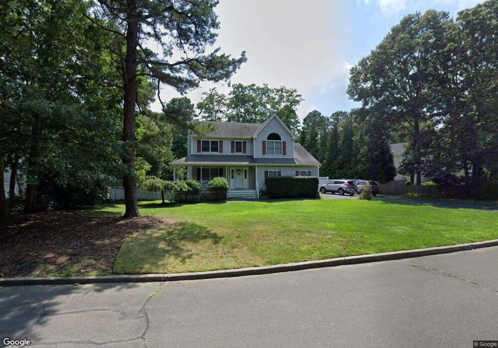
41 E Amber Ln Wading River, NY 11792
Estimated Value: $776,936 - $926,000
4
Beds
2
Baths
2,028
Sq Ft
$418/Sq Ft
Est. Value
About This Home
This home is located at 41 E Amber Ln, Wading River, NY 11792 and is currently estimated at $847,734, approximately $418 per square foot. 41 E Amber Ln is a home located in Suffolk County with nearby schools including Wading River School, Miller Avenue School, and Albert G Prodell Middle School.
Ownership History
Date
Name
Owned For
Owner Type
Purchase Details
Closed on
Oct 7, 2002
Sold by
Coleman Robert A and Coleman Donna J
Bought by
Chesterton George J and Flesch Jeannine M
Current Estimated Value
Home Financials for this Owner
Home Financials are based on the most recent Mortgage that was taken out on this home.
Original Mortgage
$312,000
Outstanding Balance
$131,186
Interest Rate
6.2%
Estimated Equity
$716,548
Purchase Details
Closed on
Aug 4, 2000
Sold by
Zoumas Contracting Corp
Bought by
Coleman Robert A and Coleman Donna J
Home Financials for this Owner
Home Financials are based on the most recent Mortgage that was taken out on this home.
Original Mortgage
$218,732
Interest Rate
8.13%
Purchase Details
Closed on
May 5, 1999
Sold by
Woodcrest Realty Ltd Partnership
Bought by
Zoumas Contracting Corp
Create a Home Valuation Report for This Property
The Home Valuation Report is an in-depth analysis detailing your home's value as well as a comparison with similar homes in the area
Home Values in the Area
Average Home Value in this Area
Purchase History
| Date | Buyer | Sale Price | Title Company |
|---|---|---|---|
| Chesterton George J | $390,000 | Commonwealth Land Title Ins | |
| Coleman Robert A | $263,000 | First American Title Ins Co | |
| Zoumas Contracting Corp | $87,000 | Stewart Title Insurance Co |
Source: Public Records
Mortgage History
| Date | Status | Borrower | Loan Amount |
|---|---|---|---|
| Open | Chesterton George J | $312,000 | |
| Previous Owner | Coleman Robert A | $218,732 |
Source: Public Records
Tax History
| Year | Tax Paid | Tax Assessment Tax Assessment Total Assessment is a certain percentage of the fair market value that is determined by local assessors to be the total taxable value of land and additions on the property. | Land | Improvement |
|---|---|---|---|---|
| 2024 | $15,162 | $3,870 | $400 | $3,470 |
| 2023 | $15,162 | $3,870 | $400 | $3,470 |
| 2022 | $12,318 | $3,870 | $400 | $3,470 |
| 2021 | $12,318 | $3,870 | $400 | $3,470 |
| 2020 | $13,749 | $3,870 | $400 | $3,470 |
| 2019 | $13,749 | $0 | $0 | $0 |
| 2018 | $12,110 | $3,870 | $400 | $3,470 |
| 2017 | $12,090 | $3,870 | $400 | $3,470 |
| 2016 | $12,055 | $3,870 | $400 | $3,470 |
| 2015 | -- | $3,870 | $400 | $3,470 |
| 2014 | -- | $3,870 | $400 | $3,470 |
Source: Public Records
Map
Nearby Homes
- 1944 Wading River Manor Rd
- 0 Route 25A Unit ONE3585320
- 247 Dogwood Dr
- 60 Randall Rd
- 33 Randall Rd
- 30 Long Bow
- 1430 Wading River Manor Rd
- 234 Lakeside Trail
- 230 Lakeside Trail
- 244 Lakeside Trail
- 243 Lakeside Trail
- 215 Lakeside Trail
- 16 Rocklein Rd
- 265 Hidden Acres Path
- 63 Lakeside Trail
- 15 Corchaug Trail
- 658 Sound Ave
- 126 Wauwepex Trail
- 169 N Side Rd
- 77 Fairway Dr
Your Personal Tour Guide
Ask me questions while you tour the home.