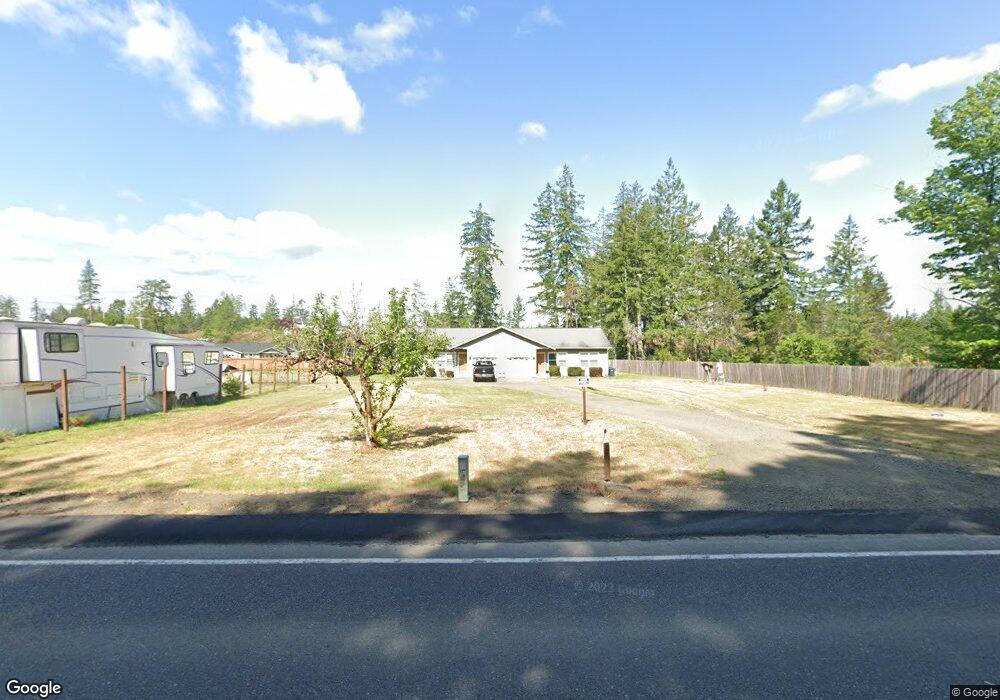
41 E Kendal Ln Shelton, WA 98584
Estimated Value: $393,000 - $450,000
--
Bed
2
Baths
1,870
Sq Ft
$227/Sq Ft
Est. Value
About This Home
This home is located at 41 E Kendal Ln, Shelton, WA 98584 and is currently estimated at $424,235, approximately $226 per square foot. 41 E Kendal Ln is a home located in Mason County with nearby schools including Mountain View Elementary School, Oakland Bay Junior High School, and Olympic Middle School.
Ownership History
Date
Name
Owned For
Owner Type
Purchase Details
Closed on
Jul 9, 2010
Sold by
Henderson Kenneth E and Henderson Kristen M
Bought by
Correa Kent and Correa Cynthia
Current Estimated Value
Purchase Details
Closed on
Jun 13, 2008
Sold by
Mchargue Jeff S
Bought by
Henderson Kenneth E and Henderson Kristin M
Home Financials for this Owner
Home Financials are based on the most recent Mortgage that was taken out on this home.
Original Mortgage
$204,000
Interest Rate
6.05%
Mortgage Type
Construction
Create a Home Valuation Report for This Property
The Home Valuation Report is an in-depth analysis detailing your home's value as well as a comparison with similar homes in the area
Home Values in the Area
Average Home Value in this Area
Purchase History
| Date | Buyer | Sale Price | Title Company |
|---|---|---|---|
| Correa Kent | $226,000 | First American Title | |
| Henderson Kenneth E | $98,500 | First American Title |
Source: Public Records
Mortgage History
| Date | Status | Borrower | Loan Amount |
|---|---|---|---|
| Previous Owner | Henderson Kenneth E | $204,000 |
Source: Public Records
Tax History Compared to Growth
Tax History
| Year | Tax Paid | Tax Assessment Tax Assessment Total Assessment is a certain percentage of the fair market value that is determined by local assessors to be the total taxable value of land and additions on the property. | Land | Improvement |
|---|---|---|---|---|
| 2025 | $3,846 | $386,470 | $49,975 | $336,495 |
| 2023 | $3,846 | $345,910 | $35,270 | $310,640 |
| 2022 | $3,446 | $288,145 | $21,375 | $266,770 |
| 2021 | $3,565 | $288,145 | $21,375 | $266,770 |
| 2020 | $3,025 | $273,675 | $23,750 | $249,925 |
| 2018 | $3,199 | $201,615 | $17,000 | $184,615 |
| 2017 | $2,524 | $201,615 | $17,000 | $184,615 |
| 2016 | $2,396 | $175,455 | $16,200 | $159,255 |
| 2015 | $2,423 | $171,205 | $16,200 | $155,005 |
| 2014 | -- | $169,390 | $15,800 | $153,590 |
| 2013 | -- | $154,625 | $15,000 | $139,625 |
Source: Public Records
Map
Nearby Homes
- 20 E Oak Place
- 1 E Fir Ct Unit Div 2
- 1 E Fir Ct
- 2201 E Island Lake Dr
- 0 Near 782 E Island Lake Dr
- 341 E Island Lake Dr
- 1110 E John's Prairie Rd
- 1100 E John's Prairie Rd
- 711 E Island Lake Dr
- 30 Lily Pond Ln
- 1400 E Jensen Rd
- 141 E Fairfield Ct
- 348 Watercress St
- 261 E North Lake Dr
- 148 S Sage St
- 1 Noel Ln
- 19 Christmas Tree Ln
- 4 Christmas Tree Ln
- 21 E North Lake Dr
- 91 E Cascara Cove Ln
- 2841 E Brockdale Rd
- 2821 E Brockdale Rd
- 2861 E Brockdale Rd
- 40 E Wandering Star
- 40 E Wandering Star
- 41 E Oak Place
- 160 E Wandering Star
- 31 E Oak Place
- 30 E Oak Place
- 50 E Willow Place
- 40 E Willow Place
- 21 E Oak Place
- 61 E Willow Place
- 51 E Willow Place
- 0 E Meyer Lake Rd
- 10 E Oak Place
- 11 E Oak Place
- 31 E Alder Place W
- 2773 E Brockdale Rd
- 21 E Alder Place W