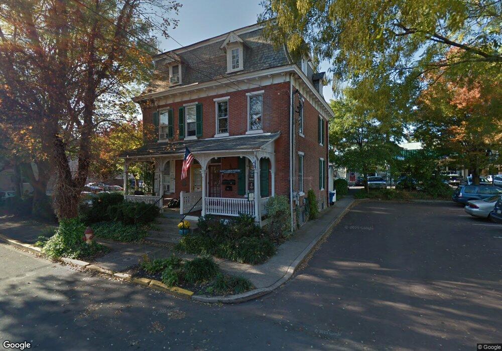
41 E Oakland Ave Doylestown, PA 18901
Estimated Value: $629,620 - $786,000
3
Beds
2
Baths
1,812
Sq Ft
$386/Sq Ft
Est. Value
About This Home
This home is located at 41 E Oakland Ave, Doylestown, PA 18901 and is currently estimated at $699,905, approximately $386 per square foot. 41 E Oakland Ave is a home located in Bucks County with nearby schools including Linden El School, Lenape Middle School, and Central Bucks High School-West.
Ownership History
Date
Name
Owned For
Owner Type
Purchase Details
Closed on
Aug 31, 1993
Sold by
Barrett Edw and Barrett Florence
Bought by
Scarborough E Thomas Iii
Current Estimated Value
Purchase Details
Closed on
Jun 1, 1948
Bought by
Barrett Edw and Barrett Florence
Create a Home Valuation Report for This Property
The Home Valuation Report is an in-depth analysis detailing your home's value as well as a comparison with similar homes in the area
Home Values in the Area
Average Home Value in this Area
Purchase History
| Date | Buyer | Sale Price | Title Company |
|---|---|---|---|
| Scarborough E Thomas Iii | $120,000 | -- | |
| Barrett Edw | -- | -- |
Source: Public Records
Tax History
| Year | Tax Paid | Tax Assessment Tax Assessment Total Assessment is a certain percentage of the fair market value that is determined by local assessors to be the total taxable value of land and additions on the property. | Land | Improvement |
|---|---|---|---|---|
| 2025 | $3,459 | $19,200 | $1,680 | $17,520 |
| 2024 | $3,459 | $19,200 | $1,680 | $17,520 |
| 2023 | $3,295 | $19,200 | $1,680 | $17,520 |
| 2022 | $3,250 | $19,200 | $1,680 | $17,520 |
| 2021 | $3,214 | $19,200 | $1,680 | $17,520 |
| 2020 | $3,179 | $19,200 | $1,680 | $17,520 |
| 2019 | $3,144 | $19,200 | $1,680 | $17,520 |
| 2018 | $3,105 | $19,200 | $1,680 | $17,520 |
| 2017 | $3,072 | $19,200 | $1,680 | $17,520 |
| 2016 | $3,072 | $19,200 | $1,680 | $17,520 |
| 2015 | -- | $19,200 | $1,680 | $17,520 |
| 2014 | -- | $19,200 | $1,680 | $17,520 |
Source: Public Records
Map
Nearby Homes
- 69 E Oakland Ave
- 110 E Ashland St
- 146 E Court St
- 61 N Hamilton St
- 169 N Main St
- 150 Selner Ln
- 236 Green St
- 102 Clear Springs Ct
- 209 Harvey Ave
- 190 Decatur St
- 195 Lafayette St
- 215 N Franklin St
- 3 Aspen Way Unit 33
- 807 N Broad St
- 45 Creek Dr
- 5 Belmont Square
- 112 Steeplechase Dr
- 2401 Lower State Rd Unit 106
- 607 S Chubb Dr
- 563 Pebble Hill Rd
- 43 E Oakland Ave Unit 1
- 62 E State St
- 19 Donaldson St
- 53 E Oakland Ave
- 21 Donaldson St
- 61 E Oakland Ave
- 61 E Oakland Ave Unit 2
- 61 E Oakland Ave Unit 3
- 38 E State St Unit B
- 38 E State St Unit REAR
- 38 E State St Unit 2A
- 38 E State St Unit 2B
- 38 E State St Unit RETAIL
- 38 E State St
- 46 E State St Unit H-J-K
- 46 E State St Unit H,K,J
- 46 E State St Unit K
- 46 E State St Unit H
- 46 E State St Unit N
- 46 E State St
Your Personal Tour Guide
Ask me questions while you tour the home.