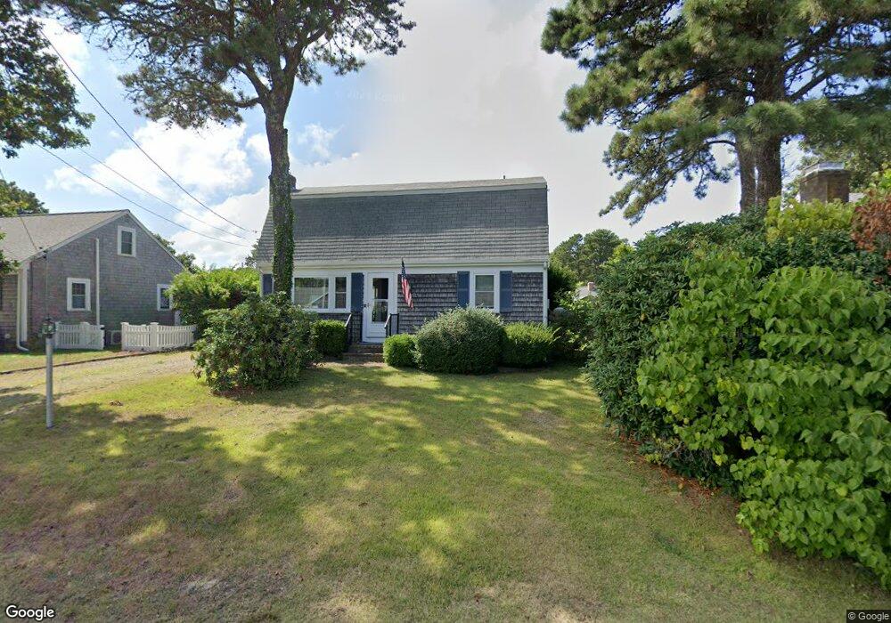
41 Easy St Dennis Port, MA 02639
Dennis Port NeighborhoodEstimated Value: $574,000 - $723,000
3
Beds
2
Baths
1,254
Sq Ft
$509/Sq Ft
Est. Value
About This Home
This home is located at 41 Easy St, Dennis Port, MA 02639 and is currently estimated at $637,754, approximately $508 per square foot. 41 Easy St is a home located in Barnstable County with nearby schools including Dennis-Yarmouth Regional High School and St. Pius X. School.
Ownership History
Date
Name
Owned For
Owner Type
Purchase Details
Closed on
Jun 14, 2021
Sold by
Peterson Patricia E Est
Bought by
Totten Glenn P and Davis Elaine T
Current Estimated Value
Purchase Details
Closed on
Oct 27, 2020
Sold by
Patricia Peterson Irt
Bought by
Davis Elaine T and Totten Glenn P
Purchase Details
Closed on
Jul 15, 2011
Sold by
Peterson Patricia E
Bought by
Ir Patricia E Peterson and Totten Glenn P
Create a Home Valuation Report for This Property
The Home Valuation Report is an in-depth analysis detailing your home's value as well as a comparison with similar homes in the area
Home Values in the Area
Average Home Value in this Area
Purchase History
| Date | Buyer | Sale Price | Title Company |
|---|---|---|---|
| Totten Glenn P | -- | None Available | |
| Davis Elaine T | -- | None Available | |
| Ir Patricia E Peterson | -- | -- |
Source: Public Records
Tax History Compared to Growth
Tax History
| Year | Tax Paid | Tax Assessment Tax Assessment Total Assessment is a certain percentage of the fair market value that is determined by local assessors to be the total taxable value of land and additions on the property. | Land | Improvement |
|---|---|---|---|---|
| 2025 | $2,079 | $480,200 | $191,800 | $288,400 |
| 2024 | $1,993 | $454,000 | $184,400 | $269,600 |
| 2023 | $1,779 | $380,900 | $167,700 | $213,200 |
| 2022 | $1,734 | $309,700 | $151,000 | $158,700 |
| 2021 | $1,819 | $301,700 | $169,200 | $132,500 |
| 2020 | $1,626 | $266,600 | $148,100 | $118,500 |
| 2019 | $1,609 | $260,800 | $145,200 | $115,600 |
| 2018 | $1,520 | $239,700 | $138,200 | $101,500 |
| 2017 | $1,448 | $235,500 | $128,300 | $107,200 |
| 2016 | $1,487 | $227,700 | $138,200 | $89,500 |
| 2015 | $1,457 | $227,700 | $138,200 | $89,500 |
| 2014 | $1,407 | $221,600 | $118,500 | $103,100 |
Source: Public Records
Map
Nearby Homes
- 31 Easy St
- 22 Wixon Rd
- 19 Standish Way
- 80 Michaels Ave
- 72 Bassett Ln
- 22 Ferncliff Rd
- 37 Beach Hills Rd
- 37-A Beach Hills Rd
- 262 Old Wharf Rd Unit 67
- 262 Old Wharf Rd Unit 5
- 262 Old Wharf Rd Unit 5
- 262 Old Wharf Rd Unit 20
- 262 Old Wharf Rd Unit 87
- 4 Coffey Ln
- 125 Main St Unit 3
- 64 Beaten Rd
- 268 Main St
- 37 Ocean Dr Unit 2
- 241 Old Wharf Rd Unit 82
- 241 Old Wharf Rd Unit 127