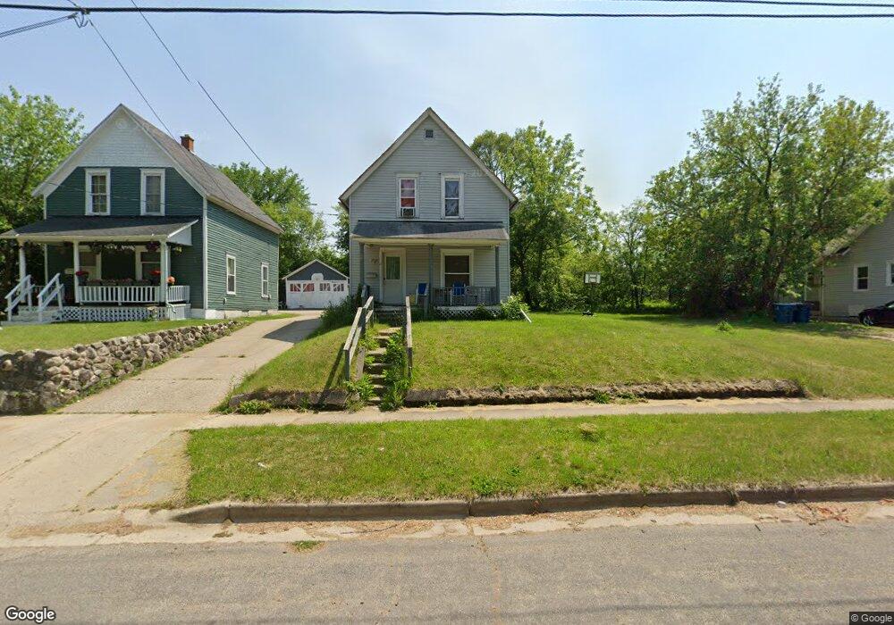
41 Eldred St Battle Creek, MI 49015
Central Battle Creek NeighborhoodEstimated Value: $80,269 - $124,000
3
Beds
1
Bath
980
Sq Ft
$105/Sq Ft
Est. Value
About This Home
This home is located at 41 Eldred St, Battle Creek, MI 49015 and is currently estimated at $103,067, approximately $105 per square foot. 41 Eldred St is a home located in Calhoun County with nearby schools including Ann J. Kellogg School, Springfield Middle School, and Battle Creek Central High School.
Ownership History
Date
Name
Owned For
Owner Type
Purchase Details
Closed on
Jul 8, 2009
Sold by
Mortgage Electronic Registration Systems
Bought by
Federal National Mortgage Association
Current Estimated Value
Purchase Details
Closed on
Jun 4, 2009
Sold by
Munoz John M
Bought by
Mortgage Electronic Registration Systems
Purchase Details
Closed on
Mar 14, 2003
Sold by
Frohm James and Frohm Jennifer
Bought by
Munoz John M
Purchase Details
Closed on
Aug 3, 2001
Sold by
Kilbourn Randy G and Kilbourn Teresa L
Bought by
Frohm James
Purchase Details
Closed on
May 4, 1998
Bought by
Kilbourn
Create a Home Valuation Report for This Property
The Home Valuation Report is an in-depth analysis detailing your home's value as well as a comparison with similar homes in the area
Home Values in the Area
Average Home Value in this Area
Purchase History
We collect this data history from publicly available records. To have your information removed, we recommend requesting removal directly through your county’s website.
| Date | Buyer | Sale Price | Title Company |
|---|---|---|---|
| Federal National Mortgage Association | -- | None Available | |
| Mortgage Electronic Registration Systems | $40,678 | None Available | |
| Munoz John M | $100 | -- | |
| Frohm James | $12,000 | -- | |
| Kilbourn | $15,500 | -- |
Source: Public Records
Tax History
| Year | Tax Paid | Tax Assessment Tax Assessment Total Assessment is a certain percentage of the fair market value that is determined by local assessors to be the total taxable value of land and additions on the property. | Land | Improvement |
|---|---|---|---|---|
| 2025 | -- | $27,900 | $0 | $0 |
| 2024 | $328 | $23,377 | $0 | $0 |
| 2023 | $1,025 | $22,362 | $0 | $0 |
| 2022 | $728 | $18,710 | $0 | $0 |
| 2021 | $974 | $17,926 | $0 | $0 |
| 2020 | $918 | $16,712 | $0 | $0 |
| 2019 | $918 | $20,330 | $0 | $0 |
| 2018 | $918 | $18,154 | $440 | $17,714 |
| 2017 | $998 | $13,898 | $0 | $0 |
| 2016 | $1,039 | $16,812 | $0 | $0 |
| 2015 | $1,019 | $16,618 | $2,129 | $14,489 |
| 2014 | $1,019 | $15,853 | $2,129 | $13,724 |
Source: Public Records
Map
Nearby Homes
- 71 Burnham St W
- 77 Eldred St
- 93 Webber St
- 79 Winter St
- 160 Goguac St W
- 223 Territorial Rd W
- 17 Tennyson Ave
- 105 Summer St
- 146 Bidwell St W
- 139 Rittenhouse Ave W
- 166 Winter St
- 74 Seivour Ave
- 44 Harris St
- 47 Frisbie Ave
- 236 Iroquois Ave
- 346 Wentworth Ave
- 256 Burr St
- 415 Orleans Ave
- 133 Harris St
- 21 Spring St
- 39 Eldred St
- 47 Eldred St
- 38 Eldred St
- 44 Eldred St
- 31 Eldred St
- 51 Eldred St
- 36 Eldred St
- 55 Eldred St
- 25 Eldred St
- 34 Eldred St
- 293 Meachem Ave
- 26 Eldred St
- 309 Meachem Ave
- 287 Meachem Ave
- 534 Capital Ave SW
- 530 Capital Ave SW
- 530 Capital Ave SW Unit 4
- 319 Meachem Ave
- 538 Capital Ave SW
- 283 Meachem Ave
Your Personal Tour Guide
Ask me questions while you tour the home.