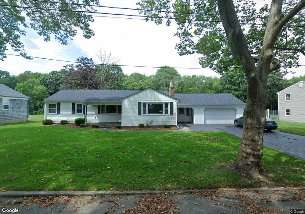
41 Elmwood Dr Bristol, RI 02809
Bristol Highlands NeighborhoodEstimated Value: $508,880 - $640,000
3
Beds
1
Bath
1,715
Sq Ft
$341/Sq Ft
Est. Value
About This Home
This home is located at 41 Elmwood Dr, Bristol, RI 02809 and is currently estimated at $585,220, approximately $341 per square foot. 41 Elmwood Dr is a home located in Bristol County with nearby schools including Mt. Hope High School, Highlander Charter Middle and High School, and Our Lady of Mt. Carmel School.
Ownership History
Date
Name
Owned For
Owner Type
Purchase Details
Closed on
May 30, 2023
Sold by
Sousa Lauryn
Bought by
Marshall Frances C
Current Estimated Value
Purchase Details
Closed on
Jul 7, 2021
Sold by
Marshall Frances C
Bought by
Sousa Lauryn and Marshall Frances C
Create a Home Valuation Report for This Property
The Home Valuation Report is an in-depth analysis detailing your home's value as well as a comparison with similar homes in the area
Home Values in the Area
Average Home Value in this Area
Purchase History
| Date | Buyer | Sale Price | Title Company |
|---|---|---|---|
| Marshall Frances C | -- | None Available | |
| Sousa Lauryn | -- | None Available | |
| Marshall Frances C | -- | None Available |
Source: Public Records
Tax History Compared to Growth
Tax History
| Year | Tax Paid | Tax Assessment Tax Assessment Total Assessment is a certain percentage of the fair market value that is determined by local assessors to be the total taxable value of land and additions on the property. | Land | Improvement |
|---|---|---|---|---|
| 2025 | $5,042 | $364,800 | $154,800 | $210,000 |
| 2024 | $5,042 | $364,800 | $154,800 | $210,000 |
| 2023 | $4,874 | $364,800 | $154,800 | $210,000 |
| 2022 | $4,742 | $364,800 | $154,800 | $210,000 |
| 2021 | $4,216 | $293,200 | $138,000 | $155,200 |
| 2020 | $4,125 | $293,200 | $138,000 | $155,200 |
| 2019 | $4,023 | $293,200 | $138,000 | $155,200 |
| 2018 | $4,749 | $308,800 | $156,500 | $152,300 |
| 2017 | $3,854 | $258,300 | $132,400 | $125,900 |
| 2016 | $3,815 | $258,300 | $132,400 | $125,900 |
| 2015 | $3,624 | $258,300 | $132,400 | $125,900 |
| 2014 | $3,936 | $301,370 | $137,600 | $163,770 |
Source: Public Records
Map
Nearby Homes
- 35 Bagy Wrinkle Cove
- 85 Canario Dr
- 53 Bagy Wrinkle Cove
- 2 Bagy Wrinkle Cove
- 0 Overhill Rd Unit 1382248
- 94 Windward Ln
- 683 Metacom Ave Unit 79
- 669 Metacom Ave Unit 17
- 7 Broadview Ave
- 40 Aaron Ave
- 1220 Hope St
- 1 Knowlton Ct
- 4 Read Ave
- 7 Knowlton Ct
- 3 Knowlton Ct
- 5 Knowlton Ct
- 0 Surf Dr
- 3 Betsy Dr
- 1 Betsy Dr
- 69 Cutler St