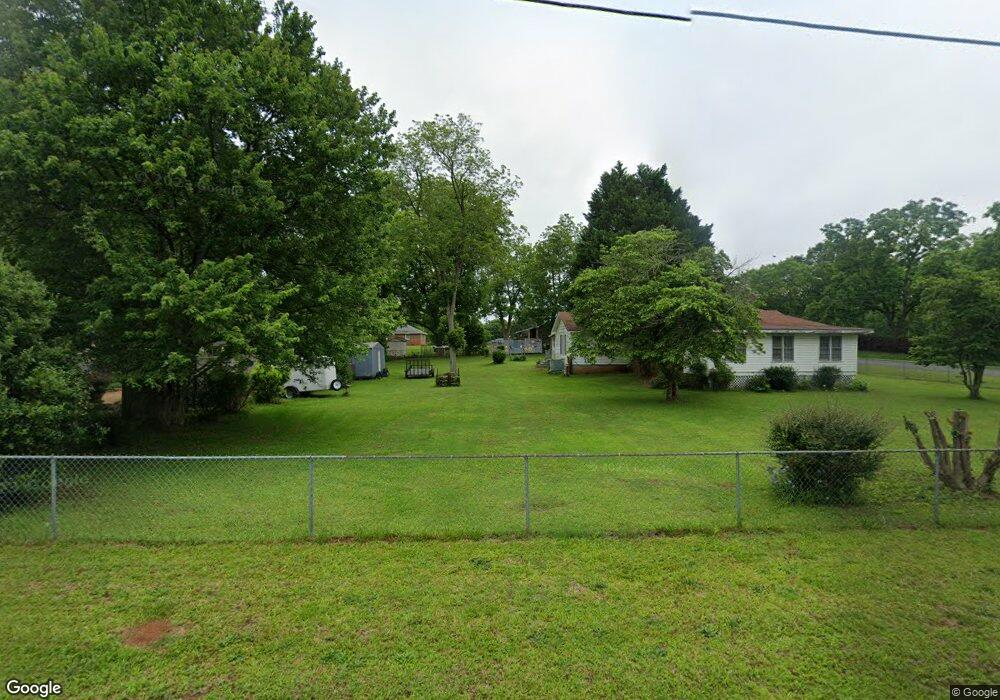
41 Empire St Yatesville, GA 31097
Estimated Value: $158,000 - $216,000
2
Beds
1
Bath
1,988
Sq Ft
$93/Sq Ft
Est. Value
About This Home
This home is located at 41 Empire St, Yatesville, GA 31097 and is currently estimated at $185,127, approximately $93 per square foot. 41 Empire St is a home located in Upson County with nearby schools including Upson-Lee South Elementary School, Upson-Lee North Elementary School, and Upson-Lee Middle School.
Ownership History
Date
Name
Owned For
Owner Type
Purchase Details
Closed on
Jan 11, 2012
Sold by
Walker Ed
Bought by
Montoya Russell L
Current Estimated Value
Home Financials for this Owner
Home Financials are based on the most recent Mortgage that was taken out on this home.
Original Mortgage
$76,000
Outstanding Balance
$52,153
Interest Rate
4%
Mortgage Type
New Conventional
Estimated Equity
$132,974
Create a Home Valuation Report for This Property
The Home Valuation Report is an in-depth analysis detailing your home's value as well as a comparison with similar homes in the area
Home Values in the Area
Average Home Value in this Area
Purchase History
| Date | Buyer | Sale Price | Title Company |
|---|---|---|---|
| Montoya Russell L | $95,000 | -- | |
| Montoya Russell L | $95,000 | -- |
Source: Public Records
Mortgage History
| Date | Status | Borrower | Loan Amount |
|---|---|---|---|
| Open | Montoya Russell L | $76,000 | |
| Closed | Montoya Russell L | $76,000 |
Source: Public Records
Tax History Compared to Growth
Tax History
| Year | Tax Paid | Tax Assessment Tax Assessment Total Assessment is a certain percentage of the fair market value that is determined by local assessors to be the total taxable value of land and additions on the property. | Land | Improvement |
|---|---|---|---|---|
| 2024 | $1,863 | $48,512 | $2,384 | $46,128 |
| 2023 | $1,274 | $46,238 | $2,384 | $43,854 |
| 2022 | $1,017 | $36,693 | $2,384 | $34,309 |
| 2021 | $840 | $31,884 | $2,384 | $29,500 |
| 2020 | $858 | $30,404 | $2,384 | $28,020 |
| 2019 | $864 | $28,185 | $2,384 | $25,801 |
| 2018 | $911 | $29,709 | $2,384 | $27,325 |
| 2017 | $1,067 | $31,747 | $2,384 | $29,363 |
| 2016 | $937 | $27,414 | $2,688 | $24,726 |
| 2015 | $927 | $27,110 | $2,384 | $24,726 |
| 2014 | $928 | $27,110 | $2,384 | $24,726 |
Source: Public Records
Map
Nearby Homes
- 1338 Edwards Rd
- 0 Rest Haven Rd Unit 10652109
- 2200 Rest Haven Rd
- 351 Main St
- 305 Zellner Rd
- 832 Jackson Dr
- 0 Ramah Church Rd Unit 10480661
- 0 Ramah Church Rd Unit 7542675
- 1505 Willis Rd
- 1972 Rest Haven Rd
- 3487 Yatesville Hwy
- 1570 the Rock Rd
- 1518 the Rock Rd
- 1031 the Rock Rd
- 144 Means Rd
- 235 Rocky Branch Rd
- 1904 U S 341
- 2222 Barnesville Hwy
- 0 Jordan Bottoms Rd Unit 25051630
- 61 ACRES Barnesville Hwy
- 74 Florence St
- 51 Florence St
- 21 Empire St
- 83 Empire St
- 71 Florence St
- 32 College St
- 98 Empire St
- 79 College St
- 48 Edwards Rd
- 0 Logtown Rd Unit 8355853
- 0 Logtown Rd Unit 5991843
- 0 Logtown Rd Unit 3122955
- 0 Logtown Rd
- 0 Logtown Rd Unit 10418566
- 0 Logtown Rd Unit 10319483
- 0 Logtown Rd Unit 10201824
- 0 Logtown Rd Unit 20127751
- 0 Logtown Rd Unit 10130668
- 66 College St
- 14 Florence St