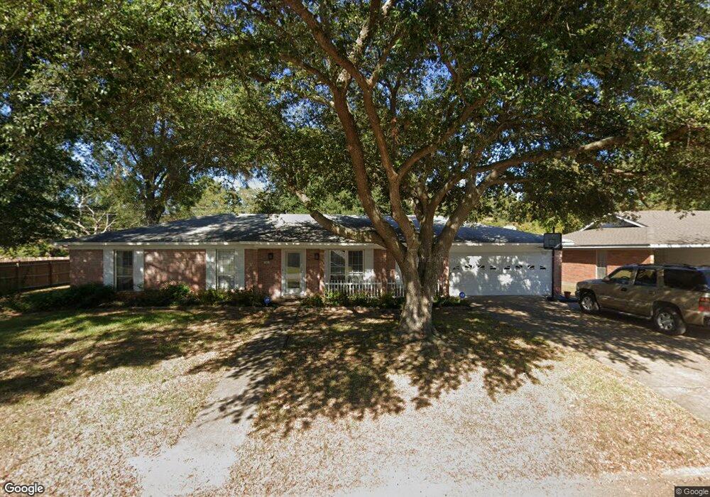
41 Fair Oaks Dr Monroe, LA 71203
Estimated Value: $202,000 - $239,000
4
Beds
2
Baths
2,147
Sq Ft
$104/Sq Ft
Est. Value
About This Home
This home is located at 41 Fair Oaks Dr, Monroe, LA 71203 and is currently estimated at $224,210, approximately $104 per square foot. 41 Fair Oaks Dr is a home located in Ouachita Parish with nearby schools including Jack Hayes Elementary School, Ouachita Junior High School, and Ouachita Parish High School.
Ownership History
Date
Name
Owned For
Owner Type
Purchase Details
Closed on
May 6, 2024
Sold by
D & H Properties Of Monroe Llc
Bought by
Randle Derrick
Current Estimated Value
Home Financials for this Owner
Home Financials are based on the most recent Mortgage that was taken out on this home.
Original Mortgage
$237,000
Outstanding Balance
$233,670
Interest Rate
6.87%
Mortgage Type
New Conventional
Estimated Equity
-$9,460
Purchase Details
Closed on
Apr 7, 2016
Sold by
Warren Helen Kay Brinson
Bought by
D & H Properties Of Monroe Llc
Create a Home Valuation Report for This Property
The Home Valuation Report is an in-depth analysis detailing your home's value as well as a comparison with similar homes in the area
Home Values in the Area
Average Home Value in this Area
Purchase History
| Date | Buyer | Sale Price | Title Company |
|---|---|---|---|
| Randle Derrick | $237,000 | None Listed On Document | |
| D & H Properties Of Monroe Llc | $50,000 | North Delta Title |
Source: Public Records
Mortgage History
| Date | Status | Borrower | Loan Amount |
|---|---|---|---|
| Open | Randle Derrick | $237,000 |
Source: Public Records
Tax History Compared to Growth
Tax History
| Year | Tax Paid | Tax Assessment Tax Assessment Total Assessment is a certain percentage of the fair market value that is determined by local assessors to be the total taxable value of land and additions on the property. | Land | Improvement |
|---|---|---|---|---|
| 2024 | $67 | $18,165 | $1,700 | $16,465 |
| 2023 | $67 | $14,797 | $1,700 | $13,097 |
| 2022 | $2,071 | $14,797 | $1,700 | $13,097 |
| 2021 | $2,088 | $14,797 | $1,700 | $13,097 |
| 2020 | $1,679 | $11,758 | $1,700 | $10,058 |
| 2019 | $1,656 | $11,758 | $1,700 | $10,058 |
| 2018 | $1,570 | $11,758 | $1,700 | $10,058 |
| 2017 | $1,451 | $10,582 | $1,530 | $9,052 |
| 2016 | $1,191 | $11,758 | $1,700 | $10,058 |
| 2015 | $594 | $11,758 | $1,700 | $10,058 |
| 2014 | $599 | $11,758 | $1,700 | $10,058 |
| 2013 | $608 | $11,758 | $1,700 | $10,058 |
Source: Public Records
Map
Nearby Homes
- 33 Fair Oaks Dr
- 26 Karen Ln
- 20 Elmwood Dr
- 2 Cypress Dr
- 55 Magnolia Dr
- 37 W Elmwood Dr
- 308 Woodale Dr Unit 2
- 211 Cotton Trace Dr
- 117 Oak Cir
- 0 Old Sterlington Rd
- 000 Stubbs Vinson Rd
- 20 Colonial Dr
- 311 Birdie Ln
- 303 Birdie Ln
- 256 N Leo Ln
- 239 N Leo Ln
- 292 Birdie Ln
- 135 N Leo Ln
- 253 N Leo Ln
- 292 N Leo Ln