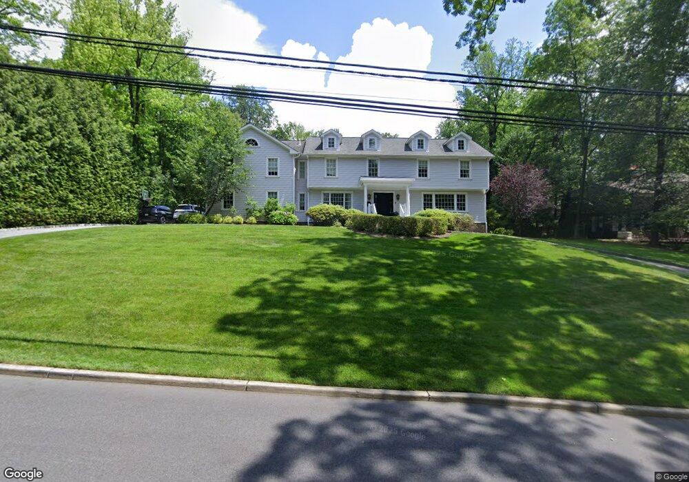
41 Farview Rd Tenafly, NJ 07670
Estimated Value: $2,449,000 - $3,147,285
7
Beds
7
Baths
5,154
Sq Ft
$552/Sq Ft
Est. Value
About This Home
This home is located at 41 Farview Rd, Tenafly, NJ 07670 and is currently estimated at $2,842,571, approximately $551 per square foot. 41 Farview Rd is a home located in Bergen County with nearby schools including Tenafly Middle School, Tenafly High School, and Academy of Our Lady of Mount Carmel.
Ownership History
Date
Name
Owned For
Owner Type
Purchase Details
Closed on
Dec 7, 2018
Sold by
Asulin Yitzhack and Asulin Samantha
Bought by
Plotkin David and Plotkin Richard
Current Estimated Value
Home Financials for this Owner
Home Financials are based on the most recent Mortgage that was taken out on this home.
Original Mortgage
$1,365,000
Outstanding Balance
$1,204,994
Interest Rate
4.9%
Mortgage Type
New Conventional
Estimated Equity
$1,637,577
Purchase Details
Closed on
Dec 22, 2006
Purchase Details
Closed on
Jun 25, 2002
Sold by
Higgins Michael
Bought by
Motai Junsuke and Motai Asako
Purchase Details
Closed on
May 14, 1997
Sold by
Mmmnj Co
Bought by
Higgins Michael and Higgins Laura
Home Financials for this Owner
Home Financials are based on the most recent Mortgage that was taken out on this home.
Original Mortgage
$500,000
Interest Rate
8.08%
Create a Home Valuation Report for This Property
The Home Valuation Report is an in-depth analysis detailing your home's value as well as a comparison with similar homes in the area
Home Values in the Area
Average Home Value in this Area
Purchase History
| Date | Buyer | Sale Price | Title Company |
|---|---|---|---|
| Plotkin David | $1,820,000 | Acres Land Title | |
| -- | $1,501,800 | -- | |
| Motai Junsuke | $1,425,000 | -- | |
| Higgins Michael | $640,000 | -- |
Source: Public Records
Mortgage History
| Date | Status | Borrower | Loan Amount |
|---|---|---|---|
| Open | Plotkin David | $1,365,000 | |
| Previous Owner | Higgins Michael | $500,000 |
Source: Public Records
Tax History
| Year | Tax Paid | Tax Assessment Tax Assessment Total Assessment is a certain percentage of the fair market value that is determined by local assessors to be the total taxable value of land and additions on the property. | Land | Improvement |
|---|---|---|---|---|
| 2025 | $45,084 | $1,586,900 | $1,092,000 | $494,900 |
| 2024 | $43,989 | $1,586,900 | $1,092,000 | $494,900 |
| 2023 | $42,926 | $1,586,900 | $1,092,000 | $494,900 |
| 2022 | $42,926 | $1,586,900 | $1,092,000 | $494,900 |
| 2021 | $42,164 | $1,586,900 | $1,092,000 | $494,900 |
| 2020 | $41,545 | $1,586,900 | $1,092,000 | $494,900 |
| 2019 | $48,868 | $1,900,000 | $1,092,000 | $808,000 |
| 2018 | $48,108 | $1,900,000 | $1,092,000 | $808,000 |
| 2017 | $47,937 | $1,900,000 | $1,092,000 | $808,000 |
| 2016 | $46,987 | $1,900,000 | $1,092,000 | $808,000 |
| 2015 | $45,942 | $1,900,000 | $1,092,000 | $808,000 |
| 2014 | $48,692 | $2,051,900 | $1,092,000 | $959,900 |
Source: Public Records
Map
Nearby Homes
- 91 Tekening Dr
- 21 Hastings Dr
- 76 Forest Rd
- 5 Leslie Place
- 27 Suffolk Ln
- 26 Glenwood Rd
- 84 Depeyster Ave
- 8 Howard Park Dr
- 158 Oxford Dr
- 12 Westervelt Ave
- 187 Buckingham Rd
- 56 Magnolia Ave
- 196 Vaccaro Dr
- 66 Hoover Dr
- 54 Westervelt Ave Unit B
- 10 Orchard Place
- 117 Truman Dr
- 211 Vaccaro Dr
- 14 Jane Dr
- 90 Essex Dr
Your Personal Tour Guide
Ask me questions while you tour the home.